Maps of Spain


Composite: Carte de la Peninsule Hispanique.
1 : 2750000 Vivien de St Martin, L.
70-71. Spain and Portugal. The World Atlas.
1 : 2500000 USSR (Union of Soviet Socialist Republics).

Hispaniæ antiquæ tabula geographica
1 Karte : Kupferdruck ; 23 x 27 cm Delamarche; Delahaye s.n.
Spanien und Portugal
1 : 1500000 Kanárské ostrovy Vogel, Carl Koffmahn, Otto Justus Perthes
Mapa geológico de Espana y Portugal
1 : 2000000 Portugalsko Botella y de Hornos, Federico de Coello, Francisco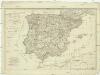
Die Königreiche Spanien und Portugal nach den neuesten Beobachtungen verfasst
1 : 2220000 Portugalsko Tranquillo Mollo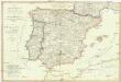
Die Königreiche Spanien und Portugal
1 : 2200000 Portugalsko Mollo, Tranquillo Tranquillo Mollo
Spanien und Portugal
Plastischer Schul-Atlas über alle Theile der Erde : in 24 Karten Woldermann, G Verlag von P. Eckerlein
Spanien und Portugal
1 : 3260000 Portugalsko López, Tomás T. Mollo
Regnorum Hispaniae et Portugalliae
1 : 2540000 Portugalsko Homann, Johann Baptist a Ioh. Bapt Homanno
L'Espagne 1212 a 1492.
1 : 4800000 Houze, Antoine Philippe
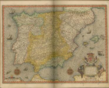
Regni Hispaniae Post Omnium Editiones Locuplessima Descriptio. [Karte], in: Theatrum orbis terrarum, S. 95.
1 Karte aus Atlas Ortelius, Abraham Vrients, Jan Baptista
Espagne, Portugal.
1 : 2300000 Robert de Vaugondy, Gilles, 1688-1766
Království španělské
Portugalsko tisk a sklad Hynka Fuchse
Espagne, Portugal postes.
1 : 2300000 Robert de Vaugondy, Gilles, 1688-1766
L'Espagne 409 a 585.
1 : 4800000 Houze, Antoine Philippe
Carte des routes de postes et itinéraires d'Espagne et de Portugal
1 : 2500000 par Ch. Picquet dressée par Lapie, Ingr. géographe, d'après les cartes de Lopez, Tofino et autres documents authentiques. Paris : chez Ch. Picquet
Espagne et Portugal 1640 a 1840.
1 : 4800000 Houze, Antoine Philippe
[Kaart], uit: Espagne et Portugal
1 : 400000 titelvariant: Carte Taride Routière Espagne et Portugal; Annotatie: Gevouwen, in pochette (19 x 13,5 cm); Met bladwijzer op pochette; Annotatie geografische gegevens: Met 3 schaalstokken; Legenda Paris : Taride / (Paris : Gaillac-Monrocq et Cie)
[Spanien und Portugal, Iberische Halbinsel]
[Allgemeiner Atlas über alle Theile der Erde in 29 Blättern] Ziegler, Jakob Melchior Top. Anstalt v. J. Wurster u. Comp.
Spain, Portugal
1 : 3000000 Andree, Richard; Times (London, England)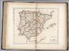
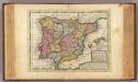
Spain and Portugal.
1 : 3300000 Carey, Mathew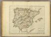
Spain And Portugal.
1 : 3300000 Carey, Mathew
Spain and Portugal.
1 : 3358080 Carey, Mathew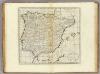
Spain and Portugal.
1 : 3294720 Carey, Mathew
Spain and Portugal.
1 : 3294720 Carey, Mathew