Maps of Czech Republic
Nova et accurata Descriptio Geographica Totius Regni Bohemiae...
Karten zu den deutschen Einheitskriegen II - Kriegsschauplatz 1866 in Deutschland und Italien
1 : 3000000 Mitteleuropa Deutscher Krieg <1866>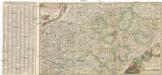
Nova et accurata descriptio geographica totius regni Bohemiae
1 : 731000 Bavorsko (Německo) Lidl, Johann Jakob J.J. Lidl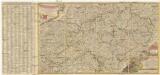
Nova et accurata descriptio geographica totius Regni Bohemiae
1 : 690000 Německo Lidl, Johann Jakob J. J. Lidl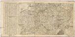
Nova et accurata Descriptio Geographica TOTIUS REGNI BOHEMIAE
1 : 6800000 Německo Lidl, Johann Jakob Joannis Jacobo Lidlii
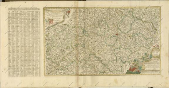
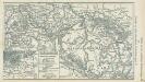
Theatre de la Guerre en Austriche, Baviere, Souabe, le Tirol et le Pays aux Environs
1 : 565000 Mollova mapová sbírka Covens, Johannes Covens, Johannes I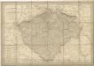
General Post & Strassen Karte des Königreichs Boehmen
Neueste General-Post & Strassen-Karte des Königreichs Boehmen
1 : 650000 Česko Fried, Franz Artaria & Comp.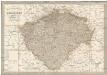
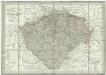
Neueste General-Post & Strassen-Karte des Königreichs Boehmen
1 : 650000 Česko Fried, Franz Artaria & Comp.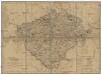
Königreich Böhmen
Česko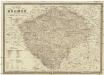
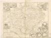
Karte von Böhmen
1 : 660000 Česko Schmitfeldt, Georg Mollo, Tranquillo Tranquillo Mollo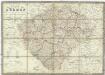
Karte von Böhmen
1 : 660000 Česko Schmitfeldt, Georg Mollo, Tranquillo Tranquillo Mollo
Geologische Übersichtskarte des Österreichischen Monarchie
1 : 576000 Rakousko-Uhersko Hauer, Franz Beck'schen Universitäts Buchhandlung (A. Hölder)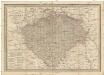
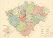
General-Post & Strassen-Karte des Königreichs Boehmen
1 : 650000 Čechy (Česko) Fried, Franz Artaria & Comp.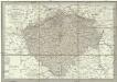
Neueste General-Post & Strassen-Karte des Königreichs Boehmen
1 : 650000 Česko Fried, Franz Artaria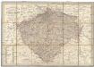
Neueste General-Post & Strassen-Karte des Königreichs Boehmen
Čechy (Česko) Fried, Franz Sartorius, Johann Christoph Artaria
Karte des Königreiches Böhmen
1 : 650000 Česko Raffelsperger, Franz in dem k. k. a. p. Civil-Geograpischen Institut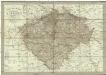
Neueste General-Post & Strassen-Karte des Königreichs Boehmen
1 : 650000 Čechy (Česko) Fried, Franz Artaria
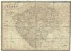
Bohemia

Karten zur Statistik des Königreiches Böhmen...
Theatre de la guerre en Boheme...
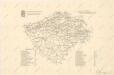
Mapa krajského rozdělení Čech r. 1654 na podkladě územní organisace soudních okresů r. 1946
Karte von Böhmen
1 : 660000 Čechy (Česko) Schmitfeldt, Georg Tranquillo Mollo
Charte des Königreiches Böhmen...

Bez titulu: Soubor statistických map Čech

Přehledná hydrografická mapa povodí Labe, Odry a Dunaje v Čechách
1 : 750000 Dunaj (řeka : povodí) Vojenský zeměpisný ústav
Přehledná hydrografická mapa povodí Labe, Odry a Dunaje v Čechách
1 : 750000 Dunaj (řeka : povodí) Vojenský zeměpisný ústav
Přehledná hydrografická mapa povodí Labe, Odry a Dunaje v Čechách
1 : 750000 Dunaj-povodí Vojenský zeměpisný ústav