Maps of Mediterranean Sea
Charte vom mittellændischen Meer
1 Karte : Kupferdruck ; 23 x 49 cm Abel; Cotta im Verlag der J. G. Cotta'schen Buchhandlung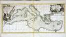
Carte de la mer Méditerranée
1 Karte : Kupferdruck ; 30 x 66 cm Bonne; Lattré chez Lattré ruë S. Jacq à la ville de Bordeaux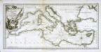
Karte des mittellændischen Meers
1 Karte : Kupferdruck ; 30 x 64 cm Schrämbl; Bonne; Alberti zu finden im eigenen Verlage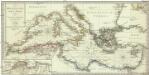
Karte des Mittellaendischen Meers enthaltend die europaische, afrikanische u. asiatische Küste
1 : 7000000 Středozemní moře-oblast Walch, Johann Joh. Walch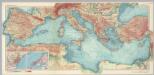
Mediterranean Sea. Pergamon World Atlas.
1 : 5000000 Polish Army Topography Service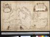
Nieuwe paskaart van de Middelanse Zee
Mediterranean Christoffel Middaghten Gerard van Keulen
Mittelländisches und Schwarzes Meer
Atlas der Hydrographie Berghaus, Hermann Justus Perthes
Mediterranean Sea.
1 : 8236800 Stanford, Edward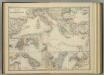
Mediterranean Basin.
1 : 6800000 Johnston, Alexander Keith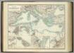
Mediterranean Basin.
1 : 6800000 Johnston, Alexander Keith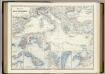
Mediterranean Basin.
1 : 6400000 Johnston, Alexander Keith, 1804-1871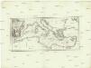
Karte des Mittellaendischen Meers
Středozemní moře Bonne, Rigobert Schraembl, Franz Anton F.A. Schraembl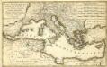
Mare Mediterranevm
1 : 5600000 Mollova mapová sbírka Homann, Johann Baptist Hauer, Daniel Adam Homann, Johann Baptista - dědici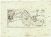
Karte des Mittellaendischen Meers
Středozemní moře-oblast Bonne, Rigobert Schraembl, Franz Anton F.A. Schraembl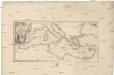
Karte des Mittellaendischen Meers
Středozemní moře-oblast Bonne, Rigobert Schraembl, Franz Anton F.A. Schraembl
Mittelländisches Meer
1 : 8250000 Středozemní moře-oblast Elfert, P. Geogr. Anstalt von Wagner & Debes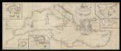
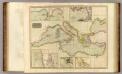
A correct chart of the Mediterranean sea from the coast of Portugal to the Levant
6 Carta nàutica. Conté: A plan of the city and Port of Civita-Vechia; The bay of Scanderoon; The bay of Tunis; A plan of the port of Neptune or Nation. Datació aproximada. Mount & Page William Mount & Thomas Page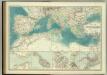
Mediterranean Basin.
1 : 6800000 Johnston, W. & A.K.
Mer Mediterranee.
1 : 10000000 Garnier, F. A., 1803-1863
Geographie des Grecs Primitive.
Malte-Brun, Conrad, 1775-1826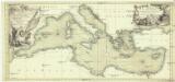
Carte de la mer Mediterranée
Středozemní moře Bonne, Rigobert Bourbon, Louis Alexandre de chez Lattré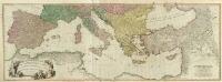
Composite: Mediterranean.
1 : 2850000 Faden, William, 1750?-1836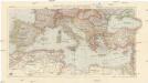
Karte der Länder des Mittelmeeres
1 : 5000000 Středozemní moře-oblast Freytag & Berndt
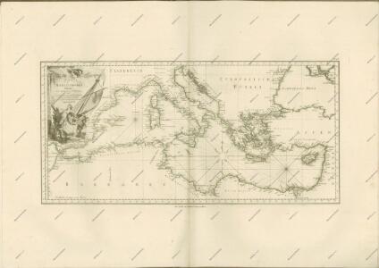
Carte nouvelle de la mer Mediterranée : divisée en mer de Levant et de Ponant, subdivisés en leurs principales parties ou mers : avec les observations des Mrs. de l'Académie
1 : 4375000 Sanson, Nicolas, 1600-1667 chez Pierre Mortier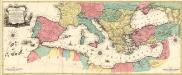
Carte Geographique representant la Mer Mediterranée ou la seconde Partie du Theatre de la Guerre entre les Russes et les Turcs
1 : 4400000 Mollova mapová sbírka Lotter, Tobias Conrad Lotter, Johann Jakob II.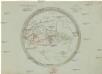
Aelteste Geographie der Griechen, nach dem Homer und Hesiodus
Afrika severní
(Mediterranean Region)
1 : 10900000 Bowen, Frances
La mer Mediterranée divisée en ses principales parties ou mers
1 : 6200000 Středozemní moře-oblast Valk, Gerhard G. Valk