Maps of North Atlantic Ocean
Karte des Atlantischen Oceans
1 : 7500000 Atlantský oceán-oblast Schraembl, Franz Anton F.A. Schraembl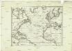
Karte des Atlantischen Oceans
1 : 22500000 Atlantský oceán-oblast Schraembl, Franz Anton F.A. Schraembl
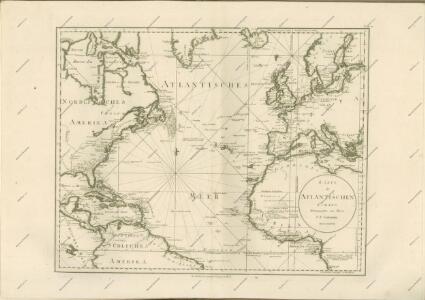
Karte des Atlantischen Oceans
Atlantský oceán-oblast Schraembl, Franz Anton F.A. Schraembl
Karte des Atlantischen Oceans
1 Karte : Kupferdruck ; 48 x 60 cm Schrämbl zu finden in eigenem Verlage Schrämbl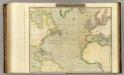
N. Atlantic Ocean.
1 : 22500000 Thomson, John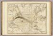
The Atlantic Ocean.
1 : 22500000 Pownall, Thomas
Carte de l'ocean Atlantique
1 Karte : Kupferdruck ; 47 x 61 cm Jefferys; Le Rouge chez Le Rouge rue des g.ds Augustins
Carte de l'océan Atlantique
1 Karte : Kupferdruck ; 48 x 61 cm Lattré chéz Lattré graveur du roy rue St. Jacques la porte cochère vis avis la rue de la Parcheminerie
General chart, of the North Atlantic, or Western Ocean, from the equator to 62° north latitude, according to the latest, surveys and observations
1 : 9000000
West Indies. Europe.
1 : 9250000 Schonberg & Co.
Carte de l'océan Pacifique au nord de l'equateur, et des côtes qui le bornent des deux côtés
1 Karte : Kupferdruck ; 36 x 50 cm Lotter publiée par Tobie Conrad Lotter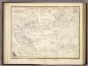
Die Luftstromungen auf dem Nordatlantishcen Ocean.
1 : 29000000 Berghaus, Heinrich
Ueberfahrts-Karte
Grosser Hand-Atlas über alle Theile der Erde in 170 Karten Meyer, J. Verlag des Bibliographischen Instituts
Ueberfahrts-Karte.
1 : 30000000 Radefeld, Carl Christian Franz, 1788-1874
Asia.
1 : 45000000 Morse, Jedidiah; Morse, Sidney E. (Sidney Edwards), 1794-1871
North Atlantic Ocean.
1 : 8000000 Blunt, Edmund M. (Edmund March), 1770-1862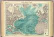
North Atlantic Ocean.
1 : 25000000 John Bartholomew & Co.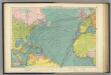
North Atlantic Ocean.
1 : 20000000 Philip, George
A chart of the Atlantic or Western Ocean / drawn from the latest surveys & astronomical observations by J. & A. Walker, London & Liverpool 1830.
from Atlantic Ocean J. & A. Walker,
Der Atlantische Ocean
Hand-Atlas über alle Theile der Erde nach dem neuesten Zustande und über das Weltgebäude Stieler, Adolf bei Justus Perthes
Der noerdliche Theil des grossen Welt Meeres / von C. G. Reichard im Jahre 1804 ; Nach des Herrn von
1 : 11100000 1 Karte : Kupferdruck ; 49 x 67 cm Reichard, Christian Gottlieb Theophil im Verlage des Geograph. Instituts
A new chart of the Atlantic or Western Ocean
1 : 9350000 Heather, W. (William) Heather, W. (William)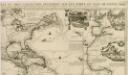
Carte tres curieuse de la mer du Sud, contenant des remarques nouvelles et tres utiles non seulement...
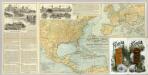
N. America, W. Europe passenger lines.
1 : 14130000 Associated Railway Land Dept of Florida
Mar Del Nort. [Karte], in: Het vijfde Deel Des Grooten Atlas : Vervatende De Water-Weereld, S. 56.
1 Karte aus Atlas Jansson, Jan Jansson, Jan
Mar del Nort / [Joannes Janssonius]
1 : 30000000 Annotatie: Origineel is Blad 3 in atlas factice Janssonius, Joannes (jr.) (1588-1664) [Amsterdam : Joannes Janssonius]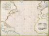
A new chart of the Atlantic or Western Ocean / improved by W. Heather; engraved by J. Stephenson.
from Charts and maps W. Heather; J. Stephenson,
Mar Del Nort. [Karte], in: Novus atlas absolutissimus, Bd. 9, S. 58.
1 Karte aus Atlas Janssonius Offizin
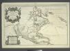
Amerique septentrionale divisée en ses principales parties: ou sont distingués les vns des autres les estats suivant qu'ils appartiennent presentemet aux François, Castillans, Anglois, Suedois, Danois, Hollandois / tirée des relations de toutes ces nations par le Sr. Sanson, geographe ordinaire du Roy; Cordier, sculps?
from Whole Sanson,