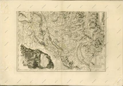
Maps of Pontic Steppe

Orientační plán hlavního města Prahy s okolím
Continental Europe.
1 : 9000000 Cornell, S. S. (Sarah S.)
Europe.
1 : 10300000 Mitchell, Samuel Augustus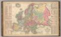
Europe.
1 : 10300000 Mitchell, Samuel Augustus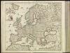
[5][5] Nova et accurata totius Europae descriptio, uit: Atlas sive Descriptio terrarum orbis
Annotatie: Gedigitaliseerde versie. Amsterdam. Heiloo : Picturae (vervaardiger), 2015. tiff-bestand. Gedigitaliseerd: 07-01-2015; Origineel: Universiteitsbibliotheek Vrije Universiteit (XL.05127.-) ; Netherlands; Titelpagina ontbreekt Wit, Frederik de Amsterdam : Frederick de Wit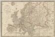
Carte physique et politique de l'Europe
1 : 7400000 Evropa Brué, Adrian Hubert Gardner, James J. Goujon
Di-gyiu Du, Ng Da-tsiu Di-du[地舆图、五大洲地图]
Di-gyiu Du, Ng Da-tsiu Di-du[地舆图、五大洲地图] 1853年,Martin, W. A. P. (William Alexander Parsons) 美国长老会传教士丁韪良用罗马拼音标注宁波方言编写的世界地理著作,对地球和各大洲进行介绍。内有东西半球图、亚洲图、欧洲图、非洲图、北美洲图、南美洲图、地中海附近图、清内地十八省图、浙江省图、宁波附近图等。 10图,墨刻本,罗马拼音标注宁波方言,图幅不一,约39 x 49.5 cm Harvard-Yenching | Rare Book | TA 2370 92,Hollis Number:008156153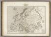
Europe.
1 : 10000000 Montemont, A.
Europe.
1 : 15778000 Hammond, C.S.
Europe.
1 : 21000000 Higgins, W.M.
L'Europe 1789, 1813.
1 : 16500000 Lapie, M. (Pierre), 1779-1850
Europe.
1 : 15000000 Colton, G.W.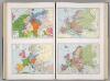
Historical Maps of Europe.
1 : 6897000 Hammond, C.S.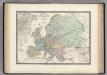
L'Europe en 1813.
1 : 12200000 Levasseur, E.
Carte Generale de Europe.
1 : 15400000 Vivien de St Martin, L.
General-Karte von Europa
1 : 8700000 Evropa Weiland, Karl Ferdinand im Verlage des Geographischen Instituts
地理志略:歐羅巴
地理志略 1903年,Alice S. Parker 此为用厦门闽南方言表述、罗马拼音书写的世界地理介绍性著作,介绍了清朝地理和世界六大洲地理概况。内有《大清國》图和《十八省》图,分别为全清和内地省级行政区划图。 2图,彩色,厦门方言罗马拼音,19.8 x 22.8 cm Harvard-Yenching | Rare Book | TA 2380 68.1,Hollis Number:008161906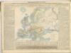

Isothermen der Erde
Evropa Gräf, C. Dellinger, A. Geographisches Institut
Europa nach seinen oro-hydrographischen Verhältnissen
1 : 8700000 Evropa Gräf, Adolf Biedermann Geographisches Institut
Europa im Jahre 1815
Evropa Gindely, Antonín F. Tempsky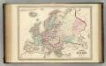
Europe.
1 : 11250000 Johnson, A.J.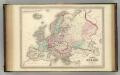
Europe.
1 : 11250000 Johnson, A.J.
EUROPAE recens DESIGNATIO
Evropa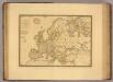
L'Europe sous l'Empire de Charlemagne.
1 : 12500000 Picquet, C.
Europa delineata juxta observationes excellorum virorum Academiae regalis scientiarum et nonnullor aliorumet juxta recentissimas annotationes
1 : 11000000 Evropa Delisle, Guillaume Lotter, Tobias Conrad in officina Tobiae Conr. Lotter
Essai d'un parallele des fleuves de l'Europe qui ont leurs embouchures immediatement dans l'ocean ou dont les eaux s'y jettent par les mers Baltique et Mediterranée
1 : 1800000 Baltské moře Buache, Philippe Schenk, Jansz. Leonard
Europa Christiani orbis domina in sua imperia, regna, et status exacte divisa
1 : 15000000 Evropa Homann, Johann Baptist Iohan. Bapt. Homann