编目地图


n/a
1791
Meßtischblatt 453 : Rossach, 1873
1873
1:250k
Meßtischblatt 5732 : Sonnefeld, 1943
1943
1:250k
Meßtischblatt 5731 : Coburg, Stand 1924
1924
1:250k
Meßtischblatt 3336 : Coburg, 1919
1919
1:250k
Meßtischblatt 3287, neue Nr. 5631 : 1936Meeder
1936
1:250k
Meßtischblatt 5632 : Neustadt b. Coburg, 1943
1943
1:250k
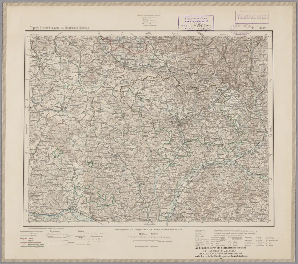
141. Coburg, uit: Topographische Uebersichtskarte des Deutschen Reiches / herausgegeben v. d. Kartogr. Abt. d. Königl. Preuß. Landesaufnahme
1899
Königlich Preußische Landesaufnahme. Kartographische Abtheilung
1:200k
n/a
1791
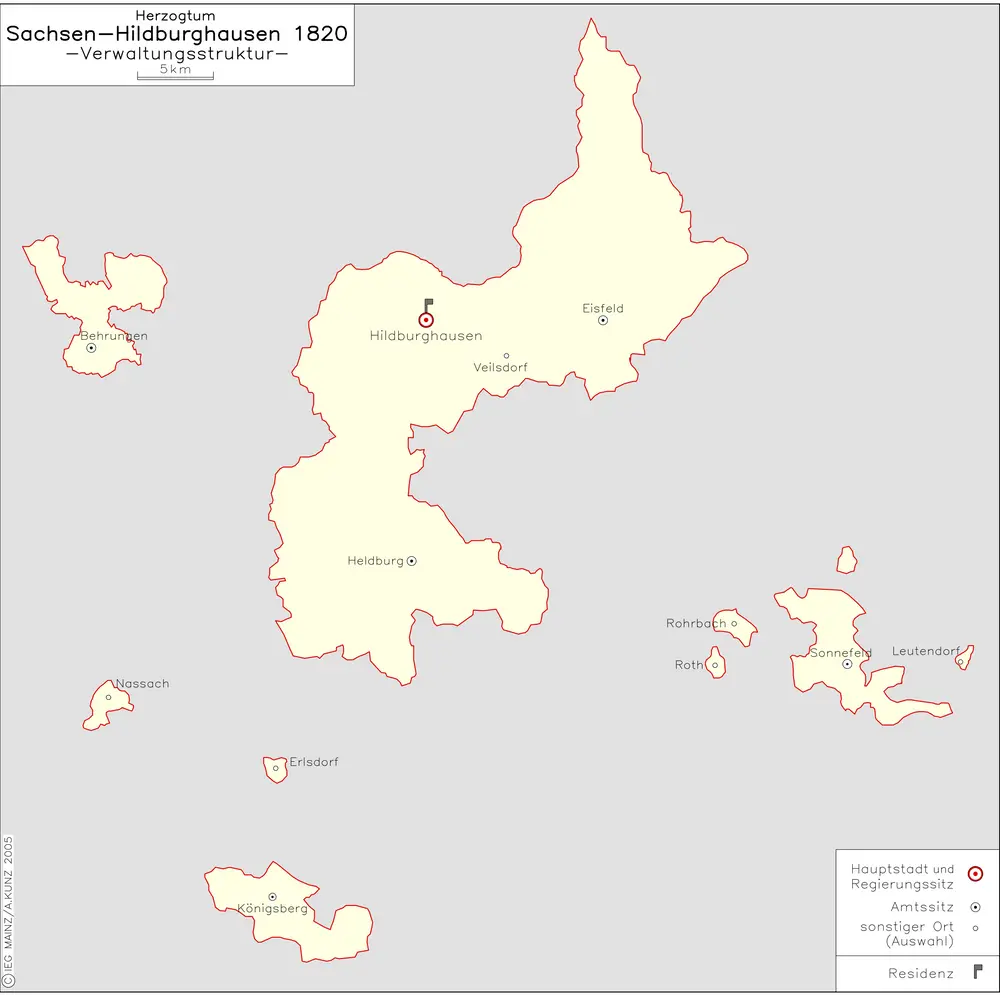
Herzogtum Sachsen-Hildburghausen 1820 Verwaltungsstruktur
1820
Kunz, Andreas ; Moeschl, Joachim Robert