Maps of Czech Republic


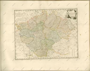
Karte des Königreiches Boehmen
1 : 875000 Česko Franz Raffelsperger
Le Royaume de Boheme divisée en ses douze cercles
1 : 700000 Kladsko-oblast (Polsko) Müller, Johann Christoph Covens et Mortier
Mappa totius regni Bohemiae
1 : 700000 Čechy (Česko) Bock-Polach, Josef Ferdinand Müller, Johann Christoph
Mappa totius regni Bohemiae
1 : 700000 Čechy (Česko) Bock-Polach, Josef Ferdinand Ponheimer, Kilian
Bohemiae Regnum in XII circulos divisum cum com. Glac et distr. Egerano ceterisque circumjacentibus terris ex Müllerianis aliisque chorographicis subsidiis delineatum nunc noviter revisum et emend. per Homannianos Heredes
Böhmen Verwaltungsgliederung
Carta del regno di Boemia
1 : 530000 Čechy (Česko) Raffelsperger, Franz Raffaelle
Carte du royaume de Boheme
1 : 530000 Čechy (Česko) Raffelsperger, Franz Rumpold, F. François Raffelsperger
Karte des Königreiches Boehmen
1 : 880000 Čechy (Česko) Raffelsperger, Franz Rumpold, F. im Typographischen Landkarten-Verlage
Bohemiae Regnum in XII. Circulos divisum ...

České království
1 : 700000
Karte vom Königreiche Böhmen
1 : 690000 Česko Carl Wilhelm Medau
Karte vom Königreiche Böhmen
1 : 690000 Česko Carl Wilhelm Medau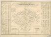
Orientirungs - Karte in der neuen gerichtlichen und politischen Eintheilung des Königreichs Böhmen

Le Royaume de Boheme

Special-Karte des Königreiches Böhmen

Bohemiae Regnum in XII. Circulos divisum ...

Mappa Geographica totius Regni Bohemiae...

Special-Karte des Königreiches Boehmen
1 : 890000 Česko
Bez titulu: Statistické mapky Čech

Mapa království Českého

Charte von Boehmen
1 : 1000000 Česko Kipferling, Karl Joseph in J. Riedl's Kunsthandlung
Charte vom Königreich Böheim
1 : 730000 Kladsko-oblast (Polsko) Müller, Johann Christoph von Homanns Erben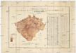
Uebersichts-Karte und statistische Darstellung der Area und der Grundsteuer-Vorschreibung des landtäflichen Grossgrundbesitzes dann des Grundbesitzes überhaupt im Königreiche Böhmen
České království Procházka, Johann F. Joh. F. Procházka
Post Charte vom Königreiche Böhmen
1 : 1200000 Česko
Post Charte vom Königreiche Böhmen
1 : 1200000 Česko
Post charte vom Königreiche Böhmen
1 : 1200000 Česko
Post charte vom Königreiche Böhmen
1 : 1200000 Česko
Post Charte vom Königreiche Böhmen
1 : 1200000 Česko
Post Charte vom Königreiche Böhmen
1 : 1200000 Česko
Post Charte vom Königreiche Böhmen
1 : 1200000 Česko
Post Charte vom Königreiche Böhmen
1 : 1200000 Česko
Post Charte vom Königreiche Böhmen
1 : 1200000 Česko