Maps of Flemish Brabant

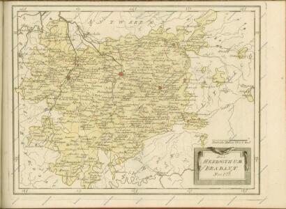
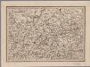
Das Herzogthum Brabant
1 : 310000 Brabantsko
Le Brabant Espagnols et L'Eveché de Liege &c.
Mollova mapová sbírka Nolin, Jean-Baptiste Nolin, Jean Baptiste
Le Duché De Brabant [...] [Karte], in: Atlas nouveau, contenant toutes les parties du monde [...], Bd. 2, S. 32.
1 Karte aus Atlas Sanson, Nicolas Jaillot, Alexis Hubert und Mortier, Pieter
Le Duché de Brabant :
1 : 146000 Mollova mapová sbírka Jaillot, Alexis-Hubert
[118][121] Pars meridionalis Brabantiae ..., uit: Atlas sive Descriptio terrarum orbis
Annotatie: Gedigitaliseerde versie. Amsterdam. Heiloo : Picturae (vervaardiger), 2015. tiff-bestand. Gedigitaliseerd: 07-01-2015; Origineel: Universiteitsbibliotheek Vrije Universiteit (XL.05127.-) ; Netherlands; Titelpagina ontbreekt Wit, Frederik de Amsterdam : Frederick de Wit
Pars Meridionalis Brabantiae continens Dominium Mechliniense Ducatum Arschotanum [...] [Karte], in: Gerardi Mercatoris et I. Hondii Newer Atlas, oder, Grosses Weltbuch, Bd. 1, S. 387.
1 Karte aus Atlas Mercator, Gerhard und Hondius, Jodocus Jansson, Jan
29th Division. March through Belgium and Germany across the Rhine to Bridghead. Sheet 1
1 : 250000 29th Division. March through Belgium and Germany across the Rhine to Bridghead. Sheet 1. Shows route of 29th Division who marched from Renaix in Belgium to Cologne in Germany to secure Rhine bridgehead immediately following the end of the First World War. War Office
Le Pais d'Entre Sambre et Meuse
1 : 316000 Mollova mapová sbírka Fer, Nicolas de Inselin, Charles Danet, Guillaume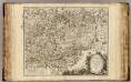
Brabant, Namur Partie Meridionale.
1 : 217500 Robert de Vaugondy, Gilles, 1688-1766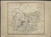
Brabant méridional, divisé en arrondissemens et cantons de justice de paix
1 : 190000 dressé et gravé par C. van Baarsel et Fils. A Amsterdam [etc.] : chez F.J. Weygand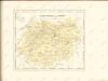
[18], uit: Hydro-Oro und Chorographische General Karte des Koenigreichs der Niederlande und der angrenzenden Länder bis Paris : mit der Angabe der Kunst und Heer-Strassen und der Entfernung der Poststationen / ... zusammengetragen und reducirt von ... Wilhelm Müller
1 : 400000 titelvariant: Generalkarte des Koenigreichs Hannover; Annotatie: 1e supplement bij: Generalkarte des Koenigreichs Hannover (1818) Müller, Wilhelm (fl. 1818) [Hannover : Wilhelm Müller]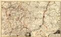
Carte Contenant le Duche de Limbourg et Partie du Dioecese de Liege dediée A Son Altesse Electorale de Baviere
1 : 140000 Mollova mapová sbírka Medtman, Matthias van Husson, Pierre
Pars Medionalis Brabantiae
1 : 220000 Mollova mapová sbírka Wit, Frederik de Covens, Johannes I
Maastricht 83, uit: [W. Liebenow's Special-Karte von Mittel-Europa]
1 : 300000 titelvariant: W. Liebenow's Mittel-Europa; Annotatie: Titel boven de bladen: W. Liebenow's Mittel-Europa Johannes Wilhelm Liebenow 1822-1897 Hannover : Hermann Oppermann
Maastricht 83, uit: Special-Karte von Mittel-Europa / nach amtlichen Quellen bearbeitet von W. Liebenow
1 : 300000 titelvariant: W. Liebenow's Mittel-Europa; Annotatie: Titel boven de bladen: W. Liebenow's Mittel-Europa Johannes Wilhelm Liebenow 1822-1897 Frankfurt a. M. : Ludwig Ravenstein
Leodiensis Dioecesis
1 : 390000 Mollova mapová sbírka Blaeu, Willem Janszoon Blaeu, Joan I.
Tetrarchia Lovaniensis una cum Arschotano Ducatu
1 : 135000 quam emendatam [...] dedicat consecratque M. van Medtman Lovanii A Amsterdam : chez R. & I. Ottens
Secunda Pars Brabantiae cuius urbs primaria Bruxellae [Karte], in: Novus atlas absolutissimus, Bd. 3, S. 47.
1 Karte aus Atlas Janssonius Offizin
Secunda Pars Brabantiae cuius urbs primaria Bruxellae [Karte], in: Le théâtre du monde, ou, Nouvel atlas contenant les chartes et descriptions de tous les païs de la terre, Bd. 1, S. 346.
1 Karte aus Atlas Blaeu, Willem Janszoon und Blaeu, Joan Blaeu, Willem Janszoon
Secunda Pars Brabantiae cuius urbs primaria Bruxellae [Karte], in: Novus Atlas, das ist, Weltbeschreibung, Bd. 1, S. 319.
1 Karte aus Atlas Blaeu, Joan Blaeu, Willem Janszoon
Secunda Pars Brabantiae cuius urbs primaria Bruxellae [Karte], in: Theatrum orbis terrarum, sive, Atlas novus, Bd. 1, S. 340.
1 Karte aus Atlas Blaeu, Joan Blaeu, Willem Janszoon

SECVNDA PARS | BRABANTIÆ | cuius urbs primaria | BRVXELLÆ
Descr. Michaele Florentio a Langren | Mathematico Regio. Guiljelmus Blaeu excudit (scale cartouche)
Lovaniensis tetrarchia una cum Arscotano ducatu in eiusdem ditiones subiacentes accuratissime divisa
1 : 176000 Aarschot (Belgie) Visscher, Nicolaes Jansz. Schenk, Pieter apud Petrum Schenk iunior
Map of Water Supply: Brussels
1 : 100000 Series of maps on water supplies. Brussels. War Office
Brussels Water Supply Map
1 : 100000 First World War Brussels Water Supply Map. Shows location of standpipes, springs, wells etc. Numbered and notated. War Office
Bruxellensis tetrarchia
1 : 130000 Brusel-oblast (Belgie) Visscher, Nicolaus Schenk, Pieter apud Petr Schenk