Maps of Spain


L'Espagne 585 a 756.
1 : 4800000 Houze, Antoine Philippe
Spanien und Portugal
Stieler's Hand-Atlas Stieler, Adolf bei Justus Perthes
Spanien und Portugal
Schul-Atlas über alle Theile der Erde nach dem neuesten Zustande, und über das Weltgebäude Stieler, Adolf bei Justus Perthes
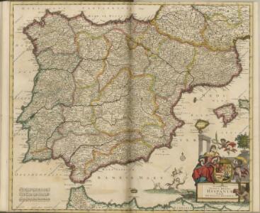
Novissima et accuratißima regnorum Hispaniae et Portugaliae tabella geographica
1 : 6170000 Portugalsko Seutter, Matthäus Lotter, Tobias Conrad Tob. Conr. Lotter
Carte des royaumes d'Espagne et de Portugal
1 Karte : Kupferdruck ; 48 x 56 cm Robert de Vaugondy; Delamarche chez le Sr. Delamarche géographe rue du Foin St. Jacques au collége de M.e Gervais
Carte des royaumes d'Espagne et de Portugal
1 Karte : Kupferdruck ; 48 x 56 cm Robert de Vaugondy; Fortin chés Fortin ingénieur mécanicien du roi pour les globes et sphères rue de la Harpe près celle du Foin
Le royaume d'Espagne et celui de Portugal
1 : 19300000 Portugalsko Bonne, Rigobert André
Spanien und Portugal
1 : 2300000 entworfen und gezeichnet von C. F. Weiland L.G. Jaeger sc. Weimar : Verlag des Geograph. Instituts
L'Espagne sous les Romains 409 ans apres J.C.
1 : 4800000 Houze, Antoine Philippe
Mapa general de España
1 Karte : Kupferdruck ; 48 x 58 cm López Tomás López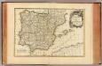
Espagne, Portugal.
1 : 3600000 Janvier, Jean
Spanjen en Portúgal
1 : 6000000 [S.l. : s.n.]
Spanien und Portugal
1 Karte : Kupferdruck ; 25 x 29 cm Sotzmann; Ramberg s.n.
Regnorum Hispaniæ et Portvgalliæ tabula generalis
1 Karte : Kupferdruck ; 45 x 57 cm Güssefeld; López chez les Heret. de Homann
Regnorum Hispaniæ et Portvgalliæ tabula generalis
1 Karte : Kupferdruck ; 45 x 57 cm Güssefeld; López chez les Heret. de Homann
Spanien und Portugal
1 : 2350000 Cádiz (Španělsko) Weiland, Karl Ferdinand im Verlage des Geographischen Instituts
Spanien und Portugal
1 : 2350000 Cádiz (Španělsko) Weiland, Karl Ferdinand im Verlage des Geographischen Instituts
Spanien und Portugal
1 : 2300000 entworfen und gezeichnet von C. F. Weiland L.G. Jaeger sc. Weimar : Verlag des Geograph. Instituts
Mapa general de Espana, dividido en sus actuales provincias, islas adyacentes, y reyno de Portugal
1 : 1400000 compuesto con lo mejor que hay impreso, manuscrito noticias de sus naturales, y sujeto á las observaciones Astronomicas por Tomas Lopez Madrid : [Tomas Lopez]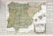
L'Espagne
1 Karte : Kupferdruck ; 46 x 54 cm Nolin; Basset; Basset chez Basset rue St. Jacques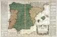
L'Espagne
1 Karte : Kupferdruck ; 45 x 54 cm Nolin; Daumont chez Daumont rue de la Feronnerie a l aigle d'or
Carte d'Espagne et de Portugal
1 Karte auf 6 Blatt : Kupferdruck ; 73 x 82 cm Brion de la Tour; Jean chez Jean rue Jean de Beauvais. no. 10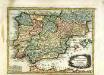
L'Espagne
1 Karte : Kupferdruck ; 19 x 25 cm Crépy chez Crepy
Cartes Blondel : Espagne-Portugal au 2.000.000e
1 : 2000000 Blondel la Rougery. Paris Paris : Blondel La Rougery
Géographie. croquis n8, Espagne et Portugal
1 : 2000000 Molard, Jules, Commandant [Paris] : Service Géographique de l'Armée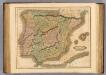
Spain, Portugal.
1 : 2450000 Lizars, Daniel
Spain, Portugal.
1 : 5200000 Arrowsmith, Aaron; Lewis, Samuel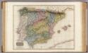
Spain and Portugal.
1 : 1920000 Pinkerton, John, 1758-1826
Spain, Portugal.
1 : 5200000 Arrowsmith, Aaron; Lewis, Samuel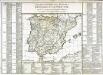
Tableau général des royaumes d'Espagne et de Portugal
1 Karte : Kupferdruck ; 34 x 43 cm, Bildgrösse 51 x 73 cm Brion de la Tour; Le Campion; Le Campion chez les Campion freres rue St. Jacques à la ville de Rouen
(L'Espagne)
1 : 12000000 Bruyset, Jean-Marie; Schneider, J. H.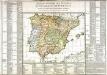
Tableau général des royaumes d'Espagne et de Portugal
1 Karte : Kupferdruck ; 34 x 43 cm, Bildgrösse 51 x 73 cm Brion de la Tour; Le Campion; Le Campion chez les Campion freres rue St. Jacques à la ville de Rouen