Maps of Regierungsbezirk Freiburg

Circvli Sveviae Mappa
1 : 470000 Mollova mapová sbírka Hase, Johann Matthias Homann, Johann Baptista - dědici
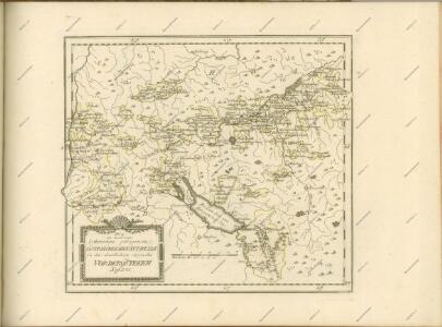
Die in und um Schwaben gelegenen Östreichischen Antheile in der ämtlichen Sprache Vorderöstreich : Nro. 58
Reilly, Franz Johann Joseph von
Circuli Sveviae
1 : 477000 Švábsko (Německo) Hase, Johann Matthias Homan[n]ianorum Heredum
Teutzchlandes Schwaebischer Creiss samt dazugehörigen Provintzen
1 : 1900000 Mollova mapová sbírka Weigel, Christoph Weigel, Christoph I.

Charte vom Schwaebischen Kreis : nach dem Entschädigungsplan im Jahr 1802 eingerichtet und illuminirt
Homannische Erben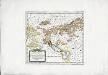
Die in und um Schwaben gelegenen östreichischen Antheile in der ämtlichen Sprache Vorderöstreich
1 Karte : Kupferdruck ; 22 x 24 cm Reilly F. J. J. von Reilly
Circulus Suevicus in quo Ducatus Wirtenbergensis cum reliquis Statibus Et Provinciis curate designatus proponitur
Seutter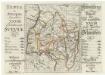
Typus ac Synopsis sequentium XXVIII Tabellarum Sveviae = Anweissung und Inhalt über hier nachfolgende XXVIII grosse Tabellen
Mollova mapová sbírka Hurter, Johann Christoph Bodenehr, Gabriel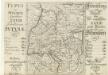
Typus ac Synopsis sequentium XXVIII Tabellarum Sveviae = Anweissung und Inhalt über hier nachfolgende XXVIII grosse Tabellen
Mollova mapová sbírka Hurter, Johann Christoph Bodenehr, Johann Georg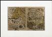
Circulus siue Liga Sveviae vulgo Schwabische Kraiß
Seltzlin, David
La Souabe
1 : 880000 Mollova mapová sbírka Sanson, Nicolas Mariette, Pierre
Circulus Suevicus in quo Ducatus Wirtenbergensis cum reliquis Statibus et Provinciis curate designatus proponitur
1 : 630000 Mollova mapová sbírka Seutter, Matthäus Seutter, Matthäus
<<[Die>> Gaugrafschaften im 11. Jahrhundert]
1 : 800000 1 Karte Wurster, Winterthur
Charte vom Churfürstenthum Schwaben
1 Karte : Kupferdruck ; 32 x 38 cm Kauffer bey A. G. Schneider u: Weigel
Charte von Schwaben
1 Karte : Radierung ; 47 x 60 cm Amman s.n.
Die in und um Schwaben gelegenen Östreichischen Antheile in der ämtlichen Sprache Vorderöstreich : Nro. 150
Reilly, Franz Johann Joseph von
Der Schwäbische Creis
Schreiber, Johann Georg
S. R. I. Circulus Sueviae Continens Ducatum Wirtenbergensem Aliosq[ue] Status Et Provincias Eidem Circulo Insertas
Homann, Johann Baptist
VI, uit: General-Karte des oesterreichischen Kaiserstaates mit einem grossen Theile der angrenzenden Länder / durch Josef Scheda ... bearb. und hrsg
1 : 576000 Annotatie geografische gegevens: Maatstokken: oesterreichische Meilen, geografische oder deutsche Meilen, preussische Meilen, türkische Berri, französische Lieues, russische Werste; Maatstok per blad: wiener Klafter, öster. Meilen; Blad XIX: statistische en taalkundige informatie; Blad XIX: legenda [Wien : K.K. Militärisch-Geografisches Institut]
Deß Hayligen Römischen Reichs Schwebischen Kraysssampt seinen Vmb unnd Inligenden lannd vnnd Herrschafften
1 : 790000 Mollova mapová sbírka Mannasser, Daniel Mittnacht, Moritz
S. R. I. Circulus Sueviae continens Ducatum Wirtenbergensem
1 : 640000 Mollova mapová sbírka Homann, Johann Baptist Homann, Johann Baptista
Circulus Suevicus : in quo Ducatus Wirtenbergensis cum reliquis Statibus Et Provinciis curate designatus proponitur
Lotter, Tobias Konrad Lotter
Circulus siue liga Sveviae, vulgo Schwabische Kraiss
1 Karte : Kupferdruck ; 31 x 23 cm Seltzlin; Ortelius s.n.
Circulus siue liga Sveviae, vulgo Schwabische Kraiss
1 Karte : Kupferdruck ; 31 x 23 cm Seltzlin; Ortelius s.n.

S. R. I. Circulus Sueviae Continens Ducatum Wirtenbergensem Aliosq[ue] Status Et Provincias Eidem Circulo Insertas
1 : 620000 Homann, Johann Baptist
Geographica provinciarum Sveviae descriptio
Švábsko (Německo) Hurter, Johann Christoph Bodenehr, Gabriel Hanß Georg Bodenehr