Maps of powiat głubczycki
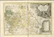
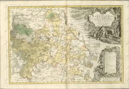
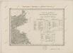
Principatvs Silesiae Karnoviensis nova et exactissima Tabula geographica, commonstrans insimul districtus ac Statvs Minores Frevdenthal Olbersdorf et Stevberndorf.
1 : 1125000 Mollova mapová sbírka Wieland, Johann Wolfgang Homann, Johann Baptista - dědici
Principatvs Silesiae Karnoviensis nova et exactissima tabula geographica commonstrans insimul districtus ac statvs minores Frevdenthal, Olbersdorf et Stevberndorf
1 : 100000 Bruntál-oblast (Česko) Wieland, Johann Wolfgang Schubarth, Matthäus Homannianos Heredes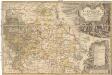
Principatvs Silesiae Karnoviensis nova et exactissima tabula geographica commonstrans insimul districtus ac statvs minores Frevdenthal Olbersdorf et Stevberndorf
1 : 100000 Bruntál-oblast (Česko) Wieland, Johann Wolfgang Schubarth, Matthäus ab Haeredibus Homannianis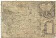
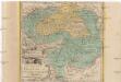
Principatvs Silesiae Karnoviensis nova et exactissima tabula geographica commonstrans insimul districtus ac Statvs minores Frevdenthal, Olbersdorf et Stevberndorf
1 : 100000 Bruntál-oblast (Česko) Wieland, Johann Wolfgang Schubarth, Matthäus Homannianos Heredes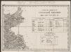
Umgebungen von Jägerndorf und die statistische Uebersicht
1 : 144000 K.K. Militärisches Geographisches Institut
Reymann ́s Special Karte 190 Troppau
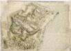
Die Fürstenthümer Troppau und Iaegerndorf in Ober-Schlesien
1 : 420000 Krnov-oblast (Česko) Schleuen, Johann David I.D. Schleuen
Podrobná mapa Markrabství moravského a Vévodství slezkého
1 : 100000 Krnov (Česko : oblast) Srp, Jan Jos. R. Vilímek
Jacerndorf.
from Spezialkarte der osterreichisch-ungarischen Monarchie.
Karte des politischen Bezirkes Jägendorf
II. vojenské mapování 2
1 : 144000
Jägerndorf
1 : 75000 Krnov (Česko : oblast) Schuberth K. u. k. Militärgeographisches Institut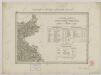
II. vojenské mapování 2
1 : 144000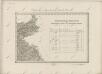
II. vojenské mapování 2
1 : 144000
III. vojenské mapování 3959
1 : 75000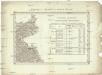
Umgebungen von Jägerndorf
Krnov-oblast (Česko) Enthoffer, J.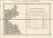
II. vojenské mapování 2
1 : 144000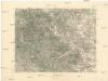
Krnov
1 : 75000 Krnov (Česko : oblast) Vojenský zeměpisný ústav
Krnov
1 : 75000 Krnov-oblast (Česko) Vojenský zeměpisný ústav
Ratibor
1 : 75000 Ratiboř-oblast (Polsko) Ministerstvo národní obrany
Karte des politischen Bezirkes Freudenthal

III. vojenské mapování 3960
1 : 75000
Krnovsko a Osoblažsko
Bez titulu: Plán bitvy u Opavy


III. vojenské mapování 3959/4
1 : 25000