Carte cataloguée


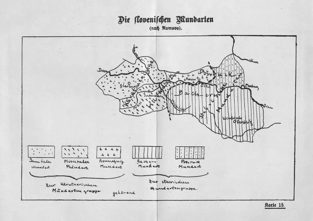
Die slovenischen Mundarten
1935
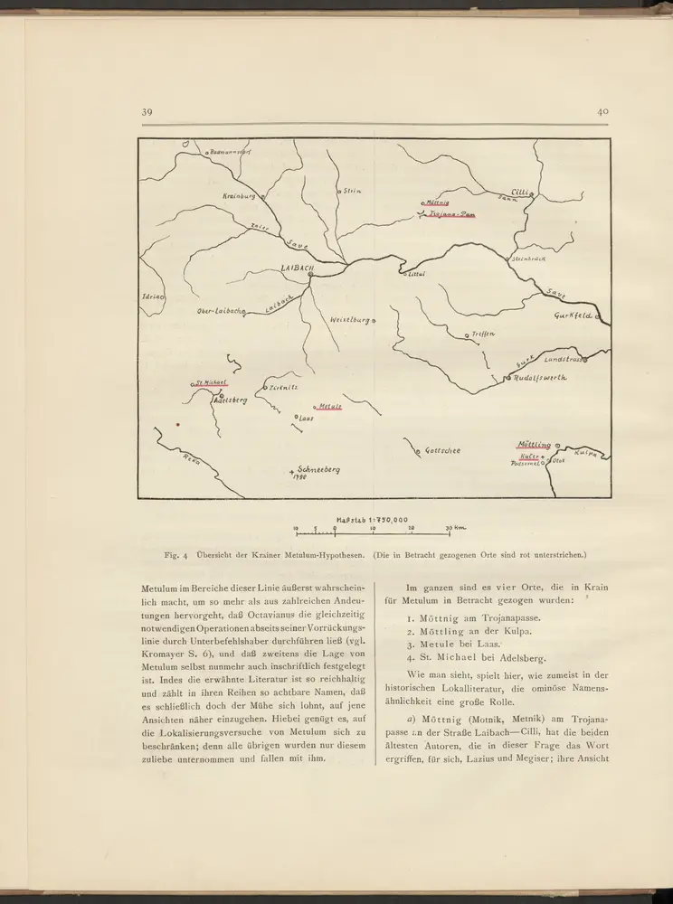
Übersicht der Krainer Metulum-Hypothesen
35
1:750k
Krain-Küstenland
1901
Bibliographisches Institut
1:850k
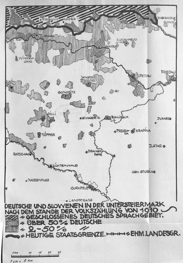
Deutsche und Slowenen in der Untersteiermark nach dem Stande der Volkszählung von 1910
1910
1:500k
33°46° Cilli / K.u.k. militär-geographisches Institut
1902
K.u.k. militär-geographisches Institut
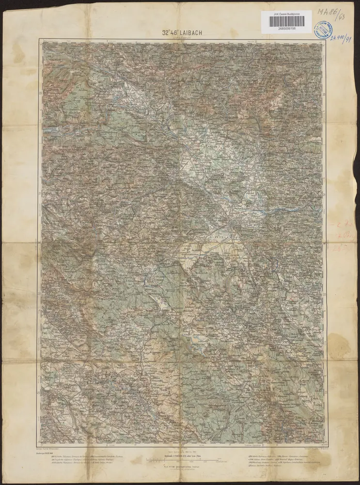
32°46° Laibach / K.u.k. militär-geographisches Institut
1900
K.u.k. militär-geographisches Institut
n/a
1796

Neuer Atlas Uber die Gantze Welt, mapa ze strany: [124]
1714
Homann Johann Baptist
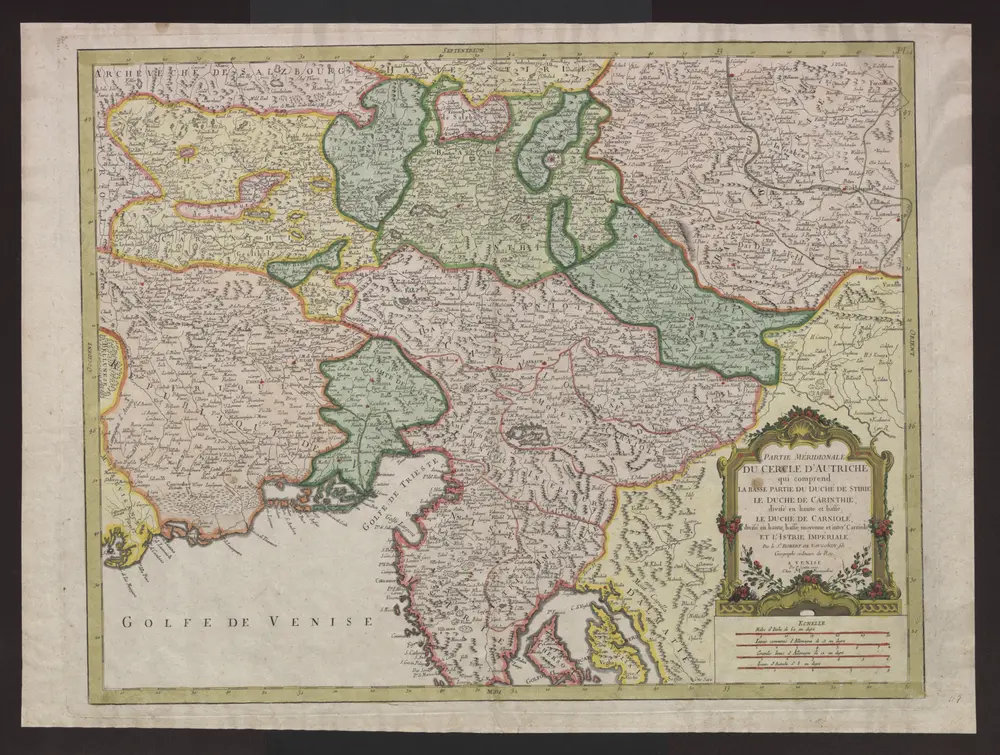
Partie méridionale du cercle d'Autriche qui comprend la basse partie du duché de Stirie, le duche de Carinthie, divisé en haute et basse, le duché de Carniole, divisé en haute, basse, moyenne et inter.e Carniole, et l'Istrie impériale
1777
Robert de Vaugondy, Didier
Der mittlere Theil von Untersteyermark oder der Marburger Kreis
1809
Kindermann; Miller; Junker