Maps of Brandenburg


II, uit: General-Karte von Mittel-Europa in 12 Blättern, im Masse 1:1.200.000 / entworfen, bearb. und hrsg. von Josef Schlacher
1 : 1200000 Annotatie: Blad 6 ontbreekt; Annotatie geografische gegevens: 21 maatstokken op blad 9; Legenda op blad 9 Wien : K.K. Militär Geografisches Institut
Nord-Östliches Deutschland
Hand-Atlas über alle Theile der Erde und über das Weltgebäude Stieler, Adolf Justus Perthes
Nord-Östliches Deutschland
Handatlas über alle Theile der Erde und über das Weltgebäude Stieler, Adolf Justus Perthes
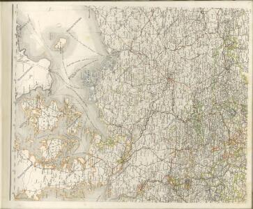
17. Pillau, uit: Topographische Uebersichtskarte des Deutschen Reiches / herausgegeben v. d. Kartogr. Abt. d. Königl. Preuß. Landesaufnahme
1 : 200000 titelvariant: Topogr. Übersichtskarte des Deutschen Reiches; Annotatie: Titel boven bladen ook: Topogr. Übersichtskarte des Deutschen Reiches; Annotatie geografische gegevens: Op elk blad twee maatstokken: 10 Kilometer = 5,5 cm; 1 geogr. Meile = 3,6 cm; Legenda onder op elk blad Königlich Preußische Landesaufnahme. Kartographische Abtheilung [S.l : Königlich Preußische Landesaufnahme, Kartographische Abtheilung]

General Karte von denen Ober- und Niedersaechsischen Kreisen nach des D. Büsching Erdbeschreibung u. den besten Hülfsmitteln entworffen
1 : 1150000 [Augsburg] : bey Joh. Walch
Prehľadná automapa NDR

Daniae Regni Typus. [Karte], in: Theatrum orbis terrarum, S. 204.
1 Karte aus Atlas Ortelius, Abraham Vrients, Jan Baptista
[Nord-Östliches Deutschland]
Hand-Atlas über alle Theile der Erde nach dem neuesten Zustande und über das Weltgebäude Stieler, Adolf bei Justus Perthes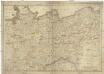
Die Königreiche Sachsen und Westphalen nach der neuesten astronomischen Beobachtungen und den besten Hülfsmitteln verfasst
1 : 1060000 Sasko (Německo) Mollo, Tranquillo T. Mollo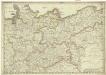
Die Königreiche Sachsen und Westphalen nach der neuesten astronomischen Beobachtungen und den besten Hülfsmitteln verfasst
1 : 1060000 Sasko (Německo) Mollo, Tranquillo T. Mollo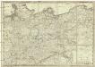
Die Königreiche Sachsen und Westphalen
1 : 1060000 Sasko (Německo) Mollo, Tranquillo T. Mollo
[Nord-Östliches Deutschland]
Hand-Atlas über alle Theile der Erde nach dem neuesten Zustande und über das Weltgebäude Stieler, Adolf bei Justus Perthes
Nord-östliches Deutschland
1 : 1850000 Braniborsko (Německo) Ausfeld, Johann Carl Justus Perthes
Nord-Ostliches Deutschland bearbeitet von C. Vogel.
1 : 1850000 Vogel, C.
Nordwestliches Deutschland
Neuer Handatlas über alle Theile der Erde Kiepert, Heinrich Verlag von Dietrich Reimer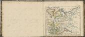

Allemagne du N.O.
1 : 1500000 Vivien St Martin, L.
[Nordoestliches Deutschland]
Stieler's Hand-Atlas Stieler, Adolf bei Justus Perthes
Postkarte von dem Obersaechsischen und Niedersaechsischen Kreise
Polsko severozápadní Kühn, Ignaz im von Reilly'schen Landkarten und Kunstwerke Verschleiss Komptoir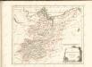

Denmark, Hanover, Brunswick, Mecklenburg, Oldenburg.
1 : 1332000 Johnston, Alexander Keith, 1804-1871
Northern and Central Germany.
1 : 2154240 Fullarton, A. & Co.
Germany north.
1 : 2800000 Arrowsmith, Aaron; Lewis, Samuel
Germany north.
1 : 2800000 Arrowsmith, Aaron; Lewis, Samuel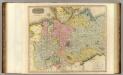
Germany N. of Mayne.
1 : 1200000 Thomson, John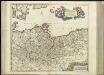
[40][40] Marchionatus Brandenburgi et Ducatus Pomeraniae tabula..., uit: Atlas sive Descriptio terrarum orbis
Annotatie: Gedigitaliseerde versie. Amsterdam. Heiloo : Picturae (vervaardiger), 2015. tiff-bestand. Gedigitaliseerd: 07-01-2015; Origineel: Universiteitsbibliotheek Vrije Universiteit (XL.05127.-) ; Netherlands; Titelpagina ontbreekt Wit, Frederik de Amsterdam : Frederick de Wit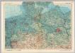
Germany - North. Pergamon World Atlas.
1 : 1250000 Polish Army Topography Service