Maps of Guiana Shield

Guiana sive Amazonum Regio. [Karte], in: Novus Atlas, das ist, Weltbeschreibung, Bd. 2, S. 340.
1 Karte aus Atlas Blaeu, Joan Blaeu, Willem Janszoon
Guiana sive Amazonum Regio [Karte], in: Le théâtre du monde, ou, Nouvel atlas contenant les chartes et descriptions de tous les païs de la terre, Bd. 2, S. 335.
1 Karte aus Atlas Blaeu, Willem Janszoon und Blaeu, Joan Blaeu, Willem Janszoon
[Süd-Amerika in 6 Blättern, Blatt 2]
Adolf Stieler's Handatlas über alle Theile der Erde und über das Weltgebäude Stieler, Adolf Justus Perthes
Guiana sive Amazonum Regio [Karte], in: Novus atlas absolutissimus, Bd. 6, S. 240.
1 Karte aus Atlas Janssonius Offizin
Guiana sive Amazonum Regio [Karte], in: Theatrum orbis terrarum, sive, Atlas novus, Bd. 2, S. 346.
1 Karte aus Atlas Blaeu, Joan Blaeu, Willem Janszoon
Ecuador, Colombia, Venezuela, Guiana. Pergamon World Atlas.
1 : 5000000 Polish Army Topography Service
(Facsimile) Guiana.
1 : 7100000 Blaeuw, William
(Facsimile) Guiana by de Laet.
1 : 8100000 De Laet, Jan
Facsimile: Guiana by Blaeuw.
1 : 7100000 Blaeuw, William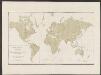
Guiana sive Amazonum Regio [Karte], in: Gerardi Mercatoris et I. Hondii Newer Atlas, oder, Grosses Weltbuch, Bd. 2, S. 404.
1 Karte aus Atlas Mercator, Gerhard und Hondius, Jodocus Jansson, Jan
Facsimile: Guiana by Blaeuw.
1 : 7100000 Blaeuw, William
A map of the Dutch settlements of Surinam, Demerary, Issequibo, Berbices, and the islands of Curassoa, Aruba, Bonaire, &c., with the French colony of Cayenne, and the adjacent Spanish countries
1 : 1
GVIANA | siue | AMAZONVM | REGIO
[Amsterdam : Joan Blaeu]
Nueva Andalucia.
1 : 6000000 Surville, Luis de
Guiana siue Amazonum regio
1 : 5500000 Blaeu, Willem Janszoon, 1571-1638 Guiljelmus Blaeuw excudit
(Facsimile) Guiana and Caribana by Sanson.
1 : 5500000 Sanson D'Abbeville, N.
Facsimile: Part of South America by D'Anville.
1 : 63400000 Anville, Jean Baptiste Bourguignon d, 1697-1782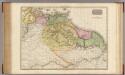
The Caracas.
1 : 3900000 Pinkerton, John, 1758-1826
Facsimile: Guiana by Bellin.
1 : 10800000 Bellin, Jacques Nicolas, 1703-1772
The Caracas.
1 : 5150000 Carey, Mathew
A map of the Caracas
1 : 5150000 Carey, Mathew, 1760-1839
Map of the Caracas.
1 : 5150000 Carey, Mathew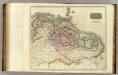
Caraccas, Guiana.
1 : 4500000 Thomson, John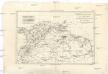
Nouveau royaume de Grenade, Nouvelle Andalousie, et Guyane
1 : 10700000 Grenada Bonne, Rigobert André
A new chart of Guyana with the colonies of Cayenne, Surinam, & Trinadad
1 : 2300000 Heather, W. (William) Heather, W. (William)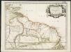
Partie de Terre Ferme ou sont Guiane et Caribane
1 : 1
Caracas, Guiana.
1 : 11000000 Arrowsmith, Aaron; Lewis, Samuel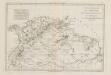
Nouveau Royaume De Grenade Nouvelle Andalousie Et Guyane.
1 : 11000000 El Atlas Encyclopédique de Bonne y Desmarest es una joya de la historia de la ciencia y de la cartografía por cuanto el texto complementario, titulado “Analyse des cartes” explica minuciosamente el método de elaboración de cada mapa. Por ejemplo, el texto describe cómo se establecieron las coordenadas geográficas de Cartagena usando los cálculos resultantes de las 19 observaciones astronómicas (eclipses de luna y emersiones de los satélites de Júpiter), realizadas allí por Louis Feuillée en 1704, Juan de Herrera entre 1719 y 1726, y Antonio de Ulloa en 1735. El método y las fuentes utilizadas para determinar la posición de cada lugar son muy detallados. El texto comienza con la explicación del cálculo usado para establecer las coordenadas de Cayenne, la capital de la colonia francesa de Guyana. Bonne, Rigobert (1727-1795) Desmarest, Nicolas (1725-1815); André