Maps of Lorraine
Western Front from Argonne to Vosges
1 : 250000 First World War map of the Western Front from Argonne to Vosges. 1918. War Office
Les duchez de Lorraine et de Bar
1 Karte : Kupferdruck ; 46 x 60 cm Nolin; Du Tralage chez I. B. Nolin sur le quay de l'Horloge du Palais à l'enseigne de la place des Victoires vers le Pont Neuf
Carte de la France, no. 6
1 Blatt : 60 x 81 cm s.n.
La Lorraine qui comprend les duches de Lorraine et de Bar et de balliages des evesches et de villes de Metz, Toul et Verdun
1 Karte : Kupferdruck ; 43 x 47 cm verlegt bey Adam Ionathan Felseckern seel Erben
Lotharingie Ducatus [Karte], in: Claudii Ptolemei viri Alexandrini mathematice discipline philosophi doctissimi geographie opus [...], S. 283.
1 Karte aus Atlas Waldseemüller, Martin [und Ptolemaeus, Claudius] Übelin, Georg
Charte von Lothringen und Barr nebst den drey Bisthümern Metz, Toul und Verdun
1 : 505000 Lotrinsko (Francie) Güssefeld, Franz L. bey den Homann. Erben
Charte von Lothringen und Barr nebst den drey Bisthümern Metz, Toul und Verdun
1 Karte : Kupferdruck ; 45 x 56 cm Güssefeld bey den Homann. Erben
Les Duchez de Lorraine et de Bar.
1 : 450000 Mollova mapová sbírka Nolin, Jean-Baptiste Nolin, Jean-Baptiste I.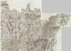
Composite 6: Carte de France.
1 : 86400 Cassini family; Cassini, Cesar-Francois, 1714-1784
Lotharingia cum contiguis
1 : 860000 Mollova mapová sbírka Weigel, Christoph Weigel, Christoph I.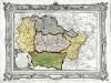
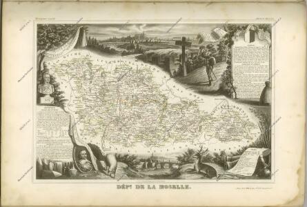
Carte des départemens de la Meuse, de la Moselle, de la Meurte, des Vôges, et du Bas Rhin
1 Karte : Kupferdruck ; 23 x 34 cm, Bildgrösse 32 x 42 cm Desnos; Starckman chez le S. Desnos rue St. Jacques au globe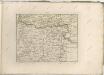

Exactissima totius Mosellae et Sarae fluvii tabula
1 : 411000 Lotrinsko (Francie) Danckertsz, Cornelis per Cornelium Danckerts

Carte de la Lorraine
1 : 500000 Alsasko (Francie) Delamarche, Charles Francois C. F. Delamarche
Exactissima Lotharingia tam regis Gallorum quam Ducis Caroli
1 : 450000 opera Caroli Allard Amsterdam : gedruckt by Carel Allardt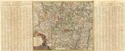
Generalis Lotharingiae Ducatus Tabula
1 : 490000 Mollova mapová sbírka Visscher, Nicolaes Visscher, Nicolaus I.
Generalis Lotharingiae Ducatus Tabula
1 : 490000 Mollova mapová sbírka Visscher, Nicolaes Visscher, Nicolaus
Le duché de Lorraine duché de Bar duché de Deux Ponts presidial de Verdun pays Messin Haute Alsace
1 Karte : Kupferdruck ; 49 x 62 cm Crépy; Crépy chez Crepy ruë S. Jacques a S. Pierre
Lotharingiae tabula generalis
1 Karte : Kupferdruck ; 47 x 55 cm Walch prostat apud Ioannem Walch
Carte pour l'intelligence de l'histoire de Lorraine
1 Karte : Kupferdruck ; 14 x 17 cm, Bildgrösse 36 x 47 cm Châtelain s.n.
Lotharingiæ tabula generalis
1 Karte : Kupferdruck ; 48 x 56 cm Homann Johann Baptist Homann
Sect. 22: Strassburg i/E, uit: Geologische Karte des Deutschen Reichs in 27 Blaettern / [von] Richard Lepsius ; Red. von C. Vogel
1 : 500000 Annotatie: Blad 18 ontbreekt; Een aantal bladen op linnen; Een aantal bladen gereviseerd 1913-1914; Annotatie geografische gegevens: Met schaalstokken o.a. in kilometers; Legenda Carl Vogel 1828-1897 Gotha : Justus Perthes
Generalis Lotharingia, dispartita in ducatum ejus proprium, et Barrensem
1 Karte : Kupferdruck ; 47 x 56 cm Valck G. Valck
Exactissima Totius Mosellae et Sarae Fluvii Tabula et Minorum in eum influentisim Cum Omnibus Adiacentibus Regionibus
1 : 430000 Mollova mapová sbírka Danckerts, Cornelis Danckerts, Cornelis
Generalis Lotharingiæ ducatus tabula
1 Karte : Kupferdruck ; 45 x 56 cm Visscher N. Visscher
Elsass-Lothringen, Bayerische Pfalz.
1 : 870000 Andree, Richard
Carte pour l'intelligence de l'histoire de Lorraine
1 : 1500000 Lotrinsko (Francie) Chatelain, Henri-Abraham Chatelain