Maps of Outer Hebrides
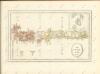
Vistus Insula, vulgo Viist, cum aliis minoribus ex Aebudarum numero ei ad meridiem adjacentibus / Auct. Timotheo Pont.
Pont, Timothy, 1560?-1614? Blaeu, Joan, 1596-1673
South Uist - OS One-Inch Map
1 : 63360 Topographic maps Ordnance Survey Ordnance Survey
Benbecula (23) - OS One-Inch map
1 : 63360 Topographic maps Ordnance Survey Ordnance Survey
Benbecula (23) - OS One-Inch map
1 : 63360 Topographic maps Ordnance Survey Ordnance Survey
Lochboisdale & Eriskay (32) - OS One-Inch map
1 : 63360 Topographic maps Ordnance Survey Ordnance Survey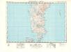
Lochboisdale & Eriskay (32) - OS One-Inch map
1 : 63360 Topographic maps Ordnance Survey Ordnance Survey
Benbecula - OS One-Inch map
1 : 63360 Topographic maps Ordnance Survey Ordnance Survey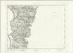
Benbecula - OS One-Inch map
1 : 63360 Topographic maps Ordnance Survey Ordnance Survey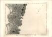
Benbecula - OS One-Inch map
1 : 63360 Topographic maps Ordnance Survey Ordnance Survey
South Uist - OS One-Inch map
1 : 63360 Topographic maps Ordnance Survey Ordnance Survey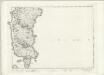
South Uist - OS One-Inch map
1 : 63360 Topographic maps Ordnance Survey Ordnance Survey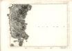
South Uist - OS One-Inch map
1 : 63360 Topographic maps Ordnance Survey Ordnance Survey
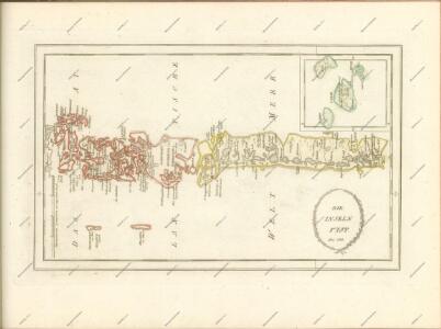
Plan of the island of South Uist.
Bald, William, ca. 1789-1857
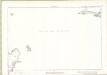
Sound of Barra
Great Britain. Hydrographic Office
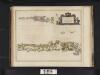
Monach and Haskeir Is. with the adjacent coast of North Uist.
Great Britain. Hydrographic Office
Loch Skiport
Great Britain. Hydrographic Office
Inverness-shire (Hebrides), Sheet LIX - OS 6 Inch map
1 : 10560 Topographic maps Ordnance Survey Ordnance Survey
Inverness-shire (Hebrides), Sheet LII - OS 6 Inch map
1 : 10560 Topographic maps Ordnance Survey Ordnance Survey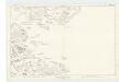
Inverness-shire (Hebrides), Sheet XLIX - OS 6 Inch map
1 : 10560 Topographic maps Ordnance Survey Ordnance Survey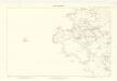
Inverness-shire (Hebrides), Sheet XXXIII - OS 6 Inch map
1 : 10560 Topographic maps Ordnance Survey Ordnance Survey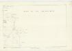
Inverness-shire (Hebrides), Sheet LVI - OS 6 Inch map
1 : 10560 Topographic maps Ordnance Survey Ordnance Survey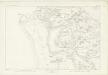
Inverness-shire (Hebrides), Sheet XLVIII - OS 6 Inch map
1 : 10560 Topographic maps Ordnance Survey Ordnance Survey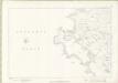
Inverness-shire - Hebrides Sheet XXXIII - OS 6 Inch map
1 : 10560 Topographic maps Ordnance Survey Ordnance Survey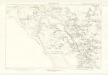
Inverness-shire (Hebrides), Sheet XXXIX - OS 6 Inch map
1 : 10560 Topographic maps Ordnance Survey Ordnance Survey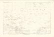
Inverness-shire (Hebrides), Sheet XXXIV - OS 6 Inch map
1 : 10560 Topographic maps Ordnance Survey Ordnance Survey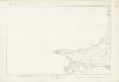
Inverness-shire (Hebrides), Sheet LXII - OS 6 Inch map
1 : 10560 Topographic maps Ordnance Survey Ordnance Survey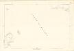
Inverness-shire (Hebrides), Sheet XXXVIII - OS 6 Inch map
1 : 10560 Topographic maps Ordnance Survey Ordnance Survey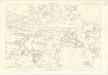
Inverness-shire (Hebrides), Sheet XL - OS 6 Inch map
1 : 10560 Topographic maps Ordnance Survey Ordnance Survey