Mappa catalogata
n/a


Titolo completo:n/a
Anno di illustrazione:1791
Data di pubblicazione:1791
Dimensione fisica:20 x 30 cm
Mapa geográfico de la provincia de Soria, 2
1783
s.n.
Charta geographica provinciam Soriam
1801
López; Güssefeld
Mapa geográfico de la provincia de Soria, 1
1783
s.n.
Mapa geografico que comprehende el partido de Santo Domingo de la Calzada y el de Logroño, correspondientes a la provincia de Burgos
1787
López
n/a
1791
Tarraconensis episcopatus
1690
Valck; Schenk
Mapa de la Rioja
1769
López
n/a
1791
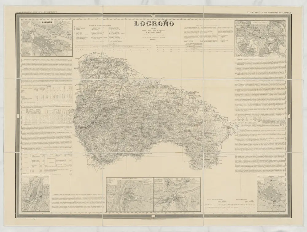
Logroño
1851
Coello, Francisco
1:200k
Mapa de la provincia de Guadalaxara
1766
López