Maps of Moravskoslezský
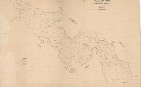
Přehledná mapa katastrálních území ve Slezsku

Slezská silniční mapa
Sbírka map a diagramů použitých na mírových konferencích v Paříži v letech 1919 - 1920
Mapa dekanátů, poutních míst a klášterů vévodství slezského
Slezsko (Česko)
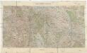
Severomoravský kraj

III. vojenské mapování 4061
1 : 75000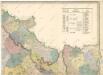
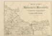
Die Markgrafschaft Maehren mit dem Herzogthume Schlesien
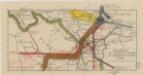
Mapa silnic Markrabství Moravského s enklávou Osoblažskou ve Vejvodství Slezském

Mapa země Moravské. S částmi pohraničnými Slezska, Čech, Rakous i Uher
[Die Burgen Nordmährens und Schlesiens]
1 : 200000 Morava severní (Česko) Kubica, Franz Vojenský zeměpisný ústav
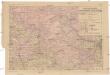
Kraj Ostravský

Kraj Ostravský

Kraj ostravský
Das deutsche Sprachgebiet Nord-Mährens u. Schlesiens auf Grand der Volkszählung v. 31. Dec. 1880
1 : 300000 Morava severní (Česko) Held, Franz Wolfschütz Historisch-statistische Section der k. k. mährisch-schlesische Ackerbaugesellschaft
Přehledná hydrografická mapa povodí Odry na Moravě a ve Slezsku
1 : 750000 Odra-povodí Čs. státní ústav hydrologický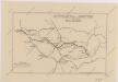
Sbírka map a diagramů použitých na mírových konferencích v Paříži v letech 1919 - 1920
Der Markgrafschaft Maehren
1 : 670000 Branná (Šumperk, Česko)
Reisekarte durch die Mähr.-Schles.-Sudeten
1 : 200000 Jeseníky (Česko : pohoří) A. Blažek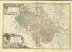

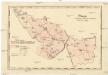
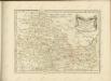
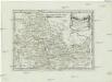
Troppauer Kreis
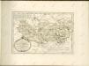
Principatvs Silesiae Oppaviensis novissima tabula geographica
1 : 150000 Opava-oblast (Česko) Wieland, Johann Wolfgang Schubarth, Matthäus Homannianos Heredes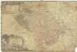
Principatvs Silesiae Oppaviensis novissima tabula geographica
1 : 150000 Opava-oblast (Česko) Wieland, Johann Wolfgang Schubarth, Matthäus Homannianos Heredes
Tabula Generalis Marchionatus Moraviae in sex circulos divisae]
1 : 183000 Mollova mapová sbírka Müller, Johann Christoph Gastl, Jan Jiří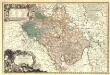
Principatvs Silesiae Oppaviensis novissima Tabula geographica.
1 : 150000 Mollova mapová sbírka Wieland, Johann Wolfgang Homann, Johann Baptista - dědici
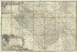
[Die Markgraftschaft Mähren]
1 : 200000 Opava-oblast (Česko) Schenkl, Conrad Philipp Carl Winiker
Der Troppauer Kreis
1 : 200000 Jeseníky (Česko) Schenkl, Conrad Philipp Carl Winiker
Olmütz 105, uit: Special-Karte von Mittel-Europa / nach amtlichen Quellen bearbeitet von W. Liebenow
1 : 300000 titelvariant: W. Liebenow's Mittel-Europa; Annotatie: Titel boven de bladen: W. Liebenow's Mittel-Europa Johannes Wilhelm Liebenow 1822-1897 Frankfurt a. M. : Ludwig Ravenstein