Maps of Volders
Plan von Innsbruck
Wagner
Insprug mit der Gegend auf 2 Stunden etc
1 : 160000 Mollova mapová sbírka Bodenehr, Gabriel
[Tyrolsko]
1 : 14000 Hall in Tirol (Rakousko)
Neuester Plan von Innsbruck und Umgebung
1 : 8800 Innsbruck (Rakousko) Csichna, C. A. C.A. Csichna
Plan der kaiserl. koenigl. Provinzial Hauptstadt Innsbruck u. der nächsten Umgebungen
1 : 16000 Annotatie: Met profiel van Innsbruck naar het Zuiden gezien, 16 afbeeldingen van gebouwen, etc. en "Topographisch-statistische Notizen und Angabe der Sehenswürdigkeiten [S.l. : s.n.]
Plan von Innsbruck
Wagner
Plan von INNSBRUCK
1 : 11000 Innsbruck (Rakousko)
Plan von Innsbruck
Innsbruck (Rakousko) Call, Jan van Beek, Anna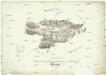
Carte von Innsbruck und dessen Umgebungen zum Behufe des Panorama
1 : 100000 Alpy rakouské-oblast Schweighofer, Franz Winter, C.
Carte von Innsbruck und dessen Umgebungen zum Behufe des Panorama
1 : 100000 Alpy rakouské-oblast Schweighofer, Franz Winter, C.
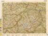
Umgebungskarte von Innsbruck
1 : 75000 Innsbruck (Rakousko : oblast) K. u. k. Militärgeographisches Institut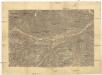
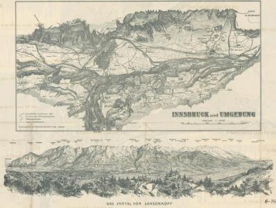
[Innsbruck a okolí]
1 : 144000 Innsbruck-oblast (Rakousko)
Brenner-Bahn
1 : 96000 Bolzano (Itálie) Fr. Unterberger's Kunsthandlung
Innsbruck und Achen-See.
from Spezialkarte der osterreichisch-ungarischen Monarchie.
Tyrolis sub Felici Regimine Mariae Theresiae Rom. Imper. Avg. Chorographice Delineata ...
1 : 104000 Mollova mapová sbírka Mansfeld, Johann Ernst Mansfeld, Johann Ernest
[Stubaier Alpen]
1 : 100000 Stubaiské Alpy (Itálie a Rakousko : pohoří) Freytag & Berndt
Matrei.
from Spezialkarte der osterreichisch-ungarischen Monarchie.
Special-Karte des Karwendel Gebirges
1 : 50000 Innsbruck (Rakousko : oblast) Rothpletz, Anton Bischoff, J. Deutscher und Österreichischer Alpenverein
Otzthal.
from Spezialkarte der osterreichisch-ungarischen Monarchie.
Zirl und Nassereith.
from Spezialkarte der osterreichisch-ungarischen Monarchie.
Zone 16, Kol. V, Innsbruck und Achen-See, uit: Geologische Karte der im Reichsrathe vertretenen Königreiche und Länder der Österreich-Ungarischen Monarchie : auf Grundlage der Specialkarte i.M. 1:75.000 des k.u.k. Militär-geographischen Institutes / neu bearb. und als Kartenwerk von 341 Blattnummern in zwanglosen Lfg. hrsg. durch die k.k. Geologische Reichsanstalt in Wien
1 : 75000 titelvariant: Geologische Spezialkarte der im Reichsrate vertretenen Königreiche und Länder der Österreichisch-Ungarischen Monarchie; Geologische Specialkarte der im Reichsrathe vertretenen Königreiche und Länder der Österreichisch-Ungarischen Monarchie; Annotatie: Titel bovenaan kaartblad: Geologische Spezialkarte der im Reichsrate vertretenen Königreiche und Länder der Österreichisch-Ungarischen Monarchie en Geologische Specialkarte der im Reichsrathe vertretenen Königreiche und Länder der Österreichisch-Ungarischen Monarchie; Annotatie geografische gegevens: Coördinaten gebaseerd op nulmeridiaan van Ferro (Hierro) Kaiserlich-Königliche Geologische Reichsanstalt, Wenen Wien : K.K. Geologische Reichsanstalt
[Innsbruck und Umgebung]
1 : 250000 Innsbruck (Rakousko : oblast) Wagner & Debes
Innsbruck 157, uit: Special-Karte von Mittel-Europa / nach amtlichen Quellen bearbeitet von W. Liebenow
1 : 300000 titelvariant: W. Liebenow's Mittel-Europa; Annotatie: Titel boven de bladen: W. Liebenow's Mittel-Europa Johannes Wilhelm Liebenow 1822-1897 Frankfurt a. M. : Ludwig Ravenstein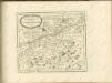
B.Z. - Karte von Oesterreich

Tyrolis sub Felici Regimine Mariae Theresiae Rom. Imper. Avg. Chorographice Delineata ...
1 : 104000 Mollova mapová sbírka Mansfeld, Johann Ernst Mansfeld, Johann Ernest
Tyrolis sub Felici Regimine Mariae Theresiae Rom. Imper. Avg. Chorographice Delineata ...
1 : 104000 Mollova mapová sbírka Mansfeld, Johann Ernst Mansfeld, Johann Ernest
Tyrolis sub Felici Regimine Mariae Theresiae Rom. Imper. Avg. Chorographice Delineata ...
1 : 104000 Mollova mapová sbírka Mansfeld, Johann Ernst Mansfeld, Johann Ernest
Tyrolis sub Felici Regimine Mariae Theresiae Rom. Imper. Avg. Chorographice Delineata ...
1 : 104000 Mollova mapová sbírka Mansfeld, Johann Ernst Mansfeld, Johann Ernest