Maps of Papua

Charles Louis-Gebergte / Netherlands Topographic Service
Netherlands Topographic Service Delft [Delft] : Netherlands Topographic Service
Charles Louis-Gebergte / prepared under the direction of the Chief Engineer by Base Map Plant USAFFE, July 1943
Base Map Plant USAFFE [S.l.] : Base Map Plant USAFFE
Schetskaart Charles Louis-gebergte / Topografische Dienst
Topografische Dienst Batavia Batavia : Topografische Dienst
Oemari / Topografische Dienst
Topografische Dienst Delft [Delft] : Topografische Dienst
[Poronggo]
[S.l. : s.n.]
Charles Louis-gebergte / Topografische Dienst
Topografische Dienst Delft [Delft] : Topografische Dienst
[Pokopomamoe]
[S.l. : s.n.]
Oeta / Topografische Dienst
Topografische Dienst Delft [Delft] : Topografische Dienst
Vlakke Hoek / Topografische Dienst
Topografische Dienst Delft [Delft] : Topografische Dienst
[Wanapiar?]
[S.l. : s.n.]
Itorakebo / Topografische Dienst
Topografische Dienst Delft [Delft] : Topografische Dienst
Boeroe / Topografische Dienst
Topografische Dienst Delft [Delft] : Topografische Dienst
Schetskaart van de Oetarivier

Schetskaart van de Bernhardmeervlakte (Centraal Nieuw-Guinea) / opgemaakt door W.J. Cator

Schetskaart van het "derde" Wisselmeer

Kokenau / Netherlands Topographic Service
Netherlands Topographic Service Delft [Delft] : Netherlands Topographic Service
Schetskaart van de Wissel-meervlakte (Centraal Nieuw-Guinea) / opgemaakt door W.J. Cator

Kokenau / prepared under the direction of the Chief Engineer by Base Map Plant USAFFE, July 1943
Base Map Plant USAFFE [S.l.] : Base Map Plant USAFFE
Aroe Eilanden / U.S. Army Map Service
U.S. Army Map Service Washington D.C. Washington D.C. : U.S. Army Map Service
Aroe-Eilanden / samengesteld en gedrukt bij den Topografischen Dienst
Topografische Dienst Batavia Batavia : Topografische Dienst
Geologische overzichtskaart van den Nederlandsch Oost-Indischen Archipel : Vogelkop / bewerkt door J. Zwierzycki
Landsdrukkerij Weltevreden (Batavia) [Weltevreden (Batavia) : Landsdrukkerij]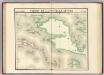
Partie, Nouvelle Guinee. Oceanique no. 22.
1 : 1641836 Vandermaelen, Philippe, 1795-1869
Kaart van Nederlandsch Nieuw Guinea en de Papoesche Eilanden
[S.l. : s.n.]
Kaart van een gedeelte der zuid en zuidwest kust van Nieuw-Guinea : volgens de opnemingen gedaan door Zr. Ms. schepen Dourga, Triton, Sireen en Postillon tusschen de jaren 1826 en 1835 / zamengesteld door Salomon Müller
[S.l. : s.n.]
Kaart van de zuyd-ooster eylanden van Banda
1 : 2200000 [Dordrecht etc.] : J. van Braam en G. Onder de Linden exc.
Nederlands Nieuw-Guinea / [Netherlands Topographic Service]
Netherlands Topographic Service Delft [Delft : Netherlands Topographic Service]
Nederlandsch-Nieuw-Guinee
Topographische Inrichting Batavia Batavia : Top[ographische] Inr[ichting]
Kaart van Nederlandsch Nieuw-Guinea en omliggende eilanden / Topographisch Bureau
Topographisch Bureau Batavia Batavia : Topographisch Bureau
Západní Irian


