Maps of Jawa Barat

[Tjiawi en Panoembangan] / published by Survey Directorate H[ead] Q[uarters] ALFSEA [=American Land Forces South East Asia] ; printed by 71 Base Map Rep[roduction] Sec[tion] R.E., Mar[ch] 1946
Survey Directorate Head Quarters American Land Forces South East Asia (ALFSEA) [Washington D.C.] : Survey Directorate H[ead] Q[uarters] ALFSEA [=American Land Forces South East Asia]
[Lebakwangi] : herzien door den Topografischen Dienst in 1919-1921 / Topografische Inrichting
Topografische Inrichting Batavia Batavia : Topografische Inrichting
[Pandjaloe] : opgenomen door den Topografischen Dienst in 1919-1921 / Topografische Inrichting
Topografische Inrichting Batavia Batavia : Topografische Inrichting
[Tjiawi] : herzien door den Topografischen Dienst in 1916-1919 / Topografische Inrichting
Topografische Inrichting Batavia Batavia : Topografische Inrichting
[Lemahpoetih] : herzien in 1918 / Topografische Inrichting
Topografische Inrichting Batavia Batavia : Topografische Inrichting
[Bodjongsoban] / Topographisch Bureau, herzien in de jaren 1908-1910
Topographisch Bureau Batavia Batavia : Topographisch Bureau
[Goeranteng] / Topographisch Bureau, herzien in de jaren 1909-1910
Topographisch Bureau Batavia Batavia : Topographisch Bureau
[Nanggewer] / Topographisch Bureau, herzien in het jaar 1909
Topographisch Bureau Batavia Batavia : Topographisch Bureau
[Tjiawi] / Topographisch Bureau, herzien in de jaren 1907-1912
Topographisch Bureau Batavia Batavia : Topographisch Bureau
[Sinoman] / Topographisch Bureau
Topographisch Bureau Batavia Batavia : Topographisch Bureau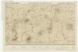
[Kaart], uit: Goentoer-Papandajan-Tjikoeraj-Galoenggoeg-Telagabodas / Topografische Inrichting, Batavia
1 : 100000 titelvariant: Java, Touristmap Garoet and environs; Touristmap Garoet and environs; Annotatie: Titel op omslag: Java. Touristmap Garoet and environs; Oorspr. uitg.: 1923; Annotatie geografische gegevens: Schaalstok van 10 km (= 10 cm); Legenda Topografische Inrichting, Batavia; Officieële Vereeniging voor Toeristen Verkeer in Nederlandsch Indië, Batavia Batavia : Officieële Vereeniging voor Toeristen Verkeer
Goentoer-Papandajan-Tjikoeraj-Galoenggoeg-Telagabodas / Topografische Inrichting, Batavia
Topografische Inrichting Batavia Batavia : Officieële Vereeniging voor Toeristen Verkeer
[Cirebon]
1 : 200000 Joh. C. Stemler Cz.
Tochten van uit het hotel "Sanatorium Garoet" en van uit het hotel "Villa Paulina" / Nederlandsch-Indische Hotelvereeniging
Nederlandsch-Indische Hotelvereeniging [Batavia etc. : G. Kolff
Bandjar / prepared under the direction of the Chief of Engineers, U.S. Army by the Army Map Service
Army Map Service Washington D.C. Washington D.C. : Army Map Service
Semarang-Cheribon : overzichtskaart / Semarang Cheribon Stoomtram Maatschappij
Semarang Cheribo Stoomtram-Maatschappij Semarang [Semarang] : Stoomtram-Maatschappij
Overzichtskaart van Java en Madoera / Topografische Dienst
Topografische Dienst Batavia Batavia : Reproductiebedrijf Topografische Dienst
Caart eeniger ryken gelegen op het eyland Groot-Java bestaande in het koningrijk Jaccatra, de Regentschappen Tjandjoer, Bandong, Timbanganten en Batoe Lejan als mede een gedeelte van Parrakkanmoentjang en Crawang
[S.l. : s.n.]
Semarang / Survey of India
Survey of India [S.l.] : Survey of India
West-Java : met aanwijzing van de bevolkingsdichtheid per district volgens de uitkomsten der volkstelling in 1930
Topografische Dienst Batavia [Batavia : Topografische Dienst]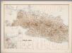
3. West Java, uit: Atlas van Nederlandsch Oost-Indië / samengest. door Topographisch Bureau te Batavia van 1897-1904
Annotatie: Omgewerkte versie van: Atlas der Nederlandsche bezittingen in Oost-Indië / naar de nieuste bronnen samengest. door J.W. Stemfoort en J.J. ten Siethoff. - 's-Gravenhage : Topographische Inrichting, [ca. 1885] Topographisch Bureau, Batavia 's-Gravenhage : Topographische Inrichting
West-Java / Topografische Dienst
Topografische Dienst Batavia Batavia : Reproductiebedrijf Topografische Dienst
West-Java : bijgewerkt tot 1 November 1935 / Reproductiebedrijf Topografische Dienst
Topografische Dienst Batavia Batavia : Topografische Dienst
Kaart van West-Java : Eerste militaire afdeeling / [door J.W Stemfoort en J.J. ten Siethoff ; gereproduceerd op last van het Departement van Koloniën, aan de Topographische Inrichting te 's-Gravenhage, onder leiding van den Directeur C.A. Eckstein]
Ministerie van Koloniën Den Haag s-Gravenhage : Departement van Koloniën
Djawa Barat
Bandung : 'Hovic' Visser
Kaart van het Rijk van Bantam, Jacatra & Cheribon op het eiland Java / door Js. van den Bosch ; gegraveerd door C. van Baarsel en Zoon
C. van Baarsel en Zoon s-Gravenhage ; Amsterdam : Gebroeders van Cleef
Java en Madoera / ontworpen en geteekend door J. Kuijper ; kopergravure door J.C. Zurcher
Leeuwarden : Hugo Suringar
Java en Madoera / Ontworpen en geteekend door J. Kuijper ; kopergravure door J.C. Zürcher
Tjeenk Willink, W.E.J. Zwolle Zwolle : Tjeenk Willink, W.E.J.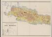
Geologische overzichtskaart van Java en Madoera
1 : 500000 West-Blatt Verbeek, R. D. M. Joh. G. Stemler Cz.
![[Tjiawi en Panoembangan] / published by Survey Directorate H[ead] Q[uarters] ALFSEA [=American Land Forces South East Asia] ; printed by 71 Base Map Rep[roduction] Sec[tion] R.E., Mar[ch] 1946](https://images-2.georeferencer.com/images/iiif/696868696636/full/,300/0/native.jpg)

