Maps of Jakarta Raya

[Lagowa] : herzien in de jaren 1901-1902 / Topographisch Bureau
Topographisch Bureau Batavia Batavia : Topographisch Bureau
Haven Tandjongpriok
[S.l. : s.n.]
Batavia en Omstreken / Topographische Inrichting, Batavia 1914
Topographische Inrichting Batavia Batavia : Topographische Inrichting
Overzichtskaart van het bestaande Spoor- en Tramwegnet te Batavia en Omstreken
Den Haag : J. Smulders & Co.
Platte grond van Batavia / uitgaaf van G. Kolff & Co.
G.Kolff & Co. Batavia [Batavia] : G. Kolff & Co.
[Kaart], uit: Plattegrond van Batavia / G. Kolff & Co
1 : 20000 G. Kolff & Co., Amsterdam Batavia : G. Kolff & Co
Plattegrond van Batavia / Komiti Matawa Yokotyo Wa Syoeyaku Su (TYUI)
Komiti Matawa Yokotyo Wa Syoeyaku Su (TYUI) [S.l.] : Komiti Matawa Yokotyo Wa Syoeyaku Su (TYUI)
Batavia military guide map
AFNEI Headquarters Survey Department [S.l.] : Svy.Dte.H.Q.AFNEI
Plattegrond van Batavia
Kolff, G. en Co. Batavia [Batavia] : G. Kolff & Co.
Kaart van Batavia en Omstreken / Topographisch Bureau
Topographisch Bureau Batavia Batavia : Topographisch Bureau
Platte grond van Batavia
Batavia : Boekhandel Visser & Co.
Plattegrond van Batavia / uitgave van Visser & Co. te Batavia
Batavia : Visser & Co.
Town plan of Batavia / revised and drawn by H[ead] Q[uarters] Survey Production Centre South East Asia ; reproduced by 110 Map Production Company R.E.
Head Quarters Survey Production Centre South East Asia [S.l.] : Survey Production Centre South East Asia
Haven van Batavia : "Tandjong Priok "

Teekening van het concessieterrein met omgeving te Tandjong Priok : staatsbladen 1890 no. 169 en 1908 no. 433
1 : 2500 titelvariant: Bijlagen van het verslag der handelingen van de Tweede Kamer der Staten-Generaal; Annotatie: Bijlage bij: Bijlagen van het verslag der handelingen van de Tweede Kamer der Staten-Generaal, zitting 1914-1915, Bijlage 371; Behoort bij het ontwerp van wet tot bekrachtiging van eene overeenkomst met de Droogdok-Maatschappij "Tandjong Priok" te Rotterdam [S.l. : s.n.]
Batavia en Omstreken / Topografische Dienst
Topografische Dienst Weltevreden (Batavia) Weltevreden (Batavia) : Reproductiebedrijf Topografische Dienst
Batavia en Omstreken / Topographische Inrichting
Topographische Inrichting Batavia : Topographische Inrichting
Garnizoenskaart Batavia en Omstreken / Topografische Dienst
Topografische Dienst Batavia Batavia : Reproductiebedrijf Topografische Dienst
Kaart van de Baai van Batavia en aangrenzende kuststrook
[Breda : Koninklijke Militaire Academie]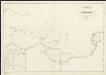
Kaart van het vaarwater uit Straat Sunda naar en op de reede van Batavia : bevattende het gedeelte tusschen het eiland Menschen-eeter en den hoek van Krawang verbeterd bij de herstelling der zeebaken [...] 1832
1 : 85000 Gecopieerd door Zecha den 25/10 1833 Lith. Ch. Motte [S.l.] : [s.n.]
Kaart van de Residentie Batavia

Batavia / prepared under the direction of the Chief of Engineers U.S. Army by the Army Map Service
Army Map Service Washington D.C. Washington D.C. : Army Map Service
Overzichtskaart van den ontworpen spoorweg van Batavia naar Anjer : met zijtakken van Doerie naar Tangerang en van Tanahabang naar Weltevreden
Bataviaasch Nieuwsblad Batavia ; Weltevreden : G. Kolff & Co.
Batavia

Overzichtskaart van de residentie Batavia / [door het] Topographisch Bureau
Topographisch Bureau Batavia Batavia : Topographisch Bureau
Overzichtskaart van de Residentie Batavia / Topographische Inrichting
Topografische Inrichting Batavia Batavia : Topographische Inrichting
Overzichtskaart van de Residentie Batavia / [Topographische Inrichting]
1 : 250000 Annotatie: Met een overzicht van de bestuurlijke indeling; Kaartrand afgesneden Topographische Inrichting, Nederlands-Indië [Batavia : Topographische Inrichting]
Overzichtskaart van Java en Madoera / Topografische Dienst
Topografische Dienst Batavia Batavia : Reproductiebedrijf Topografische Dienst
West-Java / Reproductiebedrijf Top. dienst (Reproduced by Topographical Service)
Officieële Vereeniging voor Toeristenverkeer in Nederlandsch-Indië Batavia Batavia : Travellers Official Information Bureau
![[Lagowa] : herzien in de jaren 1901-1902 / Topographisch Bureau](https://images-2.georeferencer.com/images/iiif/738414510099/full/,300/0/native.jpg)

