Mapa catalogado
Schetskaart van Zuid Celebes


Título completo:Schetskaart van Zuid Celebes
Año de ilustración:1925
Tamaño físico:20 x 30 cm
[Djeneponto] / Topografische Inrichting
1921
Topografische Inrichting Batavia
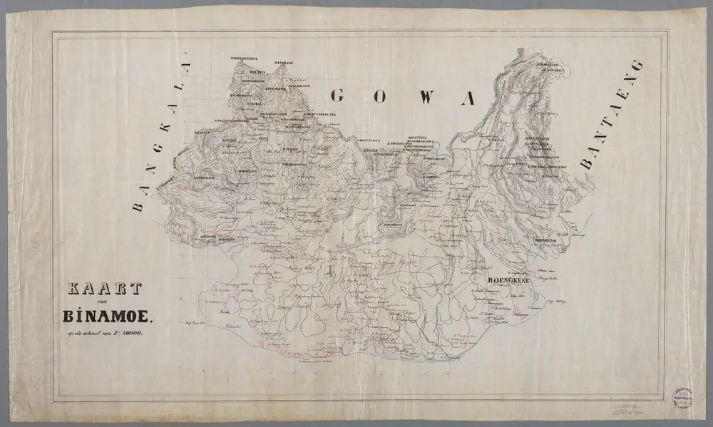
Kaart van Binamoe op de schaal van 1:50.000
1900
[S.l. : s.n.]
1:50k
[Djeneponto] / prepared under the direction of the Chief of Engineers U.S. Army, War Department
1943
War Department Washington D.C. . Chief of Engineers U.S. Army
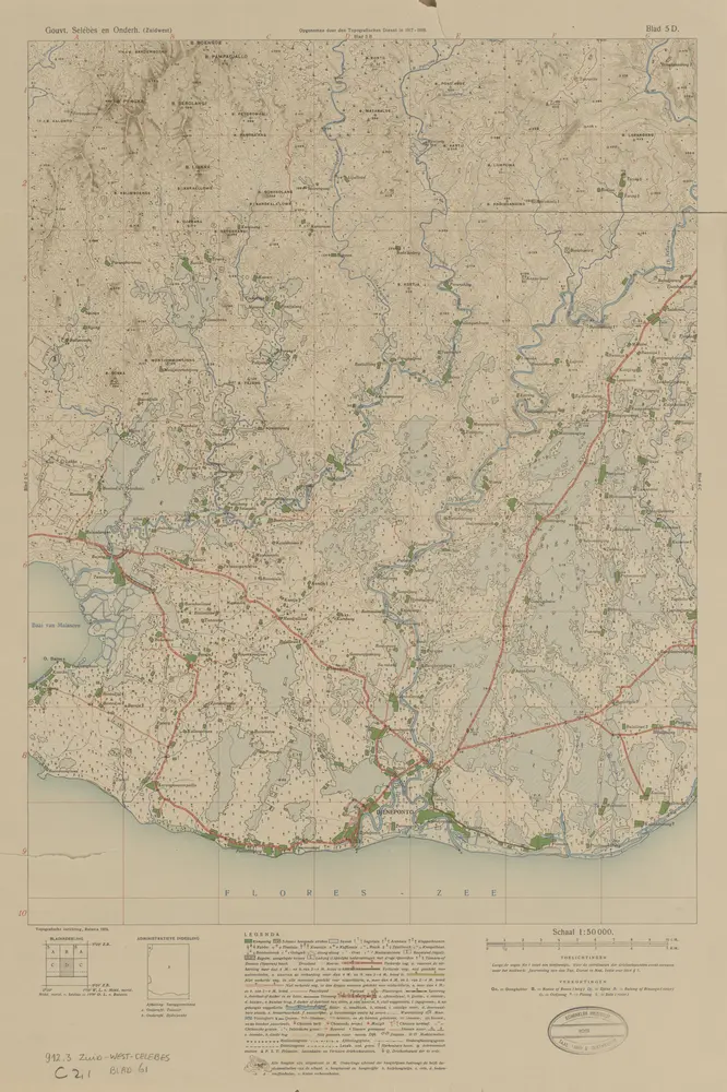
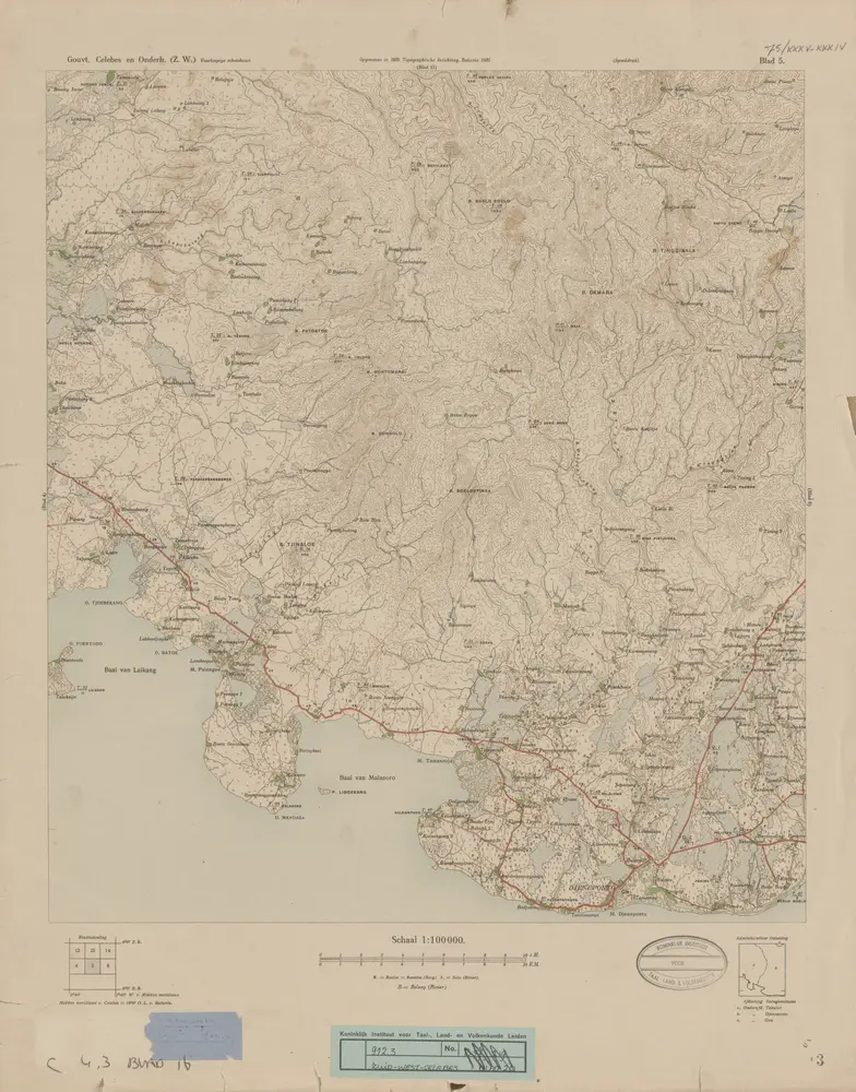
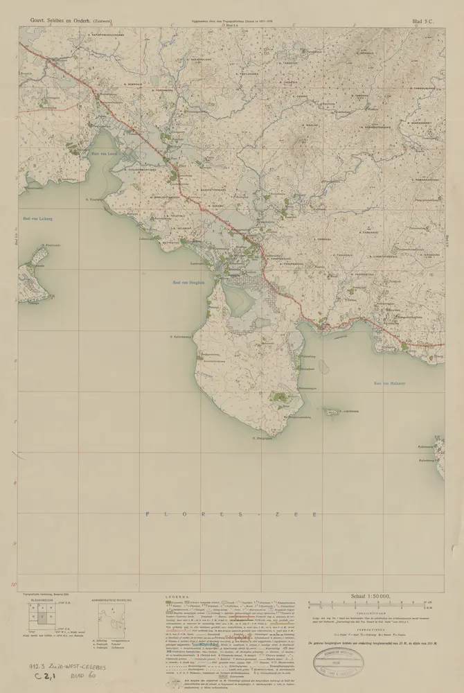
[Djeneponto] / opgenomen door den Topografischen Dienst in 1917-1919
1923
Topografische Inrichting Batavia
[Baai van Bangkala] / opgenomen door den Topografischen Dienst in 1917-1918
1924
Topografische Inrichting Batavia
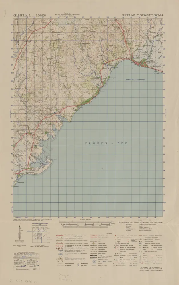
[Bantaeng] / prepared under the direction of the Chief of Engineers U.S. Army, War Department
1943
War Department Washington D.C. . Chief of Engineers U.S. Army
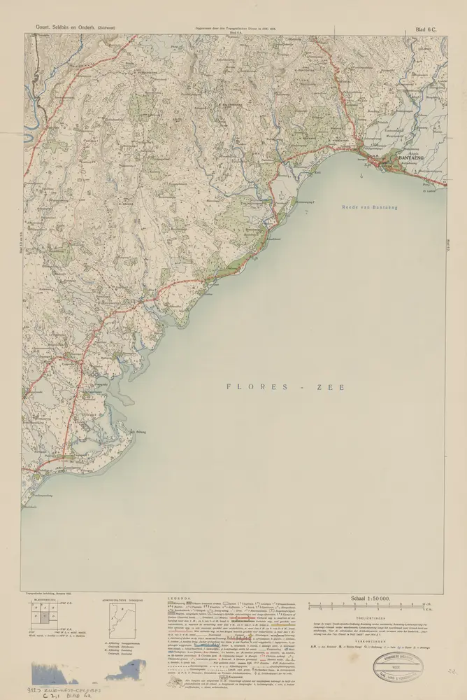
[Bantaeng] / opgenomen door den Topografischen Dienst in 1916-1918
1922
Topografische Inrichting Batavia
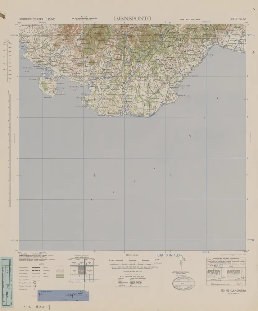
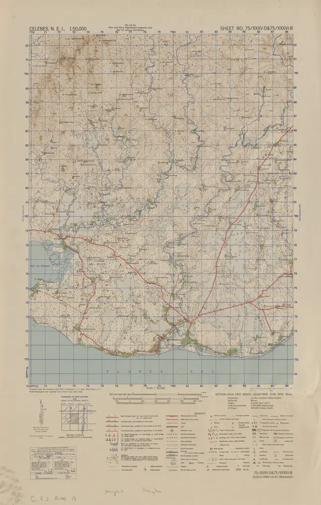
Southern Celebes / Army Map Service, Indianapolis
1943
Army Map Service Indianapolis
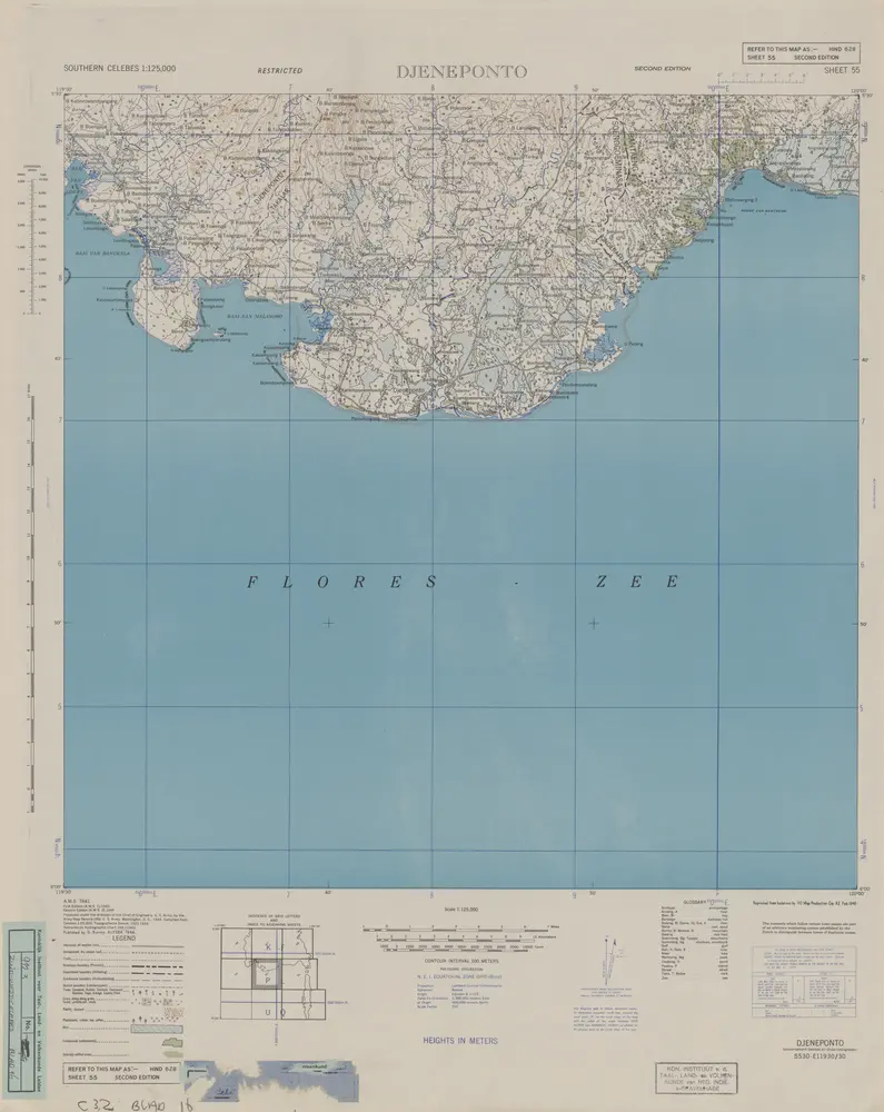
Djeneponto / prepared under the direction of the Chief of Engineers, U.S. Army by the Army Map Service
1944
Army Map Service Indianapolis
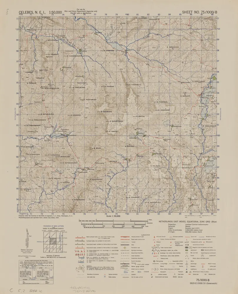
[B[atoe] Paowang] / prepared under the direction of the Chief of Engineers U.S. Army, War Department
1943
War Department Washington D.C. . Chief of Engineers U.S. Army