Maps of Papua

Bloemen-Rivier / prepared and reproduced by Base Map Plant USASOS/SWPA, December 1942 - January 1943 , from a Dutch map printed by Topografische Dienst (Topographic Service) Batavia, 1939
Base Map Plant USASOS/SWPA [S.l.] : Base Map Plant USASOS/SWPA
Torpedoboot-eiland / Topografische Dienst
Topografische Dienst Delft [Delft] : Topografische Dienst
[Torpedoboot-Eiland]
[S.l. : s.n.]
[Atimet-Rivier]
[S.l. : s.n.]
[Bloemen-Rivier]
[S.l. : s.n.]
Bloemen-Rivier / Netherlands Topographic Service
Netherlands Topographic Service Delft [Delft] : Netherlands Topographic Service
Jamas / Topografische Dienst
Topografische Dienst Delft [Delft] : Topografische Dienst
Agats / Topografische Dienst
Topografische Dienst Delft [Delft] : Topografische Dienst
Aroe Eilanden / U.S. Army Map Service
U.S. Army Map Service Washington D.C. Washington D.C. : U.S. Army Map Service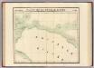
Partie, Nouvelle Guinee. Oceanique no. 23.
1 : 1641836 Vandermaelen, Philippe, 1795-1869
Kaart van een gedeelte der zuid en zuidwest kust van Nieuw-Guinea : volgens de opnemingen gedaan door Zr. Ms. schepen Dourga, Triton, Sireen en Postillon tusschen de jaren 1826 en 1835 / zamengesteld door Salomon Müller
[S.l. : s.n.]
Nederlands Nieuw-Guinea / [Netherlands Topographic Service]
Netherlands Topographic Service Delft [Delft : Netherlands Topographic Service]
Nederlandsch-Nieuw-Guinee
Topographische Inrichting Batavia Batavia : Top[ographische] Inr[ichting]
Kaart van Nederlandsch Nieuw-Guinea en omliggende eilanden / Topographisch Bureau
Topographisch Bureau Batavia Batavia : Topographisch Bureau
Západní Irian

Overzichtskaart van de Residentie Amboina en de Afdeeling Noord-Nieuw Guinea / samengesteld door het Encyclopaedisch Bureau [in] 1915
Encyclopaedisch Bureau Batavia Batavia : G. Kolff & Co.
Aroe-Eilanden / samengesteld en gedrukt bij den Topografischen Dienst
Topografische Dienst Batavia Batavia : Topografische Dienst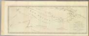
New Britain discoveries.
1 : 4500000 Hawkesworth, John, 1715?-1773
Carte des iles Moluques
1 : 3425000 par P. Melvill de Carnbee gravé par D. Heyse La Haye : lith de Ch. van Lier
[Schetskaart van Nieuw-Guinea] / Topografische Dienst
Topografische Dienst Batavia Batavia : Reproductiebedrijf Topografische Dienst
[Nieuw Guinea] / Topografische Dienst
Topografische Dienst Batavia Batavia : Reproductiebedrijf Topografische Dienst
Elf kaarten van Nieuw-Guinea / Directie Ned[erlands] Nieuw Guinea, Ministerie van Binnenlandse Zaken
Ministerie van Binnenlandse Zaken 's-Gravenhage . Directie Nederlands Nieuw Guinea ['s-Gravenhage : Staatsdrukkerij]
Schetskaart van Nieuw-Guinea / Topografische Dienst
Topografische Dienst Batavia Batavia : Reproductiebedrijf Topografische Dienst
Vegetatiekaart van Nieuw-Guinea
Topografische Dienst Delft Delft : Topografische Dienst
Schetskaart van Nieuw Guinea / Topografische Dienst
Topografische Dienst Batavia Batavia : Reproductiebedrijf Topografische Dienst
Nieuw Guinea / Topografische Dienst
Topografische Dienst Batavia Batavia : Reproductiebedrijf Topografische Dienst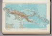
335. New Guinea, Solomon Islands. The World Atlas.
1 : 7500000 USSR (Union of Soviet Socialist Republics).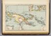
New Guinea, Papuan Archipelago.
1 : 10000000 Andree, Richard; Times (London, England)
Indonesia
IPPRESS Djakarta [Djakarta] : IPPRESS


