Mapa catalogado
Juliana-Gebergte / published by Survey Directorate H[ead] Q[uarters] SEALF [=South East Asia Land Forces]
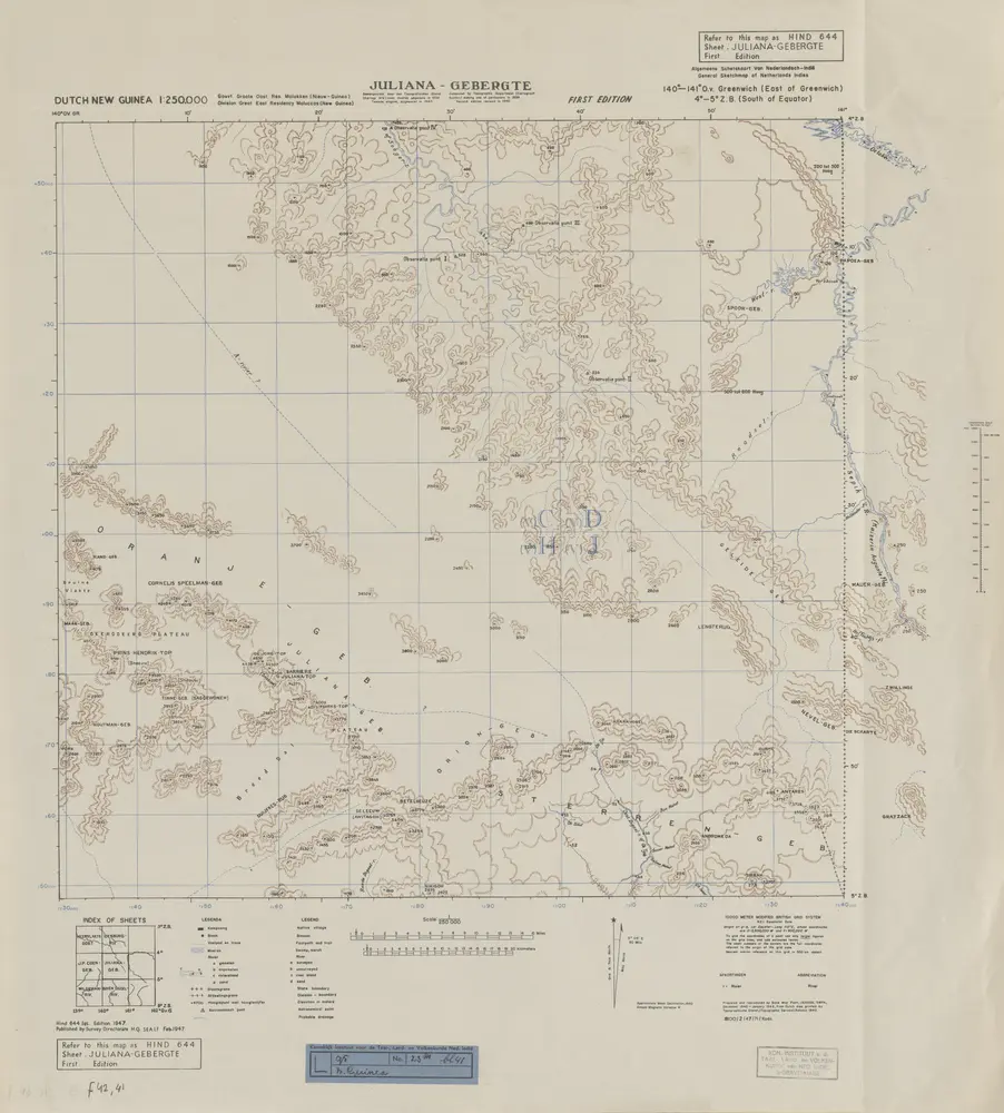

Título completo:Juliana-Gebergte / published by Survey Directorate H[ead] Q[uarters] SEALF [=South East Asia Land Forces]
Año de ilustración:1947
Editorial:[S.l.] : Survey Directorate H[ead] Q[uarters] SEALF [=South East Asia Land Forces]
Tamaño físico:20 x 30 cm
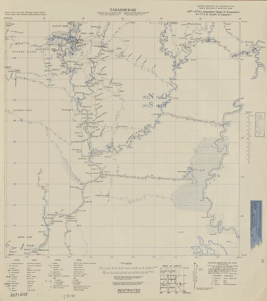
Tanahmerah / prepared and reproduced by Base Map Plant USASOS/SWPA, December 1942 - January 1943, from a Dutch map printed by Topografische Dienst (Topographic Service) Batavia, 1940
1943
Base Map Plant USASOS SWPA
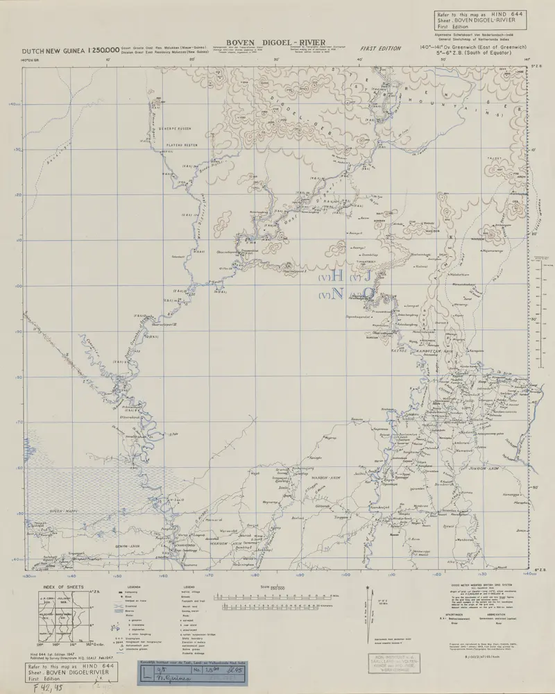
Boven Digoel-Rivier / Survey Directorate H[ead] Q[uarters] SEALF [=South East Asia Land Forces]
1947
Survey Directorate Head Quarters South East Asia Land Forces
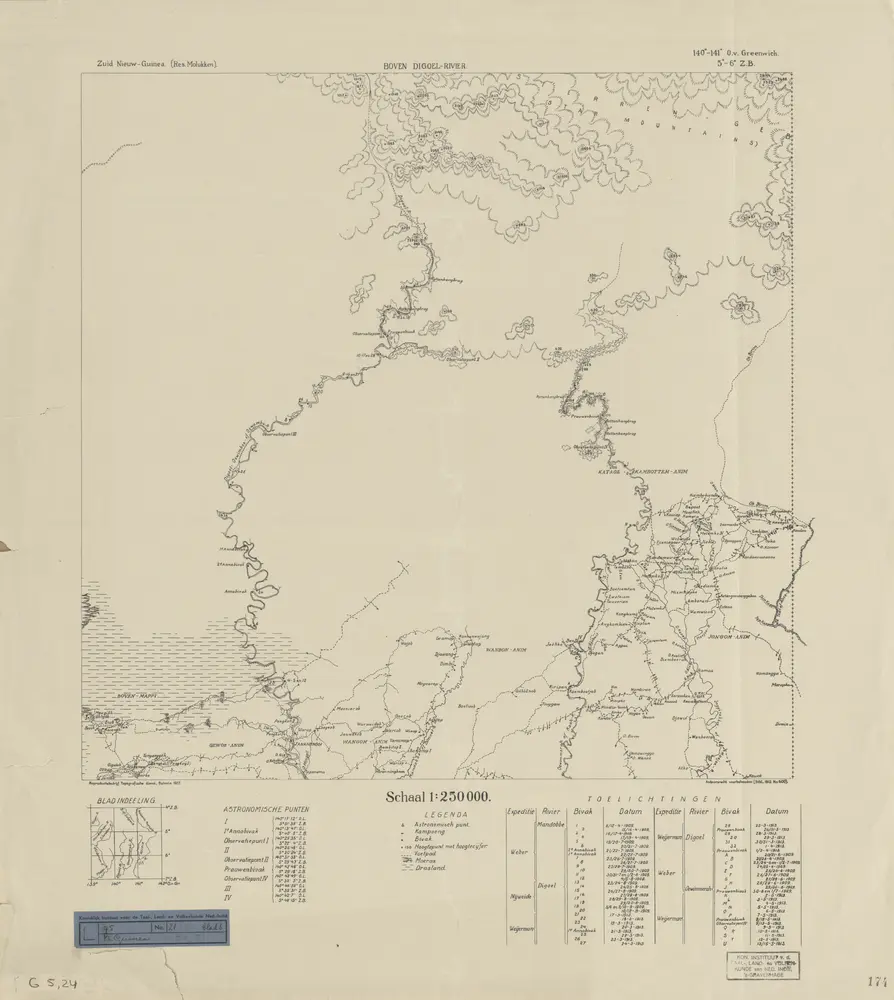
Boven Digoel-Rivier / Topografische Dienst
1937
Topografische Dienst Batavia
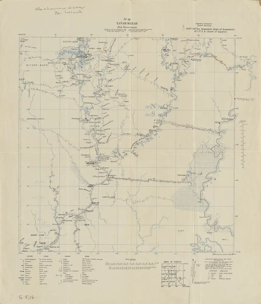
Tanah Merah / Netherlands Topographic Service
1954
Netherlands Topographic Service Delft
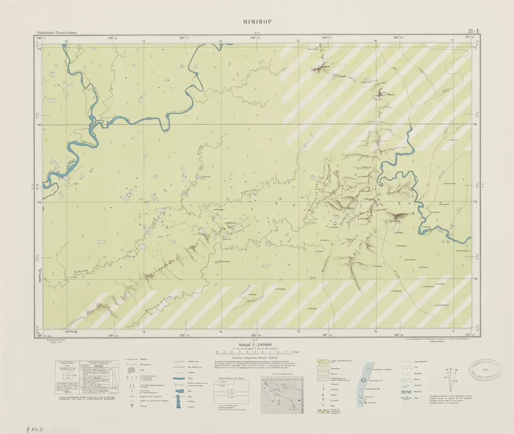
Mimirop / Topografische Dienst
1956
Topografische Dienst Delft
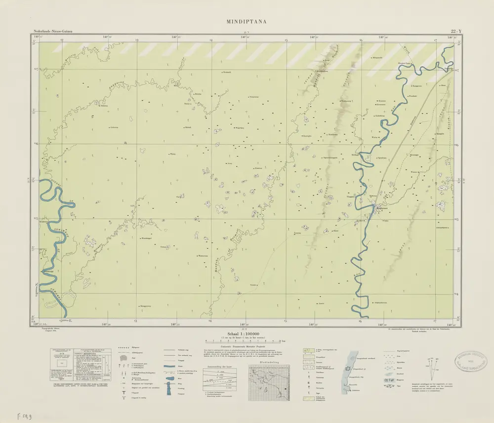
Mindiptana / Topografische Dienst
1956
Topografische Dienst Delft
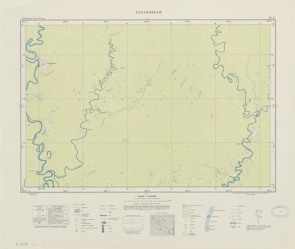
Tanahmerah / Topografische Dienst
1956
Topografische Dienst Delft
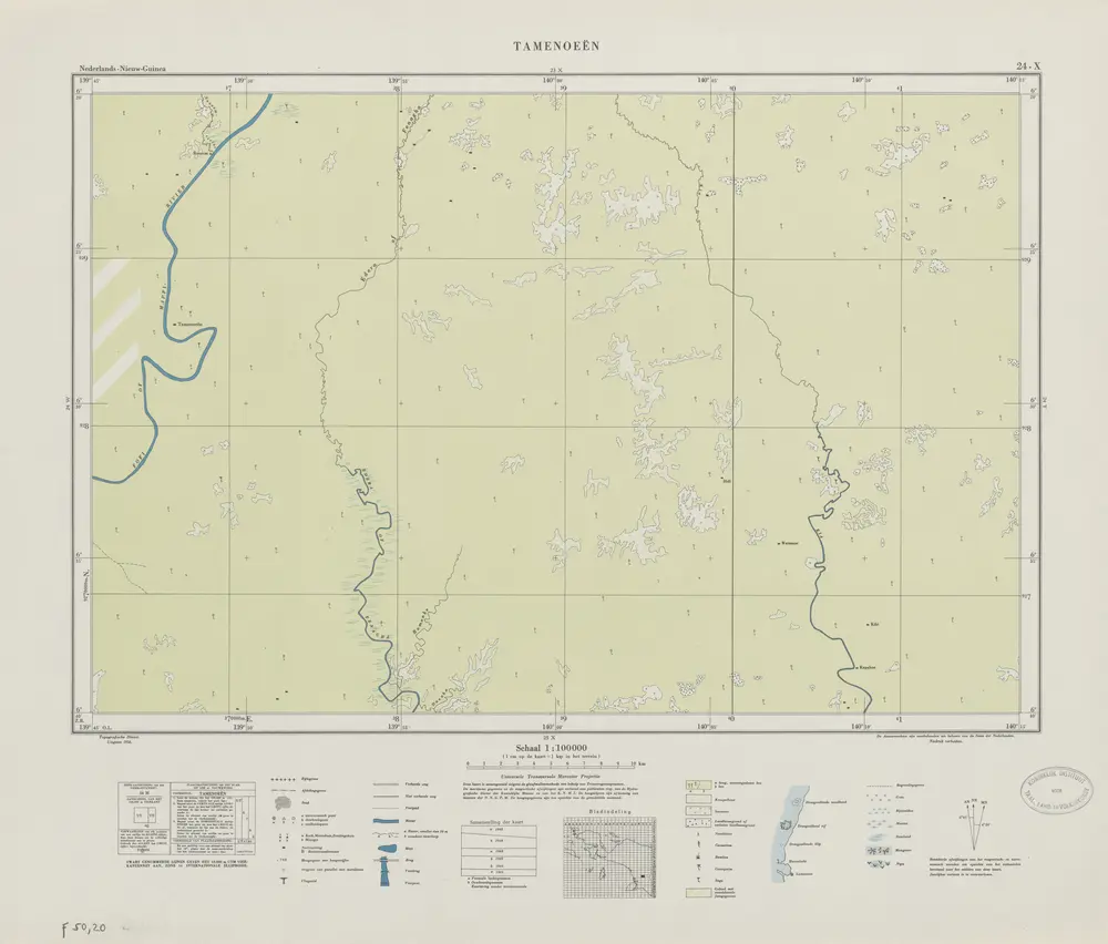
Tamenoeën / Topografische Dienst
1956
Topografische Dienst Delft
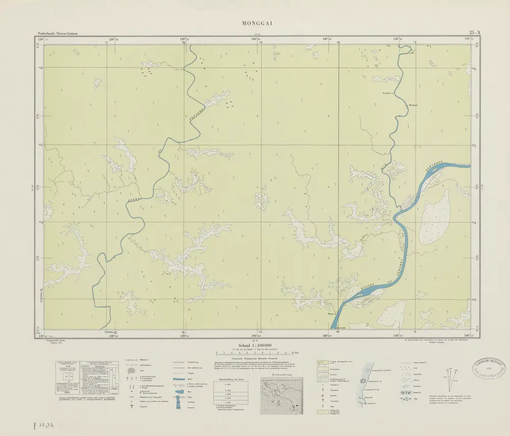
Monggai / Topografische Dienst
1956
Topografische Dienst Delft
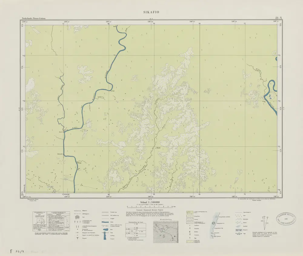
Sikafio / Topografische Dienst
1956
Topografische Dienst Delft