Maps of Papua

Tahoen Lake / prepared under the direction of the Chief Engineer by Base Map PLant U.S. Army, June 1944
Corps of Engineers US Army, War Department Washington D.C. [Washington D.C.] : Corps of Engineers U.S. Army
Biri Rivier / Survey Directorate H[ead] Q[uarters] ALFSEA [=American Land Forces South East Asia]
Survey Directorate Head Quarters American Land Forces South East Asia [S.l.] : Survey Directorate H[ead] Q[uarters] ALFSEA [=American Land Forces South East Asia]
Maremgi / published by Survey Directorate H[ead] Q[uarters] ALFSEA [=American Land Forces South East Asia]
Survey Directorate Head Quarters American Land Forces South East Asia (ALFSEA) [S.l.] : Corps of Engineers U.S. Army, War Department
Takar / prepared under the direction of the Chief Engineer by Basa Map Plant U.S. Army, May 1944
War Department Washington D.C. . Corps of Engineers U.S. Army [S.l.] : Corps of Engineers U.S. Army, War Department
M[oun]t Mesegoep / prepared under the direction of the Chief Engineer by Base Map Plant U.S. Army, May 1944
War Department Washington D.C. . Corps of Engineers U.S. Army [S.l.] : Corps of Engineers U.S. Army, War Department
Sokoata River / prepared under the direction of the Chief Engineer by Base Map Plant U.S. Army, June 1944
War Department Washington D.C. . Corps of Engineers U.S. Army [S.l.] : Corps of Engineers U.S. Army, War Department
Wakde Islands / prepared under the direction of the Chief Engineer by Base Map Plant U.S. Army, May 1944
War Department Washington D.C. . Corps of Engineers U.S. Army [S.l.] : Corps of Engineers U.S. Army, War Department
Ansoedoe / prepared under the direction of the Chief Engineer by Base Map Plant U.S. Army, May 1944
War Department Washington D.C. . Corps of Engineers U.S. Army [S.l.] : Corps of Engineers U.S. Army, War Department
Boaf River / published by S[ur]v[e]y D[irectora]te H[ead] Q[uarters] ALFSEA [=American Land Forces South East Asia]
Survey Directorate Head Quarters American Land Forces South East Asia (ALFSEA) [S.l.] : S[ur]v[e]y D[irectora]te H[ead] Q[uarters] ALFSEA [=American Land Forces South East Asia]
Kaptiaoe / published by Survey Directorate H[ead] Q[uarters] ALFSEA [=American Land Forces South East Asia]
Survey Directorate Head Quarters American Land Forces South East Asia (ALFSEA) [S.l.] : Corps of Engineers U.S. Army, War Department
Kowera / prepared under the direction of the Engineer, Sixth U.S. Army by 69th Engineer Topographic Company, August 1944
War Department Washington D.C. . Corps of Engineers U.S. Army [S.l.] : Corps of Engineers U.S. Army, War Department
Kedir / prepared under the direction of the Chief Engineer by Base Map Plant U.S. Army, April 1944
War Department Washington D.C. . Corps of Engineers U.S. Army [S.l.] : Corps of Engineers U.S. Army, War Department
Wentor River / prepared under the direction of the Engineer, Sixth U.S. Army by 69th Engineer Topographic Company, August 1944
War Department Washington D.C. . Corps of Engineers U.S. Army [S.l.] : Corps of Engineers U.S. Army, War Department
Sermo River / prepared under the direction of the Chief Engineer by Base Map Plant U.S. Army, May 1944
War Department Washington D.C. . Corps of Engineers U.S. Army [S.l.] : Corps of Engineers U.S. Army, War Department
Wakde Islands / prepared and reproduced under the direction of the Engineer, Alamo Force by 69th Engineer Topo[graphic] Co[mpany], April 1944
War Department Washington D.C. . Corps of Engineers U.S. Army [S.l.] : Corps of Engineers U.S. Army, War Department
Bladwijzer van Sawar en omgeving
[S.l. : s.n.]
Bladwijzer van eilanden rondom Nieuw-Guinea
[S.l. : s.n.]
Bladwijzer van Hollandia en omgeving
[S.l. : s.n.]
Tor River / prepared under the direction of the Chief Engineer by Base Map Plant U.S. Army, June 1944
War Department Washington D.C. . Corps of Engineers U.S. Army [S.l.] : Corps of Engineers U.S. Army, War Department
Bladwijzer van Eilanden Biak-Japen en Kuststrook Verkam-Hollandia
[S.l. : s.n.]
Aitape / U.S. Army Map Service
U.S. Army Map Service Washington D.C. Washington D.C. : U.S. Army Map Service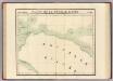
Partie, Nouvelle Guinee. Oceanique no. 23.
1 : 1641836 Vandermaelen, Philippe, 1795-1869
Nederlands Nieuw-Guinea / [Netherlands Topographic Service]
Netherlands Topographic Service Delft [Delft : Netherlands Topographic Service]
Nederlandsch-Nieuw-Guinee
Topographische Inrichting Batavia Batavia : Top[ographische] Inr[ichting]
Kaart van Nederlandsch Nieuw-Guinea en omliggende eilanden / Topographisch Bureau
Topographisch Bureau Batavia Batavia : Topographisch Bureau
Západní Irian

Overzichtskaart van de Residentie Amboina en de Afdeeling Noord-Nieuw Guinea / samengesteld door het Encyclopaedisch Bureau [in] 1915
Encyclopaedisch Bureau Batavia Batavia : G. Kolff & Co.
[Schetskaart van Nieuw-Guinea] / Topografische Dienst
Topografische Dienst Batavia Batavia : Reproductiebedrijf Topografische Dienst
[Nieuw Guinea] / Topografische Dienst
Topografische Dienst Batavia Batavia : Reproductiebedrijf Topografische Dienst


