Maps of Papua

M[oun]t Tulband / prepared under the direction of the Chief Engineer by Base Map Plant U.S. Army, July 1944
War Department Washington D.C. . Corps of Engineers U.S. Army [Washington D.C.] : Corps of Engineers U.S. Army, War Department
[Apauwar]
[S.l. : s.n.]
[Meervlakte-Oost?]
[S.l. : s.n.]
Verkam River / prepared under the direction of the Chief Engineer by Base Map Plant U.S. Army, June 1944
War Department Washington D.C. . Corps of Engineers U.S. Army [S.l.] : Corps of Engineers U.S. Army, War Department
Tor River / prepared under the direction of the Chief Engineer by Base Map Plant U.S. Army, June 1944
War Department Washington D.C. . Corps of Engineers U.S. Army [S.l.] : Corps of Engineers U.S. Army, War Department
Liki Island (Koemamba Islands) / published by Survey Directorate H[ead] Q[uarters] ALFSEA [=American Land Forces South East Asia]
Survey Directorate Head Quarters American Land Forces South East Asia (ALFSEA) [S.l.] : Corps of Engineers U.S. Army, War Department
Maffin Bay / prepared under the direction of the Chief Engineer by Base Map Plant U.S. Army, June 1944
War Department Washington D.C. . Corps of Engineers U.S. Army [S.l.] : Corps of Engineers U.S. Army, War Department
Woske River / prepared under the direction of the Engineer, Sixth U.S. Army by 69th Engineer Topographic Company, August 1944
War Department Washington D.C. . Corps of Engineers U.S. Army [S.l.] : Corps of Engineers U.S. Army, War Department
Sarmi / prepared under the direction of the Chief Engineer by Base Map Plant U.S. Army, April 1944
War Department Washington D.C. . Corps of Engineers U.S. Army [S.l.] : Corps of Engineers U.S. Army, War Department
Cape Masdoar (Koemamba Islands) / prepared under the direction of the Chief Engineer by Base Map Plant U.S. Army, May 1944
War Department Washington D.C. . Corps of Engineers U.S. Army [S.l.] : Corps of Engineers U.S. Army, War Department
Niroemoar Island (Koemamba Islands) / prepared under the direction of the Chief Engineer by Base Map Plant U.S. Army, May 1944
War Department Washington D.C. . Corps of Engineers U.S. Army [S.l.] : Corps of Engineers U.S. Army, War Department
Sawar Drome / prepared under the direction of the Engineer, Sixth U.S. Army by 69th Engineer Topographic Company, August 1944
War Department Washington D.C. . Corps of Engineers U.S. Army [S.l.] : Corps of Engineers U.S. Army, War Department
Maffin Village / prepared under the direction of the Chief Engineer by Base Map Plant U.S. Army, April 1944
War Department Washington D.C. . Corps of Engineers U.S. Army [S.l.] : Corps of Engineers U.S. Army, War Department
Arara / prepared under the direction of the Chief Engineer by Base Map Plant U.S. Army, April 1944
War Department Washington D.C. . Corps of Engineers U.S. Army [S.l.] : Corps of Engineers U.S. Army, War Department
Bladwijzer van eilanden rondom Nieuw-Guinea
[S.l. : s.n.]
Van Rees en Gauttier Gebergte / prepared and reproduced by Base Map Plant, December 1942 - January 1943, from Dutch map printed by Topografische Dienst (Topographic Service) Batavia, 1939
[Washington D.C.] : Base Map Plant USASOS, SWPA
Van Rees en Gauttier Gebergte / Netherlands Topographic Service
Netherlands Topographic Service Delft [Delft] : Netherlands Topographic Service
Koemamba Eilanden / prepared and reproduced by Base Map Plant USASOS, December 1942 - January 1943 from Dutch map printed by Topographische Dienst (Topographical Service) Batavia, 1936 ; published by Survey Directorate H[ead] Q[uarters] ALSEA [=American Land Forces South East Asia], Oct. 1946
Survey Directorate Head Quarters American Land Forces South East Asia (ALFSEA) [S.l.] : Survey Directorate H[ead] Q[uarters] ALFSEA [=American Land Forces South East Asia]
Bladwijzer van Sawar en omgeving
[S.l. : s.n.]
[Rombebai-Meer]
[S.l. : s.n.]
[Manggasi]
[S.l. : s.n.]
Wakde Islands / prepared and reproduced under the direction of the Engineer, Alamo Force by 69th Engineer Topo[graphic] Co[mpany], April 1944
War Department Washington D.C. . Corps of Engineers U.S. Army [S.l.] : Corps of Engineers U.S. Army, War Department
[Monding Mamberamo-Rivier]
[S.l. : s.n.]
Bladwijzer van Eilanden Biak-Japen en Kuststrook Verkam-Hollandia
[S.l. : s.n.]
Aitape / U.S. Army Map Service
U.S. Army Map Service Washington D.C. Washington D.C. : U.S. Army Map Service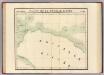
Partie, Nouvelle Guinee. Oceanique no. 23.
1 : 1641836 Vandermaelen, Philippe, 1795-1869
Nederlands Nieuw-Guinea / [Netherlands Topographic Service]
Netherlands Topographic Service Delft [Delft : Netherlands Topographic Service]
Nederlandsch-Nieuw-Guinee
Topographische Inrichting Batavia Batavia : Top[ographische] Inr[ichting]
Kaart van Nederlandsch Nieuw-Guinea en omliggende eilanden / Topographisch Bureau
Topographisch Bureau Batavia Batavia : Topographisch Bureau
![M[oun]t Tulband / prepared under the direction of the Chief Engineer by Base Map Plant U.S. Army, July 1944](https://images-2.georeferencer.com/images/iiif/475251599858/full/,300/0/native.jpg)

