Gecatalogiseerde kaart
Niederländisch-Indien / Druck und Verlag von Carl Flemming


Volledige titel:Niederländisch-Indien / Druck und Verlag von Carl Flemming
Jaar illustratie:1880
Uitgever:Glogau : Carl Flemming
Fysieke grootte:20 x 30 cm
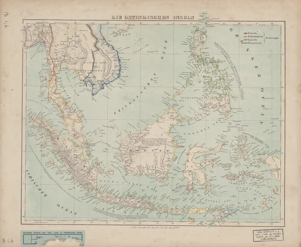
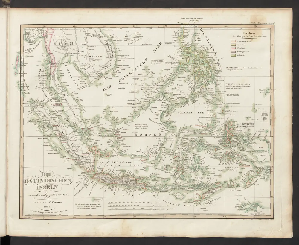
Die Ostindischen Inseln
1870
[S.l. : s.n.]
A new map of the East India Isles from the latest authorities
1801
Cary, John, ca. 1754-1835
1:9m

Die Ostindischen Inseln
1869
Stieler, Adolf
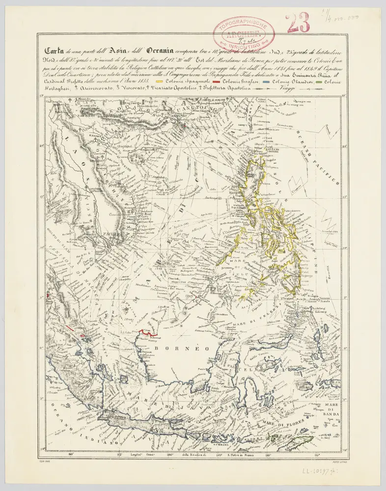
Carta di una parte dell'Asia e dell'Oceania ... per poter conoscere le colonie Europee, ed i punti, ove si trova stabilita la religion Cattolica in quei luoghi, con i viaggi che fece dall'anno 1841 fino al 1849 il capitano Don Carlo Cuarteron / presentata dal medesimo ... l'anno 1855
1950
Carlo Cuarteron 1816-1880
1:4m
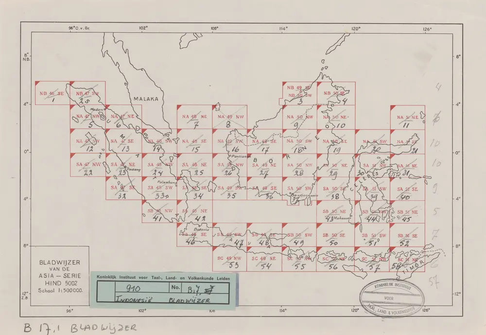
Bladwijzer van de Asia-Serie
1945
[S.l.] : [Survey of India]
Hinterindien und Malaien-Archipel
1901
Bibliographisches Institut
1:18m
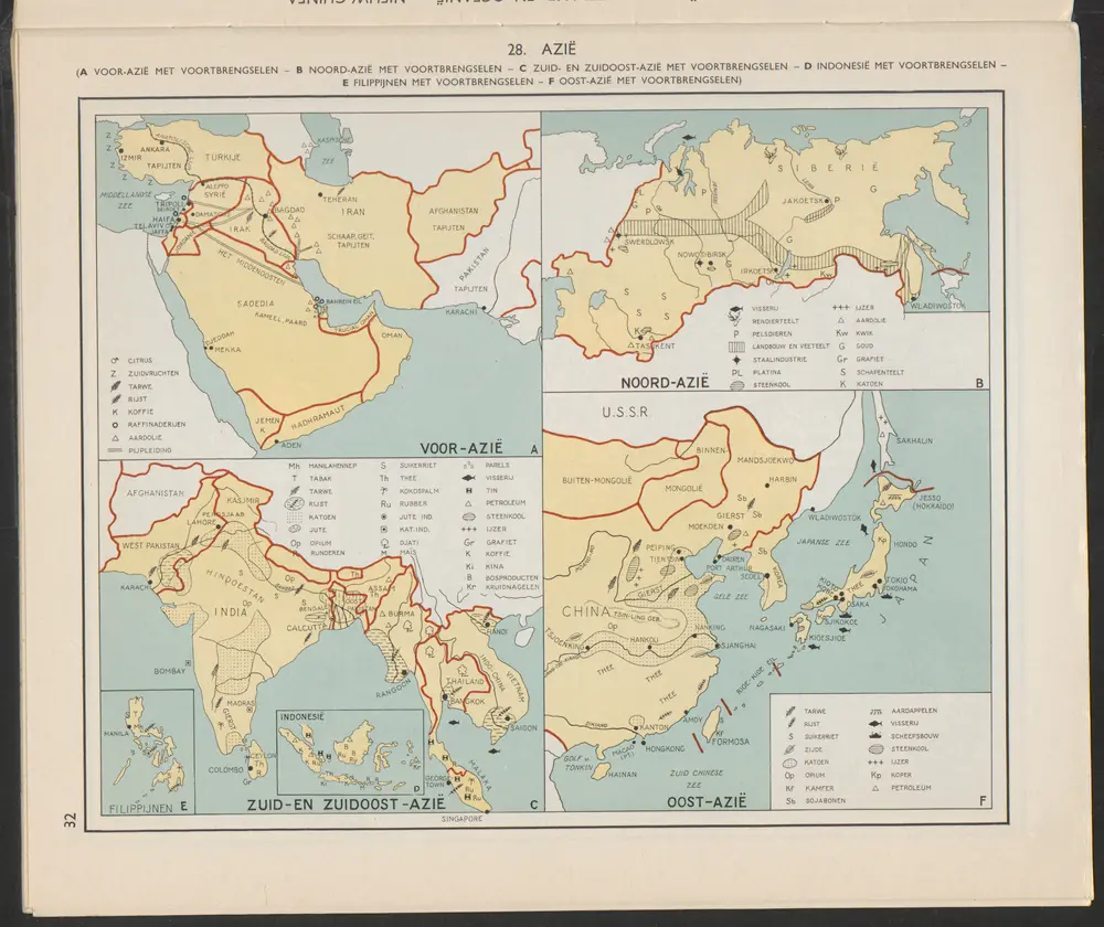
Indonesië [D]
1956
Arnoldus Johannes Cornelius Krafft (1892-)
n/a
1858
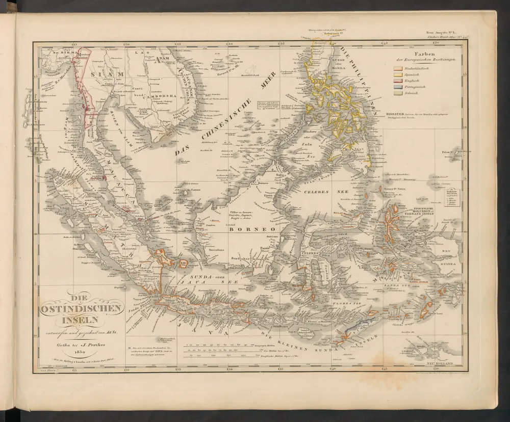
Die Ostindischen Inseln
1833
Stieler, Adolf
Die Ostindischen Inseln
1845
Stieler, Adolf