Cataloged map
Nieuwe kaart van het oostelykste deel der weereld, dienende tot aanwyzing van de scheepstogten der Nederlanderen naar Oostindië : volgens de laatste ontdekkingen


Full title:Nieuwe kaart van het oostelykste deel der weereld, dienende tot aanwyzing van de scheepstogten der Nederlanderen naar Oostindië : volgens de laatste ontdekkingen
Depicted:1753
Publisher:Te Amsterdam : by Is. Tirion
Physical Size:20 x 30 cm
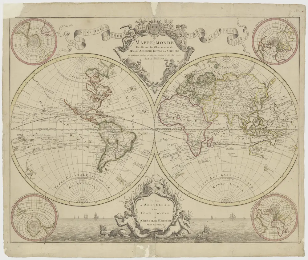
"Mappemonde dressé sur les observations de Mrs de l'Académie Royale des Sciences enz.", met dubbeltitel: "Nova orbis tabula ad usum serenissimi Burgundiae Ducis." (Twee halfronden).
1710
Darstellung der isodynamischen Linien : nach den Beobachtungen der magnetischen Intensität, die in den Jahren 1790 bis 1830 gemacht worden sind
1849
Duperrey, Louis-Isidore, 1786-1865
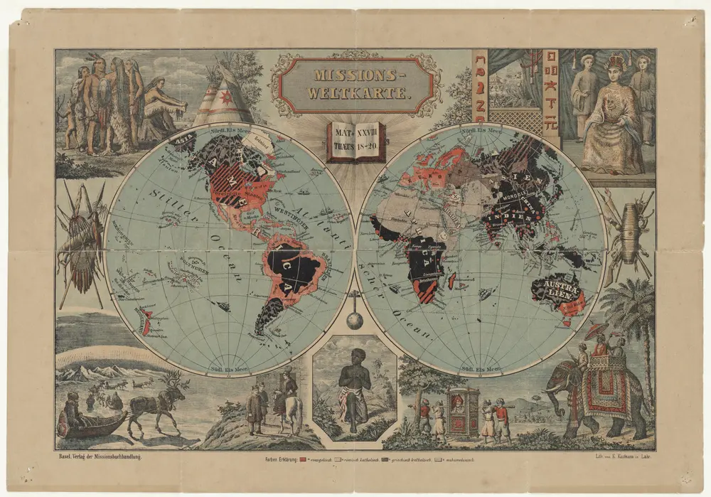
Missions-Weltkarte / lith. von E. Kaufmann
1891
E. Kaufmann
1:80m
Wachsende Karte der Magnetischen Meridiane und Parallelen : Gegründet auf die Beobachtungen der Declination welche sämmtlich auf das Jahr 1825 reducirt worden sind
1849
Duperrey, Louis-Isidore, 1786-1865
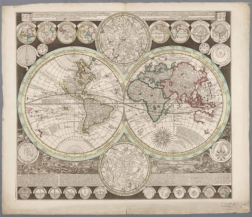
Planisphaerium terrestre cum utroque coelesti hemisphaerio, sive diversa orbis terraquei ... / opera et studio A.F. Zürneri = Vlakke Aard-kloot met het beide hemelsch half-rond, of de onderscheidene verbeelding van de land-water-waereld ... / door vlyt en naarstigheid van A.F. Zürner
1700
Adam Friedrich Zürner 1680-1742
1:74m
Carte de l'Amerique septentrionale et méridionale
1810
Lotter; Lotter
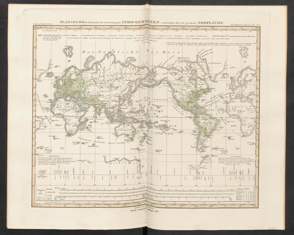
Planiglob zur Übersicht der Verbreitung der Indo-Germanen und Semiten über die gesammte Erdfläche
1852
Humboldt, Alexander von
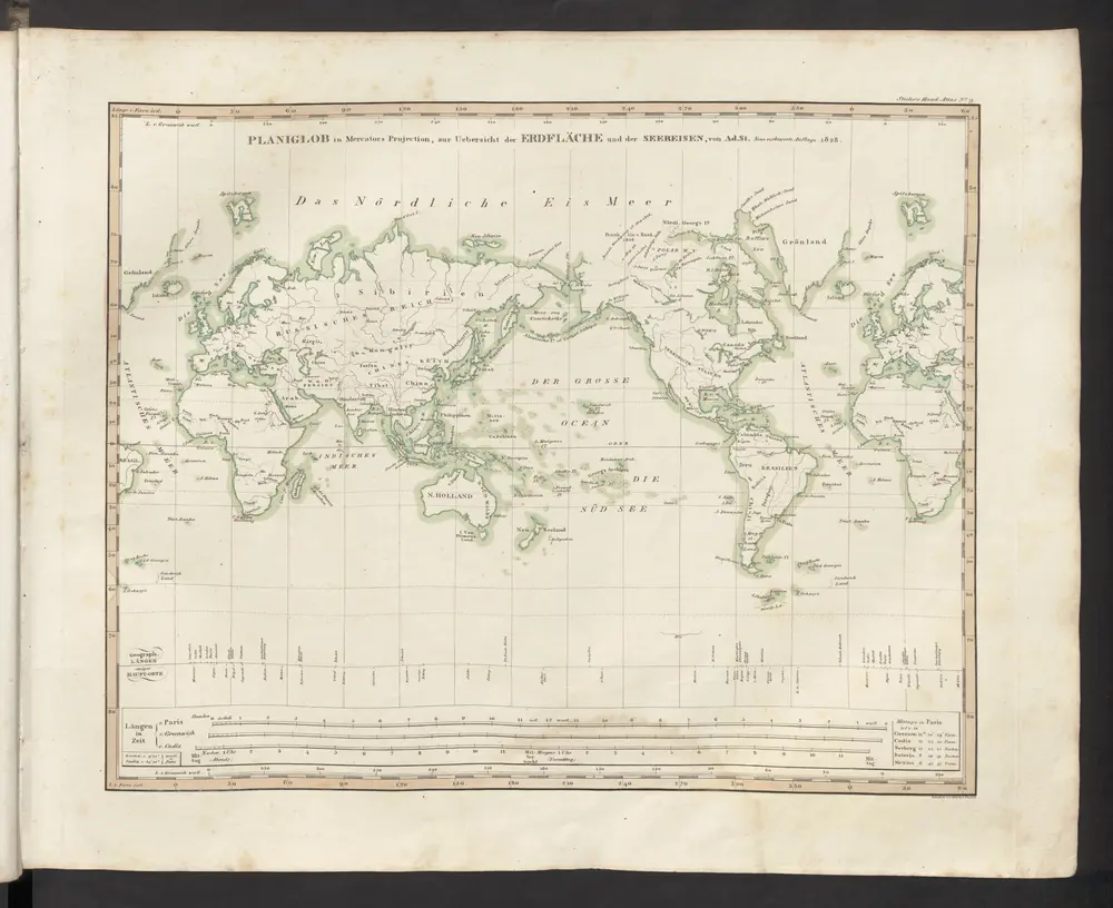
[Planiglob in Mercators Projection, zur Uebersicht der Erdfläche und der Seereisen]
1833
Stieler, Adolf
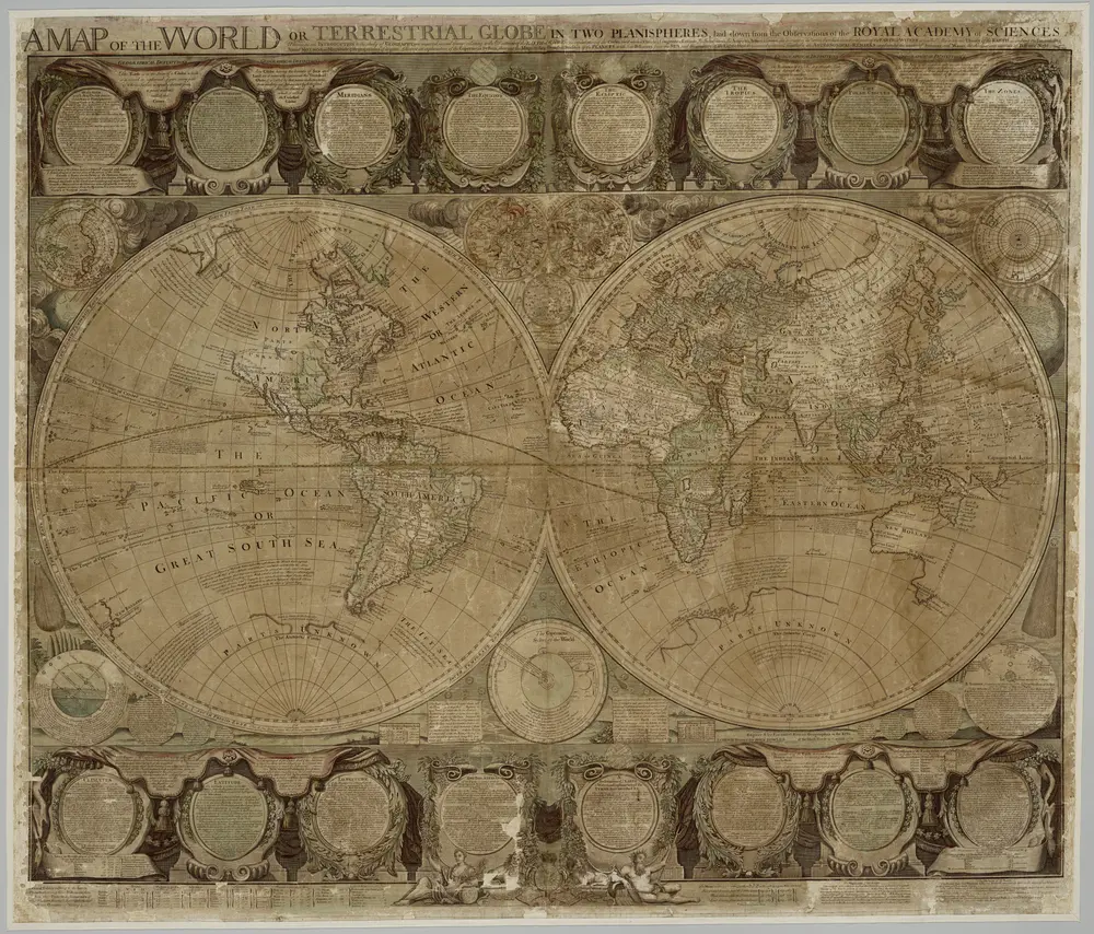
A map of the world or terrestial globe in two planispheres : laid down from the observations of the Royal Academy of Sciences / [John Bowles] ; engraved by Emanuel Bowen
1759
Bowles, John; Bowen, Emanuel
1:34m

Speculum nauticum super navigatione maris Occidentalis confectum, continens omnes oras maritimas Galliae, Hispaniae et praecipuarum partium Angliae, in diuersis mappis maritimis comprehensum una cum usu et interpretatione carundem, accurata diligentia concinnatum, et elaboratum., mapa ze strany: [5]
1583
Waghenaer Lucas Janszoon