Cataloged map
Schetskaartje van een gedeelte der Westkust van Nieuw Guinea / door W.F. Versteeg

Full title:Schetskaartje van een gedeelte der Westkust van Nieuw Guinea / door W.F. Versteeg
Depicted:1885
Publisher:Amsterdam : C.L. Brinkman
Physical Size:20 x 30 cm
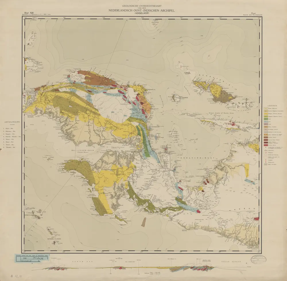
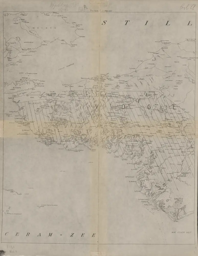
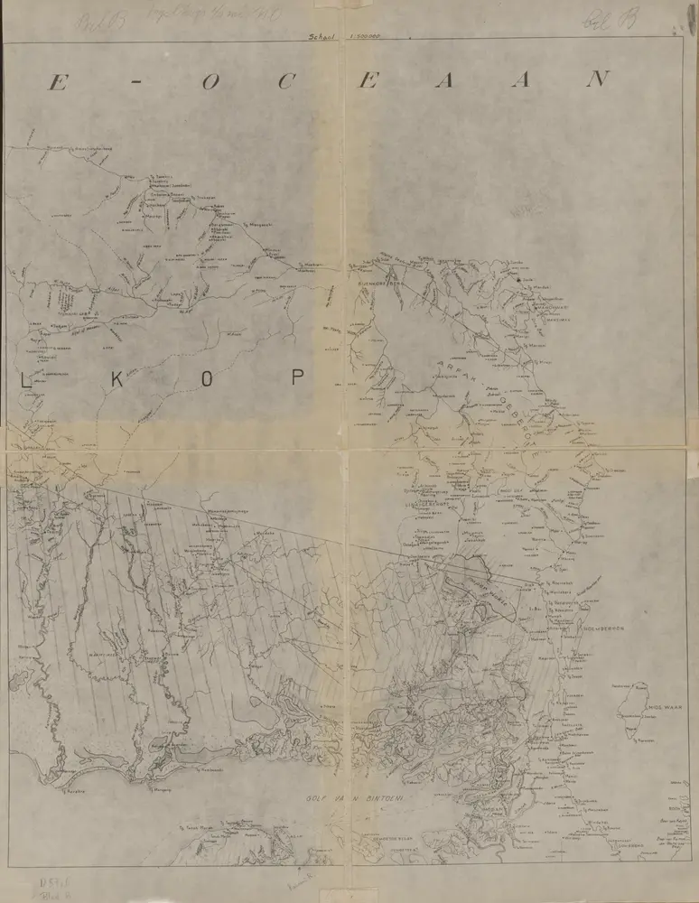
Geologische overzichtskaart van den Nederlandsch Oost-Indischen Archipel : Vogelkop / bewerkt door J. Zwierzycki
1932
Landsdrukkerij Weltevreden (Batavia)
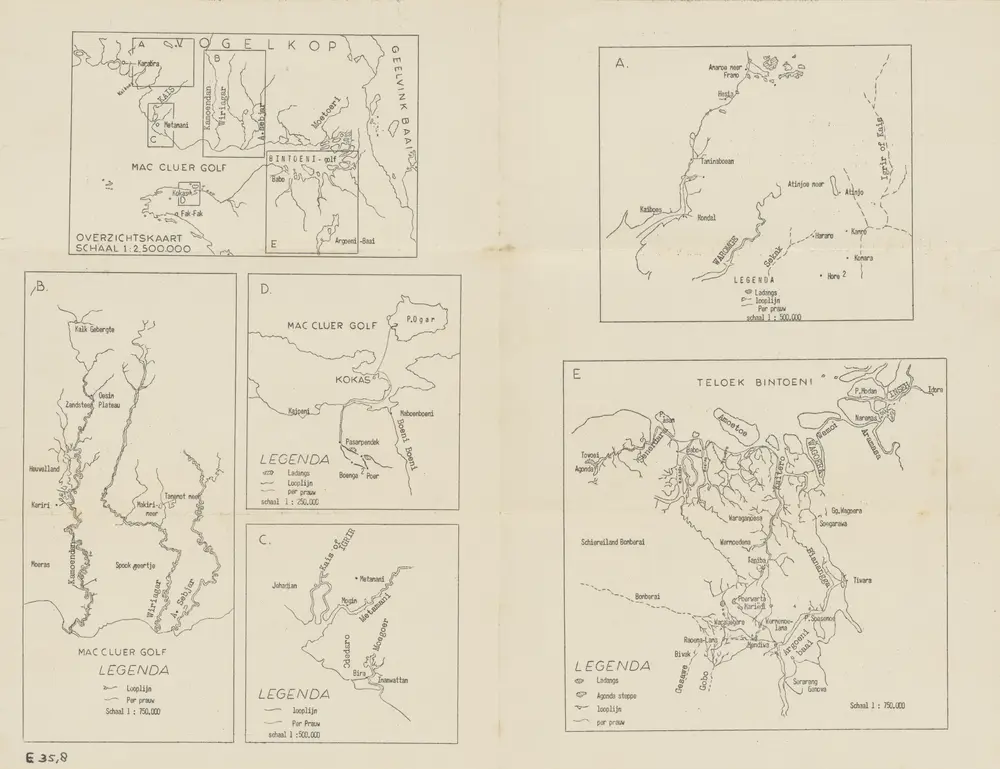
MacCluer-Golf
1955
[S.l. : s.n.]
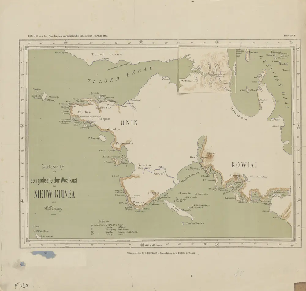
Schetskaartje van een gedeelte der Westkust van Nieuw Guinea / door W.F. Versteeg
1885
Nederlandsch Aardrijkskundig Genootschap Amsterdam
[Deel van de onderafdeling Fak-Fak met zuidelijk deel van de Vogelkop] / prepared under the direction of the Chief Engineer by Base Map Plant U.S. Army
1947
Corps of Engineers U.S. Army War Department Washington D.C.
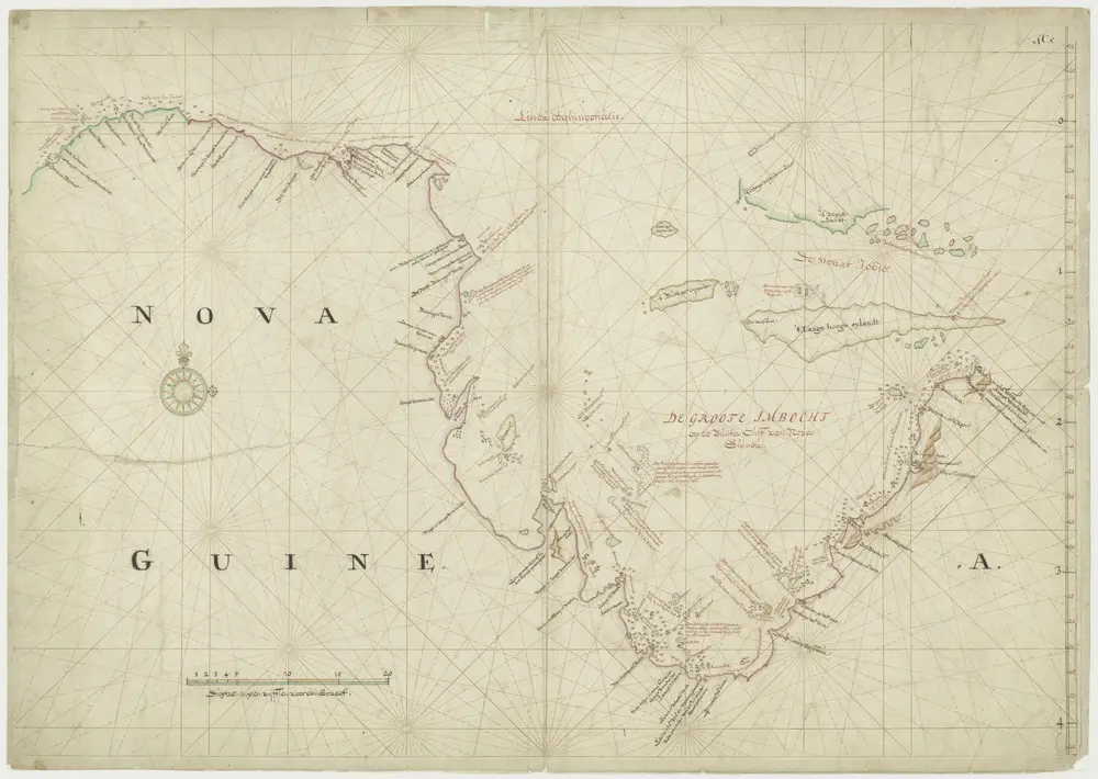
Kaart van het noordelijk deel van Nova Guinea
1705
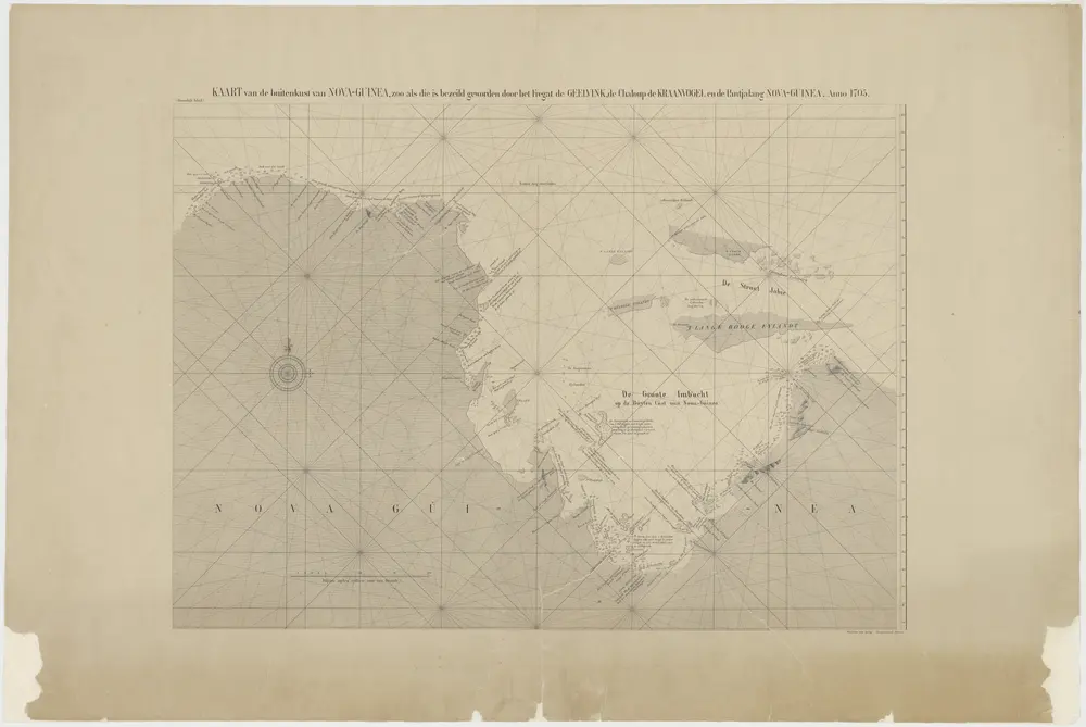
Kaart van buytenkust van Nova-Guinea zoo als die is bezeilt door het fregat de Geelvink, de chaloup de Kraanvogel en de pantjalang Nova-Guinea.
1865
Vogelkop
1940
[S.l. : s.n.
Vogelkop
1940
[S.l. : s.n.
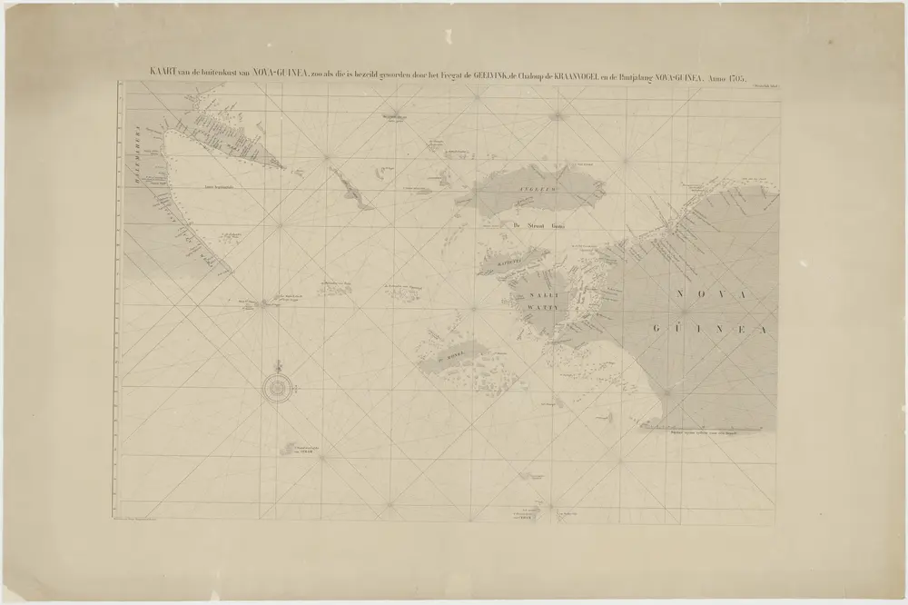
Kaart van buytenkust van Nova-Guinea zoo als die is bezeilt door het fregat de Geelvink, de chaloup de Kraanvogel en de pantjalang Nova-Guinea.
1865
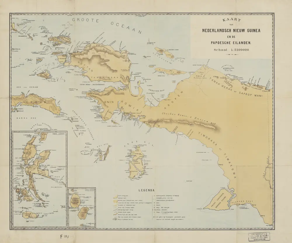
Kaart van Nederlandsch Nieuw Guinea en de Papoesche Eilanden
1880
[S.l. : s.n.]