Mapa catalogado
Schetskaart van Nieuw Guinea / Topografische Dienst

Título completo:Schetskaart van Nieuw Guinea / Topografische Dienst
Año de ilustración:1938
Editorial:Batavia : Reproductiebedrijf Topografische Dienst
Tamaño físico:20 x 30 cm
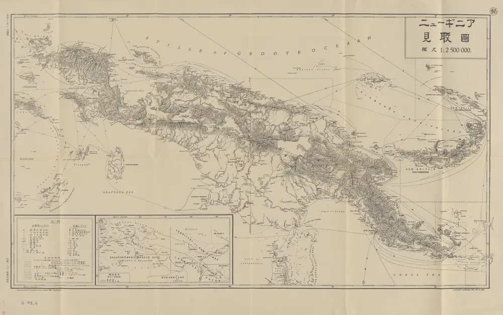
[Schetskaart van Nieuw-Guinea] / Topografische Dienst
1942
Topografische Dienst Batavia
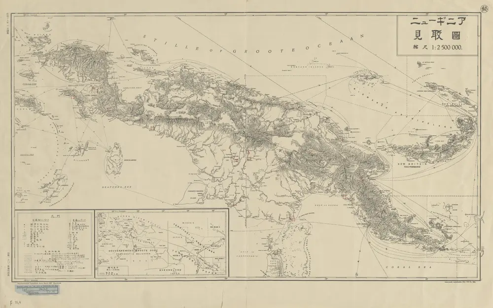
[Nieuw Guinea] / Topografische Dienst
1942
Topografische Dienst Batavia
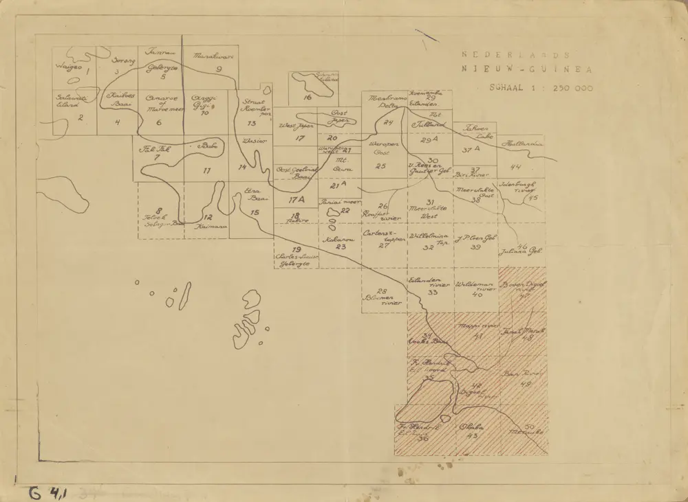
Elf kaarten van Nieuw-Guinea / Directie Ned[erlands] Nieuw Guinea, Ministerie van Binnenlandse Zaken
1960
Ministerie van Binnenlandse Zaken 's-Gravenhage . Directie Nederlands Nieuw Guinea
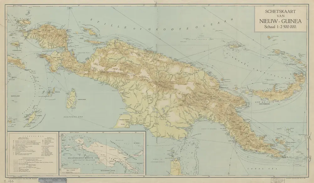
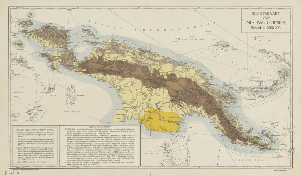
Schetskaart van Nieuw-Guinea / Topografische Dienst
1938
Topografische Dienst Batavia
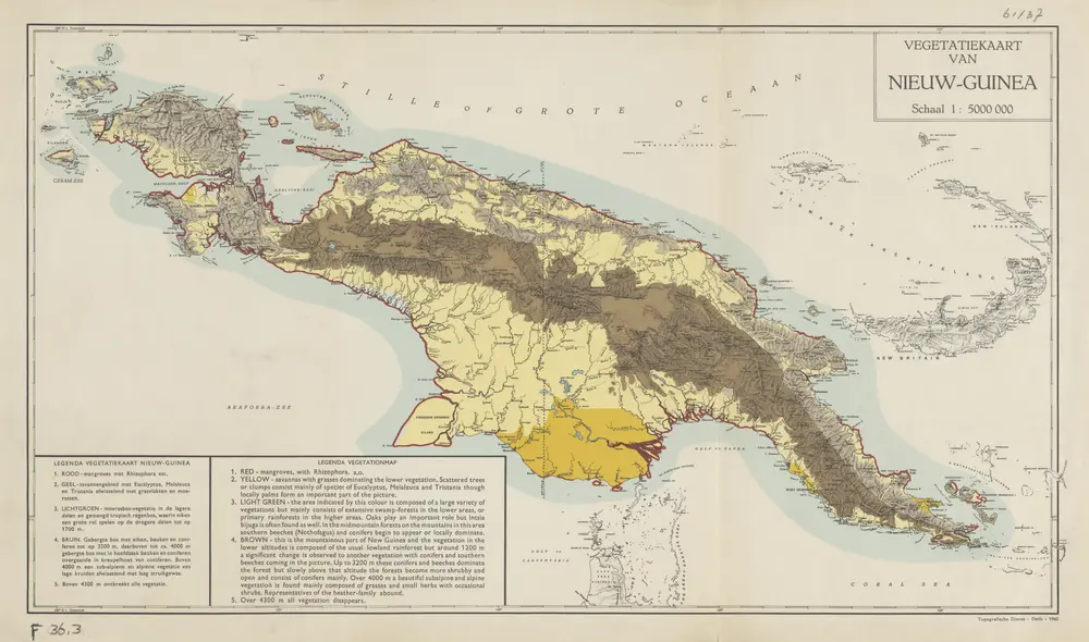
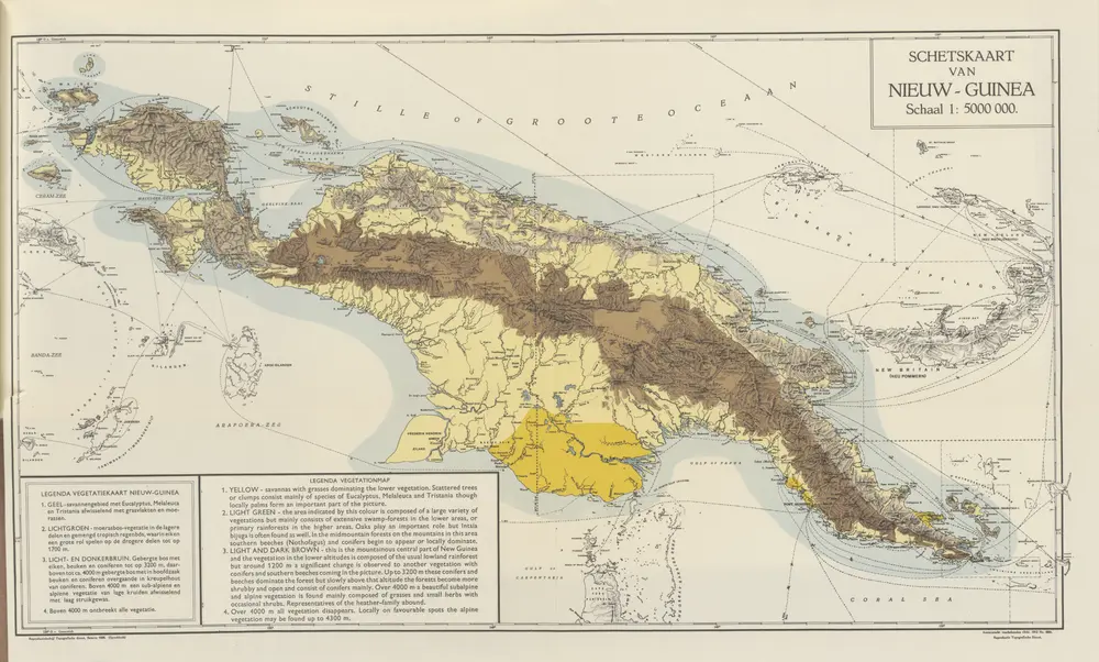
Vegetatiekaart van Nieuw-Guinea
1960
Topografische Dienst Delft
Schetskaart van Nieuw Guinea / Topografische Dienst
1938
Topografische Dienst Batavia
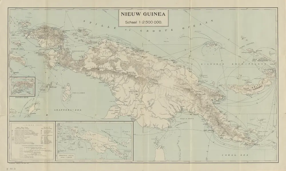
Nieuw Guinea / Topografische Dienst
1937
Topografische Dienst Batavia
Nederlands Nieuw-Guinea / [Netherlands Topographic Service]
1954
Netherlands Topographic Service Delft
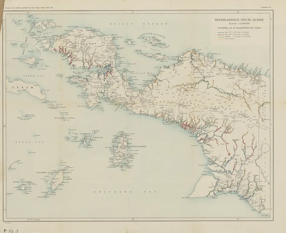
Nederlandsch-Nieuw-Guinee
1915
Topographische Inrichting Batavia
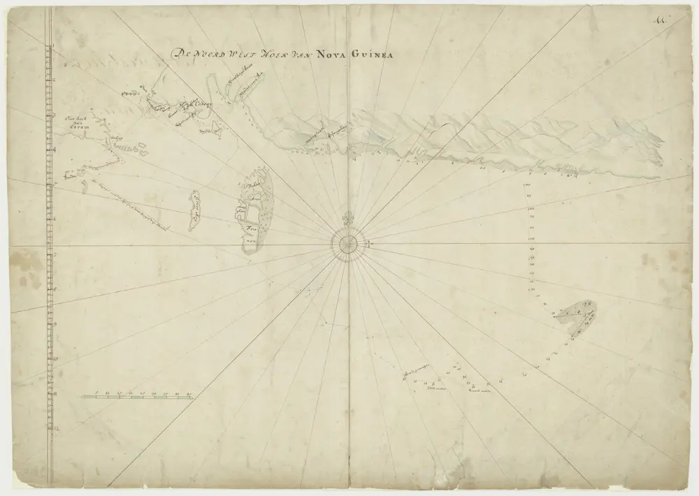
Kaart van de noordwesthoek van Nova Guinea
1700