Carte cataloguée
Kaart van het eiland Flores / door A. Wichmann

Titre complet:Kaart van het eiland Flores / door A. Wichmann
Année de l'image:1891
Éditeur:Leiden : E.J. Brill
Taille physique:20 x 30 cm
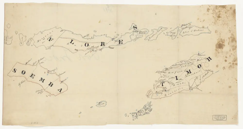
Flores, Soemba, Timor
1875
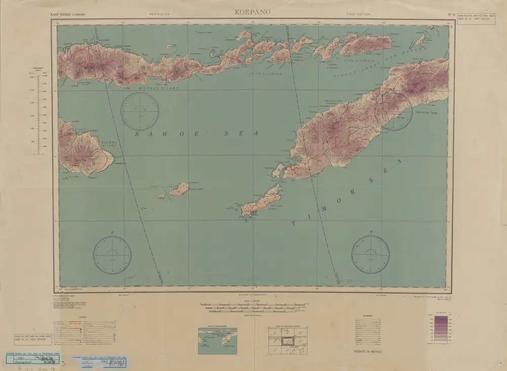
Koepang / U.S. Army Map Service
1944
U.S. Army Map Service Washington D.C.
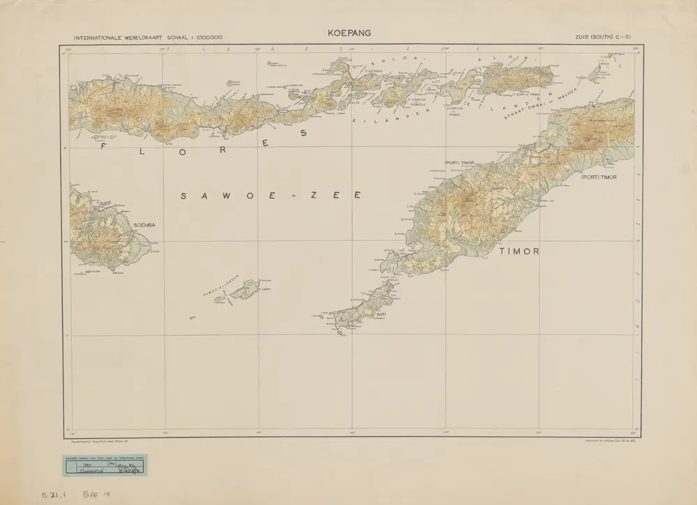
Koepang / Topografische Dienst
1941
Topografische Dienst Batavia
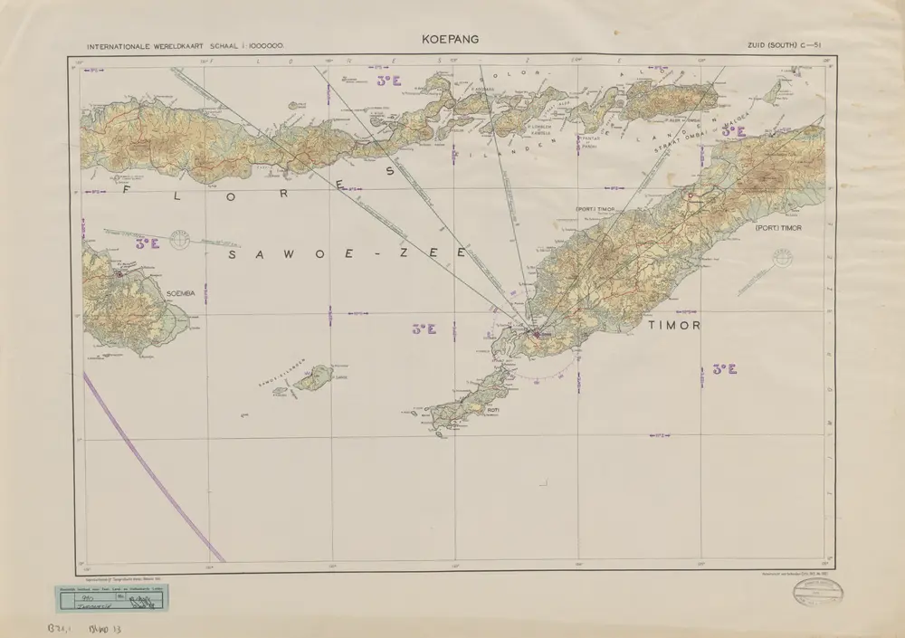
Koepang / Topografische Dienst
1941
Topografische Dienst Batavia
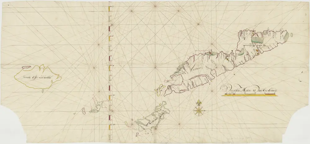
Kaart van Timor en omgeving
1800
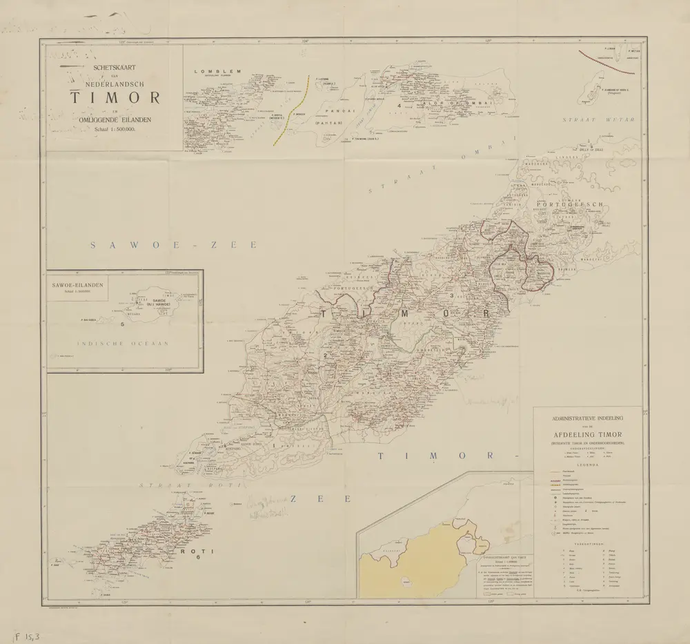
Schetskaart van Nederlandsch Timor en omliggende eilanden / Topographische Inrichting
1911
Topografische Inrichting Batavia
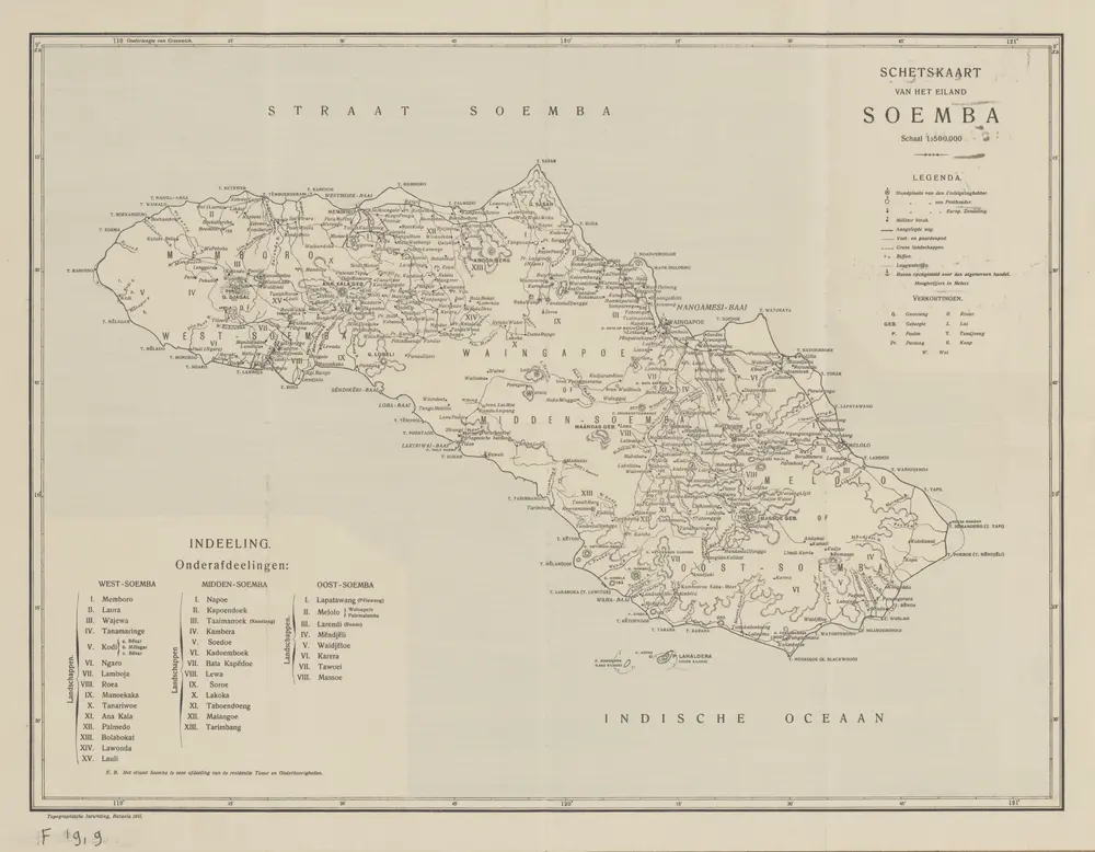
Schetskaart van het eiland Soemba / Topographische Inrichting
1911
Topographische Inrichting Batavia
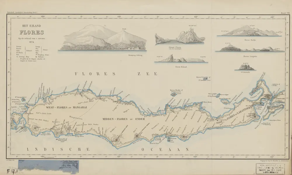
Heteiland Flores / J.G. veth, del. 1874
1876
Aardrijkskundig Genootschap Amsterdam
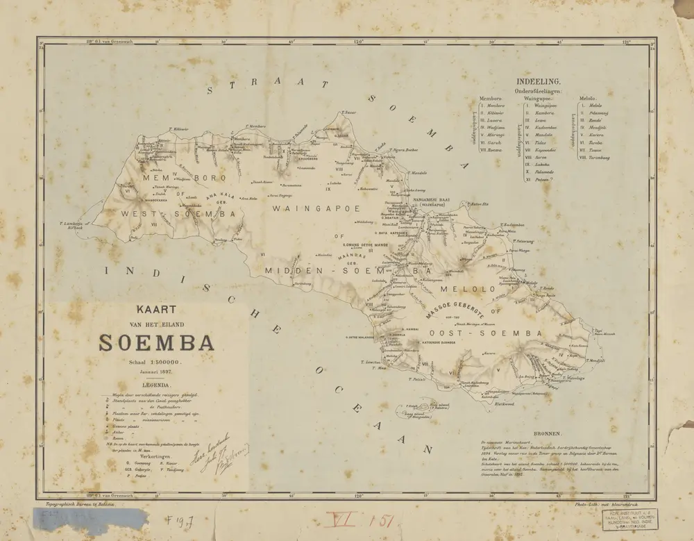
Kaart van het Eiland Soemba / Topographisch Bureau, januari 1897 ; [Met aantekening in pen: herziene herdruk juli 1897 door H.D.H. Bosboom]
1897
Topographisch Bureau Batavia
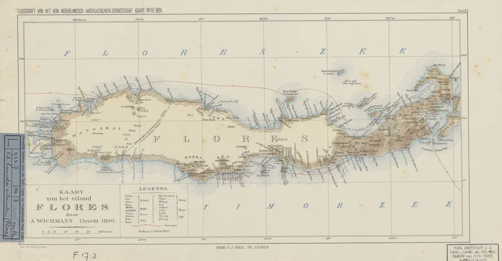
Kaart van het eiland Flores / door A. Wichmann
1891
Koninklijk Nederlandsch Aardrijkskundig Genootschap Amsterdam