Cataloged map
Heteiland Flores / J.G. veth, del. 1874

Full title:Heteiland Flores / J.G. veth, del. 1874
Depicted:1876
Publisher:Amsterdam : C.F. Stemler
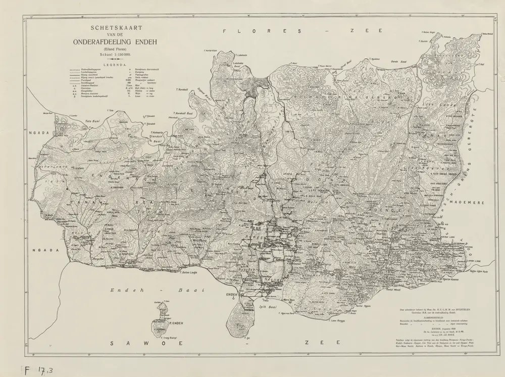
Schetskaart van de Onderafdeeling Endeh : (Eiland Flores) / samengesteld door Ch. Leroux
1921
Encyclopaedisch Bureau Batavia
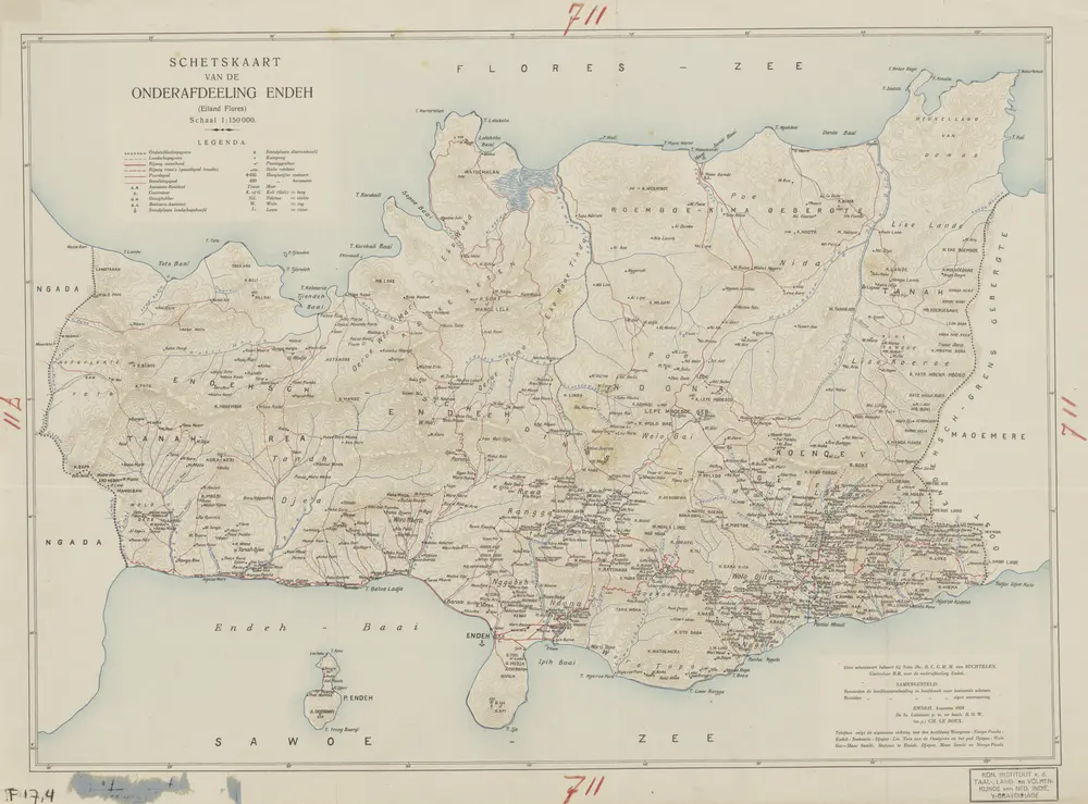
Schetskaart van de Onderafdeeling Endeh : (Eiland Flores) / samengesteld door Ch. Leroux
1921
Encyclopaedisch Bureau Batavia
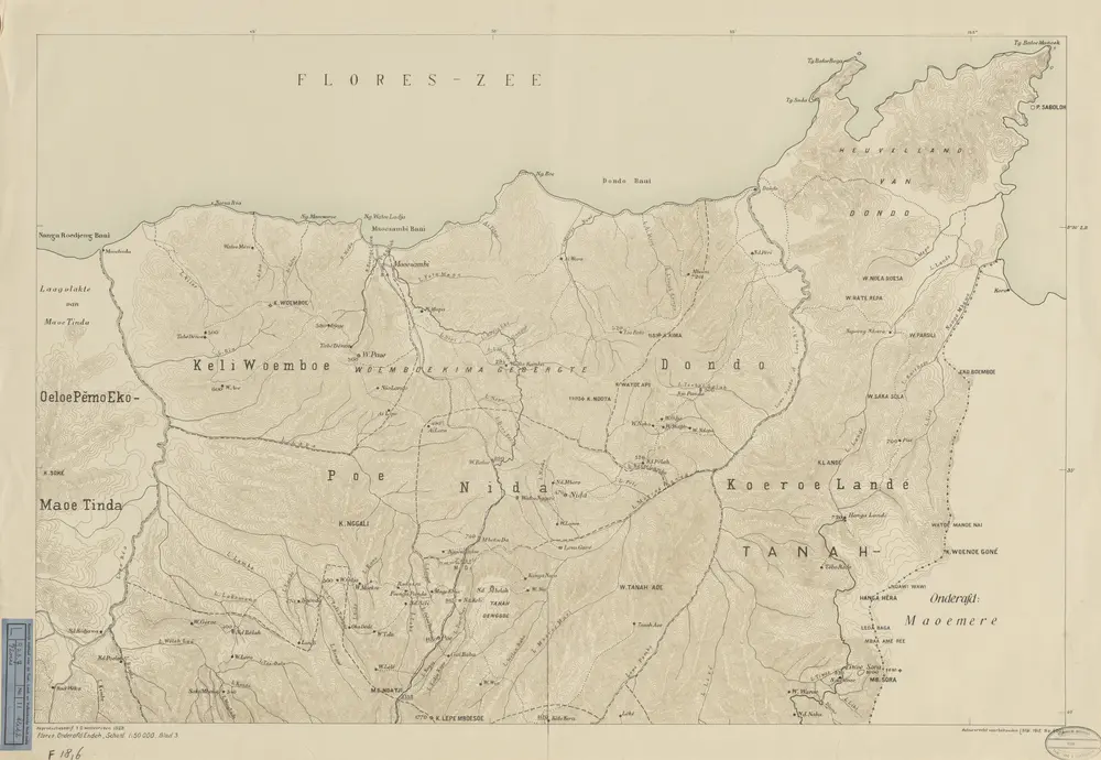
Schetskaart van de Onderafdeeling Endeh (Residentie Flores) / Topografische Dienst
1928
Topografische Dienst Weltevreden (Batavia)
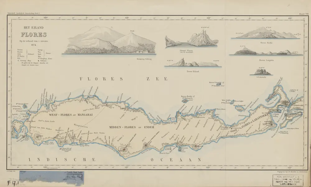
Heteiland Flores / J.G. veth, del. 1874
1876
Aardrijkskundig Genootschap Amsterdam
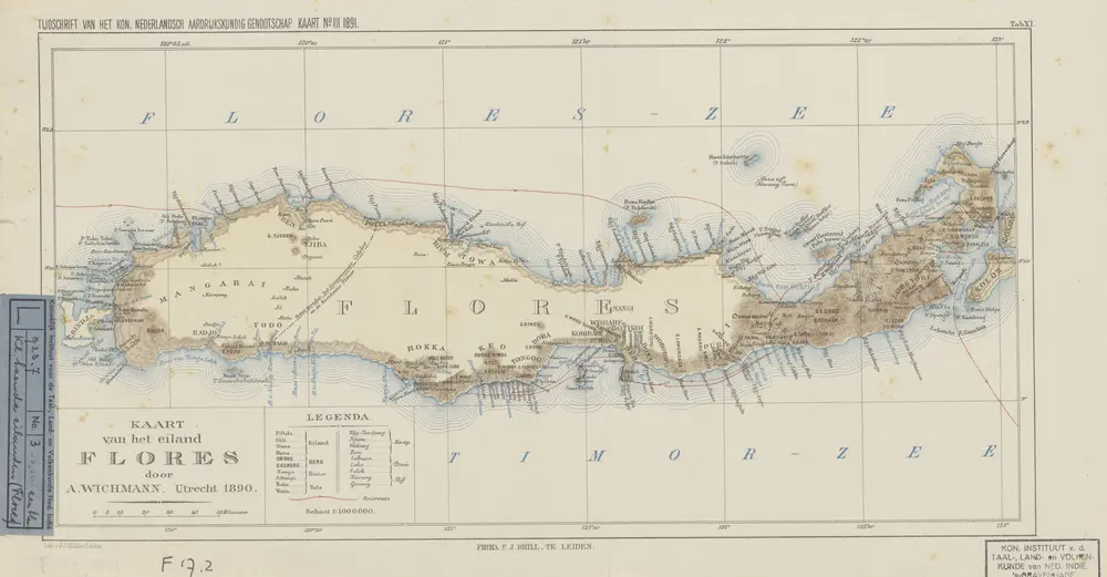
Kaart van het eiland Flores / door A. Wichmann
1891
Koninklijk Nederlandsch Aardrijkskundig Genootschap Amsterdam
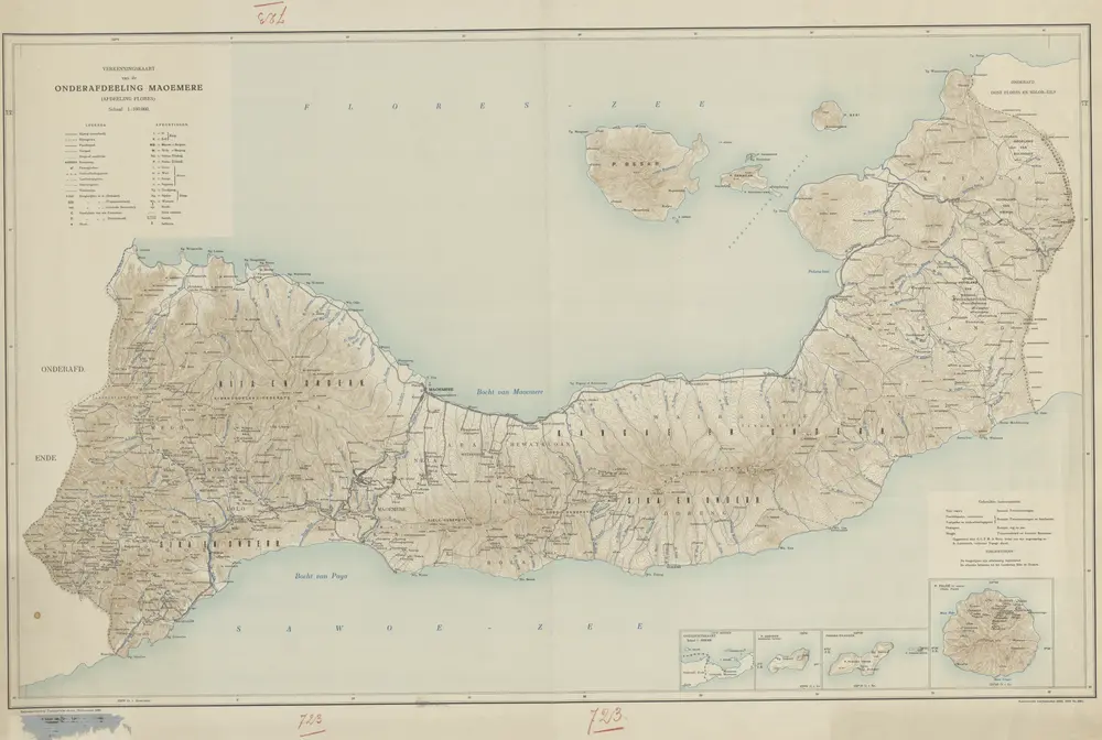
Verkenningskaart van de Onderafdeeling Maoemere (Afdeeling Flores) / Topografische Dienst
1930
Topografische Dienst Weltevreden
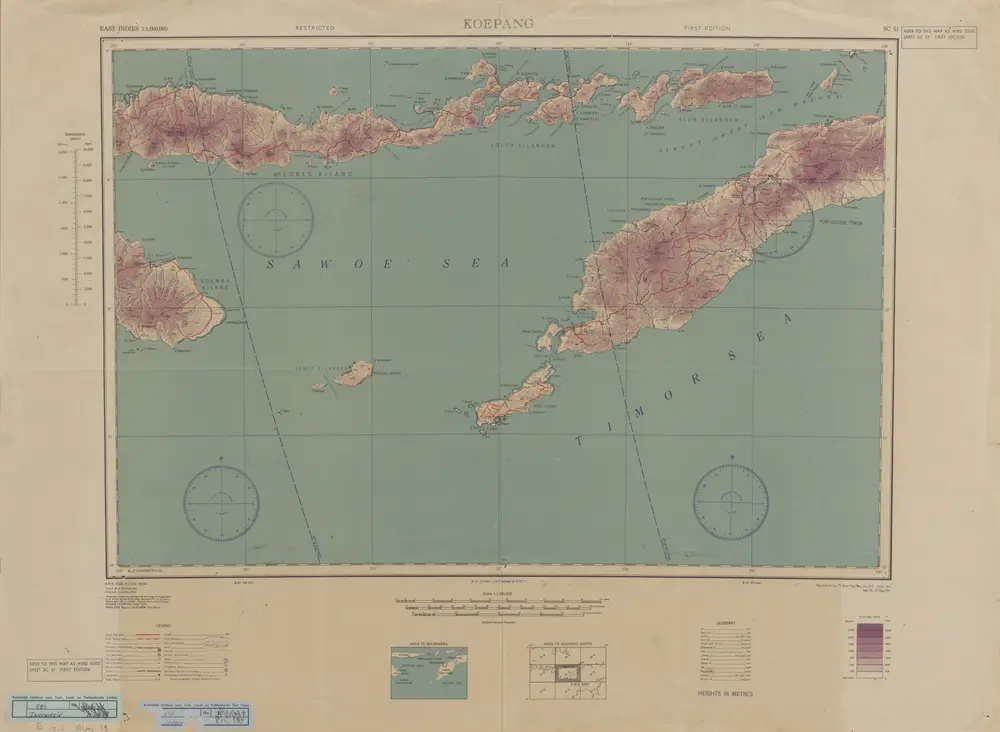
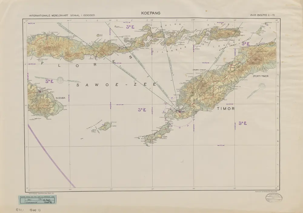
Koepang / U.S. Army Map Service
1944
U.S. Army Map Service Washington D.C.
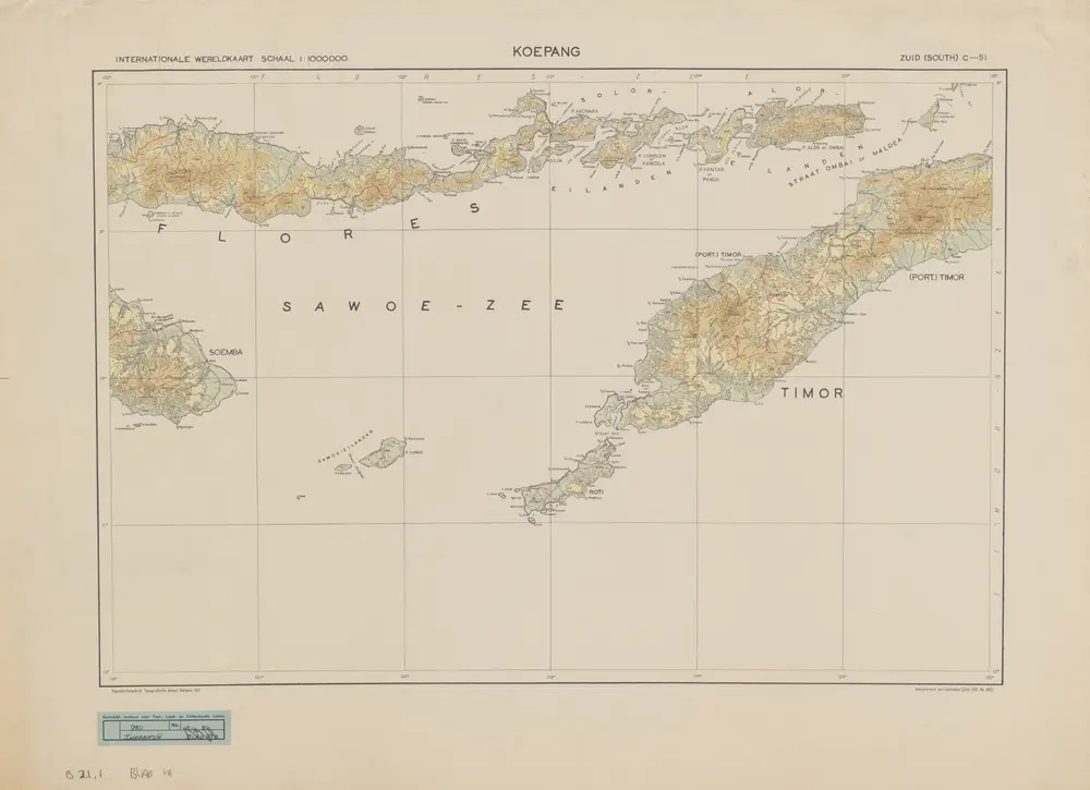
Koepang / Topografische Dienst
1941
Topografische Dienst Batavia
Koepang / Topografische Dienst
1941
Topografische Dienst Batavia
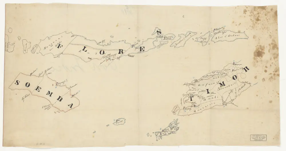
Flores, Soemba, Timor
1875