Mapa catalogado
Kota Denpasar

Título completo:Kota Denpasar
Año de ilustración:1930
Tamaño físico:20 x 30 cm
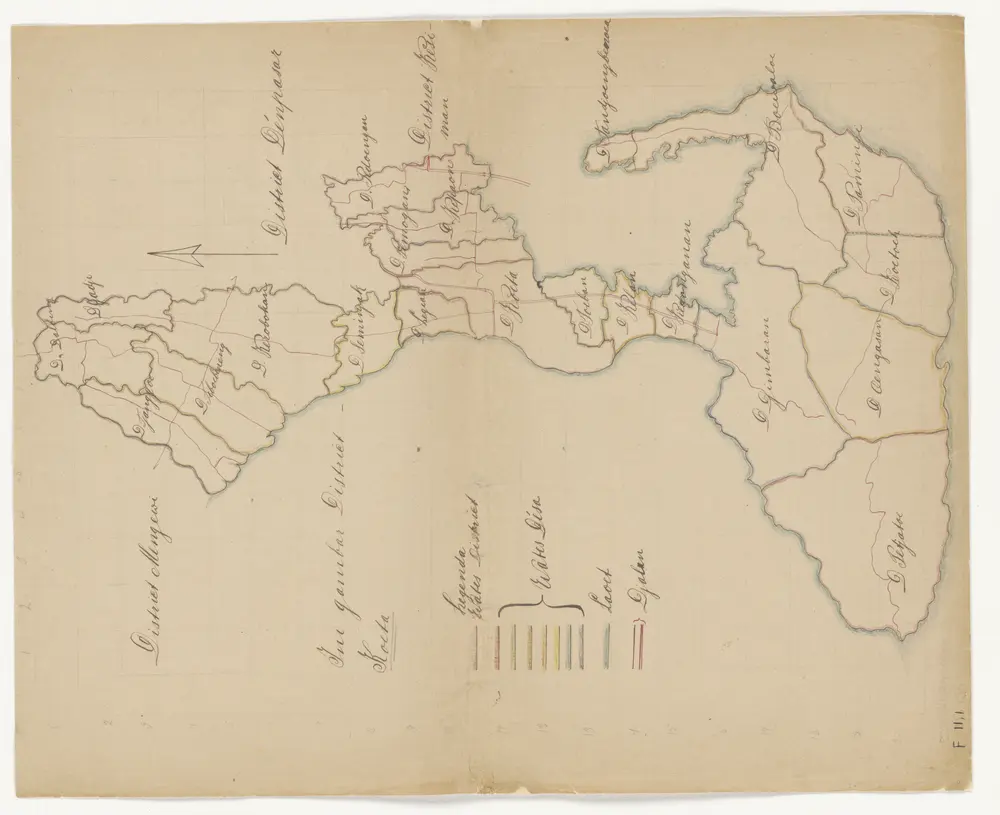
Ini gambar District Koeta
1870
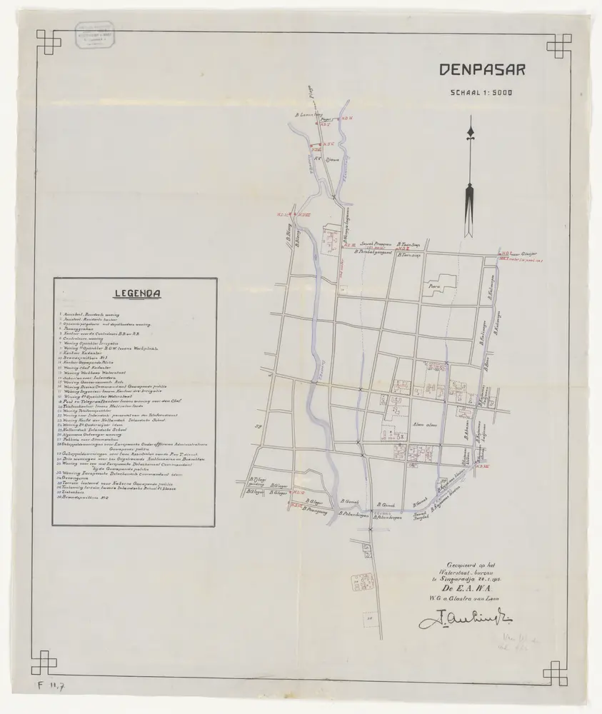
Denpasar / gecopieerd op het Waterstaat Bureau te Singaradja, 28-1-1915, [door] de E.A.W.A., w.g. A. Glastra van Loon
1915
Waterstaat Bureau Singaradja
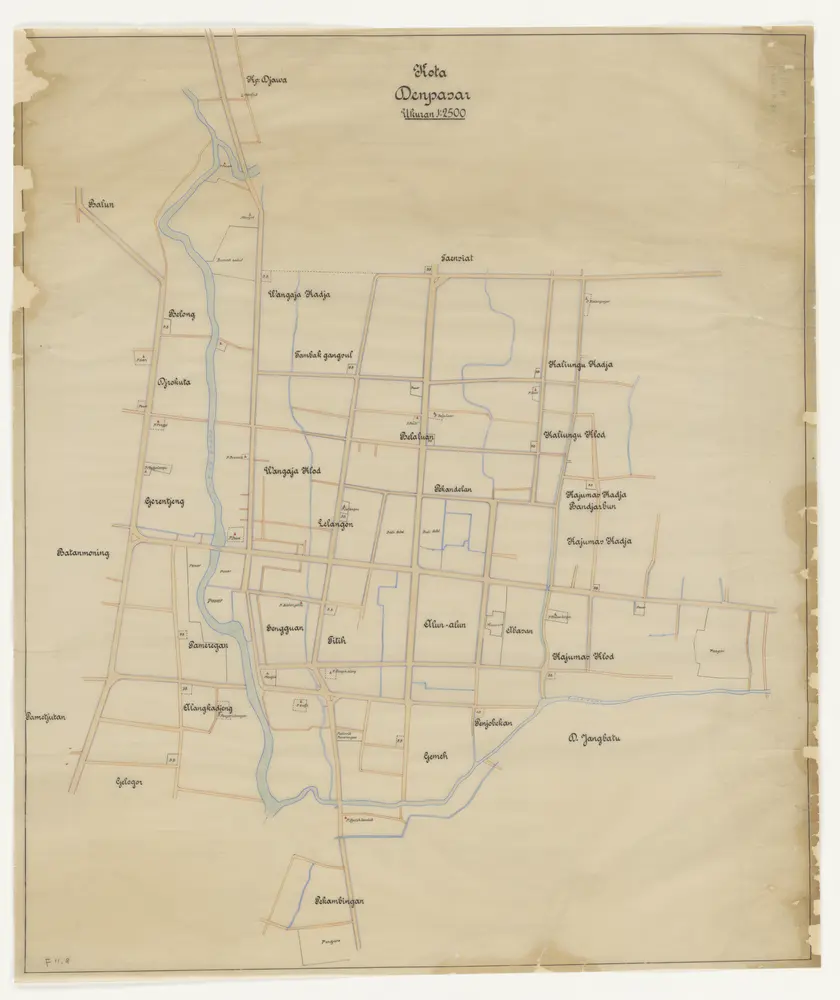
Kota Denpasar
1930
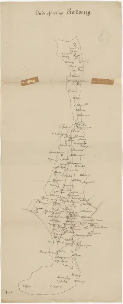
Onderafdeeling Badoeng
1910
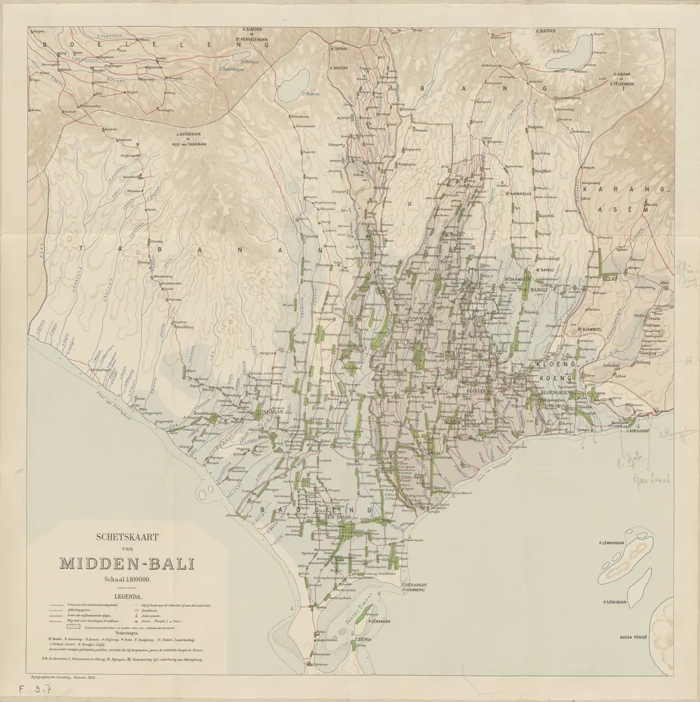
Schetskaart van Midden Bali / Topographische Inrichting
1906
Topographische Inrichting Batavia
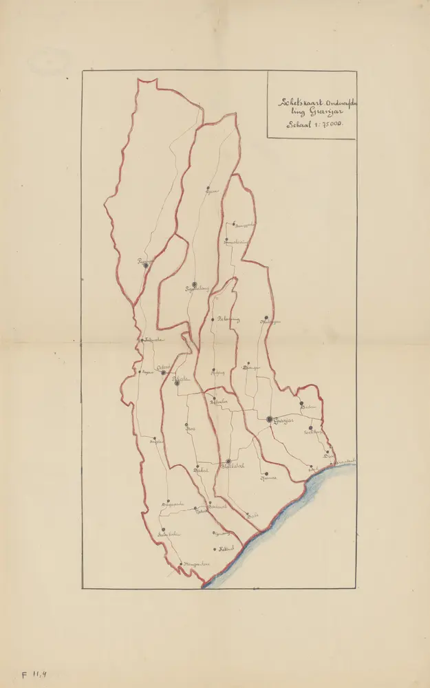
Schetskaart Onderafdeeling Gianjar
1925
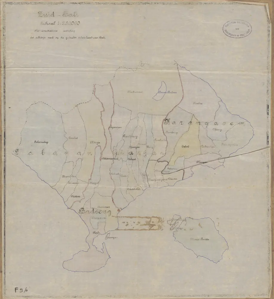
Zuid Bali : administratieve indeeling
1910
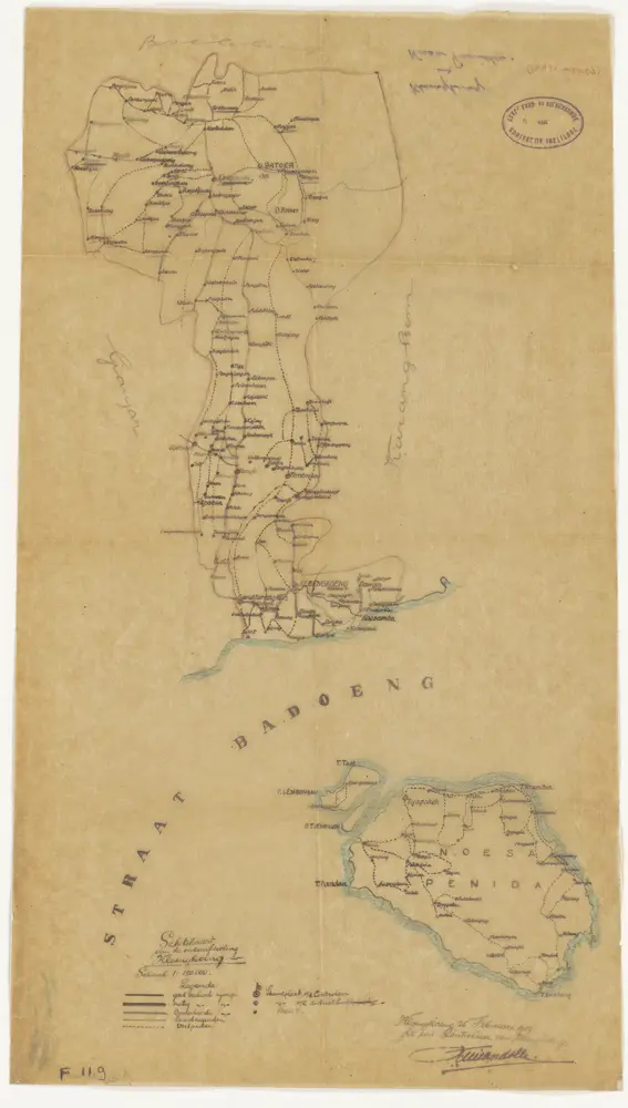
Schetskaart van de onderafdeeling Kloengkoeng / Waarnemend Controleur van Kloengkoeng [J.F. Mirandolle]
1919
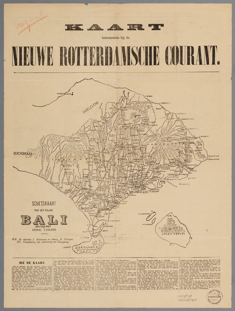
[Recto], uit: Schetskaart van het eiland Bali : (oostelijk deel)
1904
[S.l. : s.n.]
1:250k
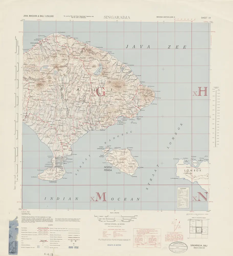
Singaradja / prepared under the direction of the Chief of Engineers, U.S. Army by the Army Map Service
1944
Army Map Service Washington D.C.