Cataloged map
Bali / Topografische Dienst

Full title:Bali / Topografische Dienst
Depicted:1935
Publisher:Batavia : Reproductiebedrijf Topografische Dienst
Physical Size:20 x 30 cm
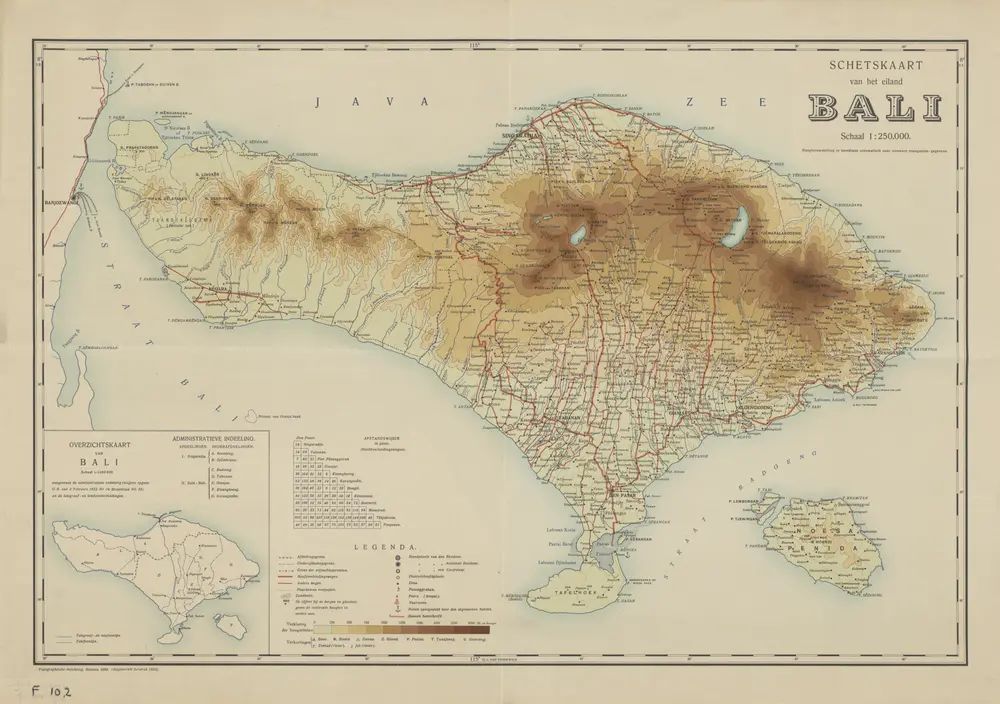
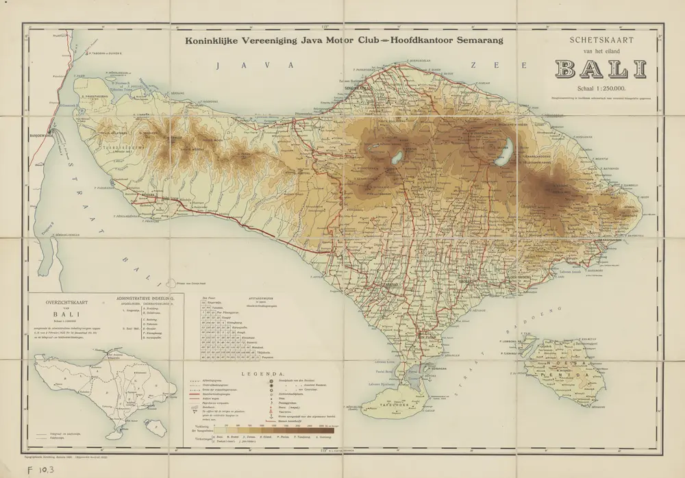
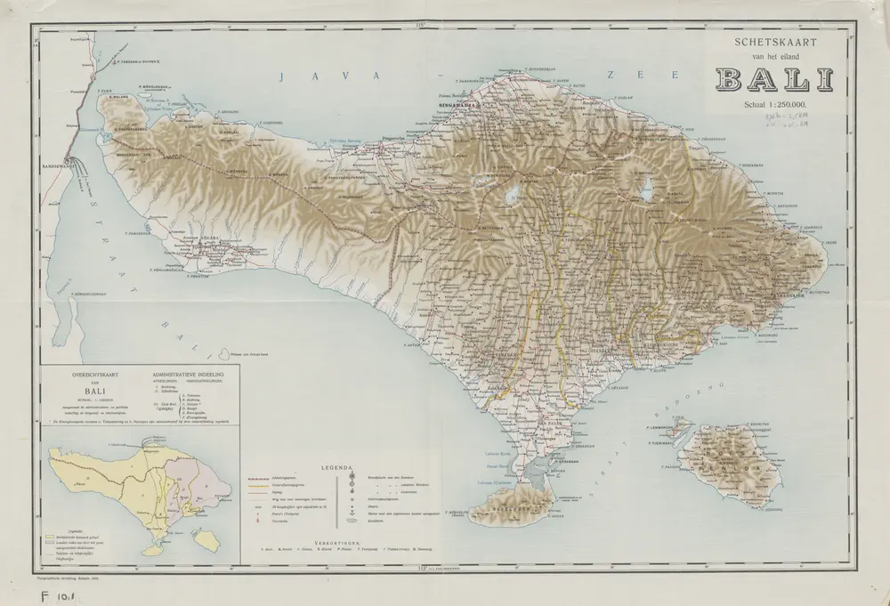
Schetskaart van het eiland Bali
1915
[Batavia : Topographische Inrichting?]
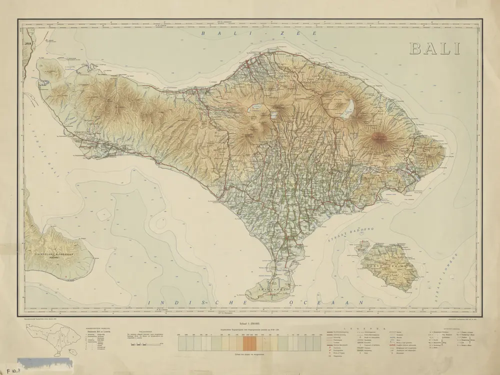
Bali / Topografische Dienst
1935
Topografische Dienst Batavia
Bali
1920
[S.l. : s.n.]
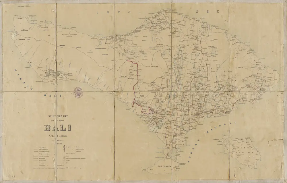
Schetskaart van het eiland Bali / Topographische Inrichting
1922
Topografische Inrichting Batavia
Schetskaart van het eiland Bali / Topographische Inrichting
1922
Koninklijke Vereeniging Java Motor Club Semarang
Schetskaart van het eiland Bali / Topographische Inrichting
1909
Topographische Inrichting Batavia
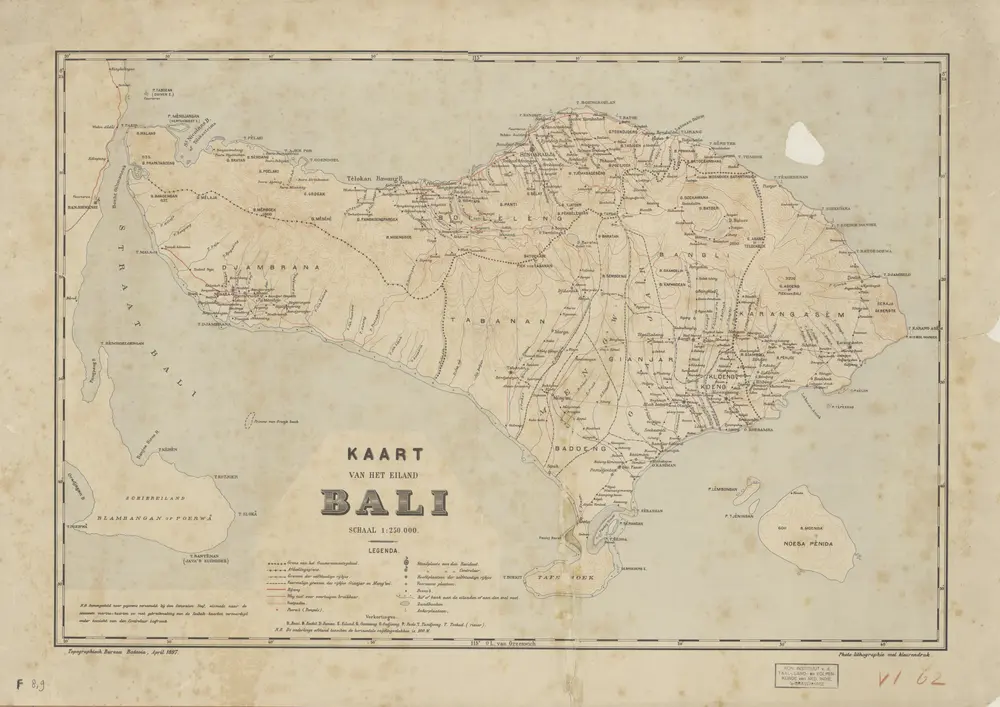
Kaart van het Eiland Bali / Topographisch Bureau Batavia, april 1897
1897
Topographisch Bureau Batavia
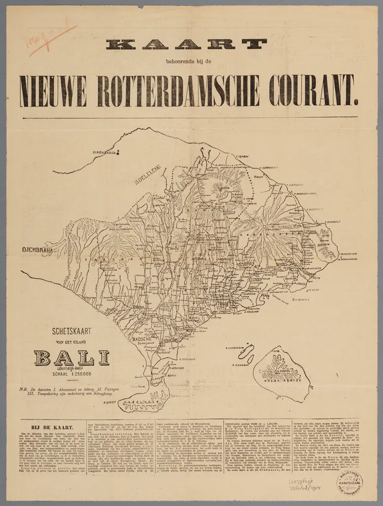
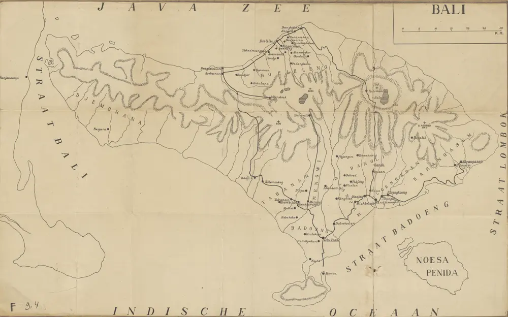
[Recto], uit: Schetskaart van het eiland Bali : (oostelijk deel)
1904
[S.l. : s.n.]
1:250k
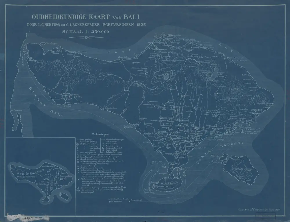
Oudheidkundige kaart van Bali / door L.C. Heyting en C. Lekkerkerker, Scheveningen 1925 ; gecop[ieeerd] door M. Kartodisastro, aug[ustus] 1925
1925
[S.l. : s.n.]
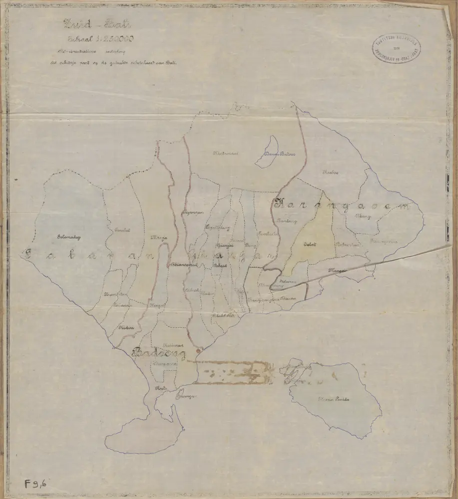
Zuid Bali : administratieve indeeling
1910