Maps of Caraga

Partie des Iles Philippines / [dressée par Ph. Vandermaelen]
[Bruxelles : P.M.G. Vandermaelen, Éditeur]
No. 19. Leyte.
1 : 660000 U.S. Coast and Geodetic Survey
[Islas filipinas - Leyte]
Atlas de Filipinas Algué, P. José Government Printing Office
No. 18. Samar.
1 : 686000 U.S. Coast and Geodetic Survey
[Islas filipinas - Sámar]
Atlas de Filipinas Algué, P. José Government Printing Office
No. 30. Estrecho de Juanico.
1 : 133000 U.S. Coast and Geodetic Survey
[Islas filipinas - Estrecho de S.Juanico]
Atlas de Filipinas Algué, P. José Government Printing Office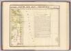
Partie, Iles Philippines. Oceanique no. 7.
1 : 1641836 Vandermaelen, Philippe, 1795-1869
[Islas filipinas - Mindanao oriental]
Atlas de Filipinas Algué, P. José Government Printing Office
[Islas filipinas - Mindanao Joló]
Atlas de Filipinas Algué, P. José Government Printing Office
No. 26. Mindanao Jolo.
1 : 2500000 U.S. Coast and Geodetic Survey
No. 27. Mindanao Oriental.
1 : 1830000 U.S. Coast and Geodetic Survey
Geologic reconnaissance map of Mindanoa / Bureau of Science, Division of Mines ; P. Moskaira, engraved ; geology by Warren D. Smith
Bureau of Science . Division of Mines [S.l.] : Bureau of Science
No. 23. Bohol.
1 : 363000 U.S. Coast and Geodetic Survey
[Islas filipinas - Cebú]
Atlas de Filipinas Algué, P. José Government Printing Office
[Islas filipinas - Bohol]
Atlas de Filipinas Algué, P. José Government Printing Office
No. 22. Cebu.
1 : 642000 U.S. Coast and Geodetic Survey
Islas Filipinas / por C. Alabern
1 mapa. Alabern, C.
Carte Hydrographique & Chorographique des ISLES PHILIPPINES
1 : 2000000 Filipíny Murillo Velarde, Pedro Bagay, Nicolás de la Cruz par les Heritiers de Homann
REDUZIRTE-KARTE VON DEN PHILIPPINEN und den SULU INSELN
1 : 2400000 Filipíny Berghaus, Heinrich Karl Wilhelm Aragon, Ildefonso de Justus Perthes
Reduzirte Karte von den Philippinen und den Sulu-Inseln
1 : 2356000 den Manen Don Alexandro ́s Malaspina, Espinosa y Tello's, [...] Don Ildefonso de Aragon gewidmet vom Verfasser [H. Berghaus] gest. v. Selmar Siebert Gotha : Perthes
Mapa de las yslas Philipinas
1 : 3100000
No. 2. Mapa General.
1 : 6000000 U.S. Coast and Geodetic Survey
[Islas filipinas - distribution de temblores]
Atlas de Filipinas Algué, P. José Government Printing Office
[Islas filipinas - estaciones meteorologico-seismicas]
Atlas de Filipinas Algué, P. José Government Printing Office
[Islas filipinas - mapa general]
Atlas de Filipinas Algué, P. José Government Printing Office
No. 3. Mapa Etnografico.
1 : 6000000 U.S. Coast and Geodetic Survey
No. 4. Mapa Orografico.
1 : 6000000 U.S. Coast and Geodetic Survey
Mapa de las Islas Filipinas : formado expresamente para "El Correo Espaÿûnol" / por el topografo D. José Mendez
Madrid : Mendez
![Partie des Iles Philippines / [dressée par Ph. Vandermaelen]](https://images-2.georeferencer.com/images/iiif/402490583027/full/,300/0/native.jpg)

