Maps of Tasikmalaya

Goentoer-Papandajan-Tjikoeraj-Galoenggoeg-Telagabodas / Topografische Inrichting, Batavia
Topografische Inrichting Batavia Batavia : Officieële Vereeniging voor Toeristen Verkeer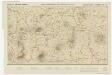
[Kaart], uit: Goentoer-Papandajan-Tjikoeraj-Galoenggoeg-Telagabodas / Topografische Inrichting, Batavia
1 : 100000 titelvariant: Java, Touristmap Garoet and environs; Touristmap Garoet and environs; Annotatie: Titel op omslag: Java. Touristmap Garoet and environs; Oorspr. uitg.: 1923; Annotatie geografische gegevens: Schaalstok van 10 km (= 10 cm); Legenda Topografische Inrichting, Batavia; Officieële Vereeniging voor Toeristen Verkeer in Nederlandsch Indië, Batavia Batavia : Officieële Vereeniging voor Toeristen Verkeer
Wandelkaart van Garoet en Omstreken
Weltevreden : Official Tourist Bureau
Garoet / prepared under the direction of the Chief of Engineers U.S. Army, 1943, copied from a Dutch map dated 1919
Army Map Service U.S. Army Washington D.C. Washington D.C. : Army Map Service
Tjitjapar / prepared under the direction of the Chief of Engineers U.S. Army, 1943, copied from a Dutch map dated 1920
Army Map Service U.S. Army Washington D.C. Washington D.C. : Army Map Service
[Tjisoeroepan] / photolithographed and reprinted from a Dutch map dated 1921 by the Army Map Service
Army Map Service U.S. Army Washington D.C. Washington D.C. : Army Map Service
Cisurupan / Direktorat Tata Guna Tanah, Departemen Dalam Negeri
Departemen Dalam Negeri Jakarta . Direktorat Tata Guna Tanah [Jakarta] : Direktorat Tata Guna Tanah, Departemen Dalam Negeri
Tasikmalaja / prepared under the direction of the Chief of Engineers U.S. Army, 1944, copied from a Dutch map dated 1925
Army Map Service U.S. Army Washington D.C. Washington D.C. : Army Map Service
[Leles] / photolithographed and reprinted from a Dutch map dated 1919 by the Army Map Service
Army Map Service U.S. Army Washington D.C. Washington D.C. : Army Map Service
[Baloeboerlimbangan] / photolithographed and reprinted from a Dutch map dated 1923 by the Army Map Service
Army Map Service U.S. Army Washington D.C. Washington D.C. : Army Map Service
[Tjiparaj] / photolithographed and reprinted from a Dutch map dated 1919 by the Army Map Service
Army Map Service U.S. Army Washington D.C. Washington D.C. : Army Map Service
[Tjiawi en Panoembangan] / published by Survey Directorate H[ead] Q[uarters] ALFSEA [=American Land Forces South East Asia] ; printed by 71 Base Map Rep[roduction] Sec[tion] R.E., Mar[ch] 1946
Survey Directorate Head Quarters American Land Forces South East Asia (ALFSEA) [Washington D.C.] : Survey Directorate H[ead] Q[uarters] ALFSEA [=American Land Forces South East Asia]
Majalaya / Direktorat Tata Guna Tanah, Departemen Dalam Negeri
Departemen Dalam Negeri Jakarta . Direktorat Tata Guna Tanah [Jakarta] : Direktorat Tata Guna Tanah, Departemen Dalam Negeri
[Djamanis] : hermeten door den Topografischen Dienst in 1917-1920 / Topografische Inrichting
Topografische Inrichting Batavia Batavia : Topografische Inrichting
[Tjiawi] : herzien door den Topografischen Dienst in 1916-1919 / Topografische Inrichting
Topografische Inrichting Batavia Batavia : Topografische Inrichting
[Tjipeusing] : hermeten in 1916-1917 / Topografische Inrichting
Topografische Inrichting Batavia Batavia : Topografische Inrichting
[Tjibatoe] : hermeten in 1917-1919 / Topografische Inrichting
Topografische Inrichting Batavia Batavia : Topografische Inrichting
[Tasikmalaja] : hermeten door den Topografischen Dienst in 1919-1921 / Topografische Inrichting
Topografische Inrichting Batavia Batavia : Topografische Inrichting
[Lemahpoetih] : herzien in 1918 / Topografische Inrichting
Topografische Inrichting Batavia Batavia : Topografische Inrichting
[Baloeboer Limbangan] : hermeten in 1918 / Topografische Inrichting
Topografische Inrichting Batavia Batavia : Topografische Inrichting
[Malangbong] : hermeten in 1916-1917 / Topografische Inrichting
Topografische Inrichting Batavia Batavia : Topografische Inrichting
[Tanggoelon] : opgenomen door den Topografischen Dienst in 1921-1922 / Topografische Inrichting
Topografische Inrichting Batavia Batavia : Topografische Inrichting
[Pandjaloe] : opgenomen door den Topografischen Dienst in 1919-1921 / Topografische Inrichting
Topografische Inrichting Batavia Batavia : Topografische Inrichting
[Dindinghari] / [Topographisch Bureau]
Topographisch Bureau Batavia [Batavia : Topographisch Bureau]
[Lebakwangi] : herzien door den Topografischen Dienst in 1919-1921 / Topografische Inrichting
Topografische Inrichting Batavia Batavia : Topografische Inrichting
[Tjikoeraj] / [Topographisch Bureau]
Topographisch Bureau Batavia [Batavia : Topographisch Bureau]
[Patroltjiheuleut] / Topographisch Bureau
Topographisch Bureau Batavia Batavia : Topographisch Bureau
[Leles] / [Topographisch Bureau]
Topographisch Bureau Batavia [Batavia : Topographisch Bureau]
[Tjilampoeng Hilir] / [Topographisch Bureau]
Topographisch Bureau Batavia [Batavia : Topographisch Bureau]


