Mappa catalogata
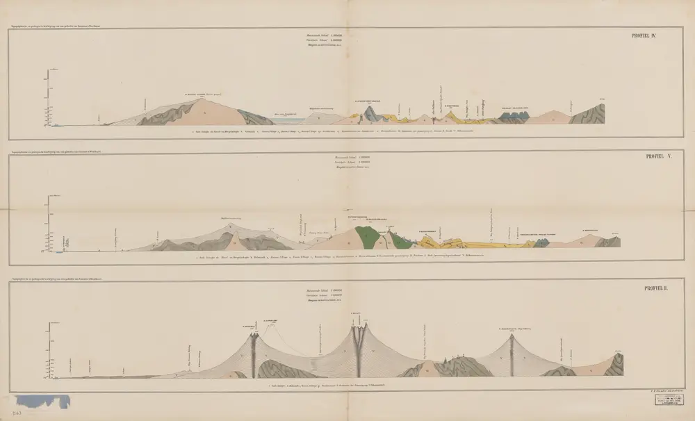
[Profielen Sumatra's Westkust]

Titolo completo:[Profielen Sumatra's Westkust]
Anno di illustrazione:1883
Editore:Amsterdam : C.F. Stemler
Dimensione fisica:20 x 30 cm
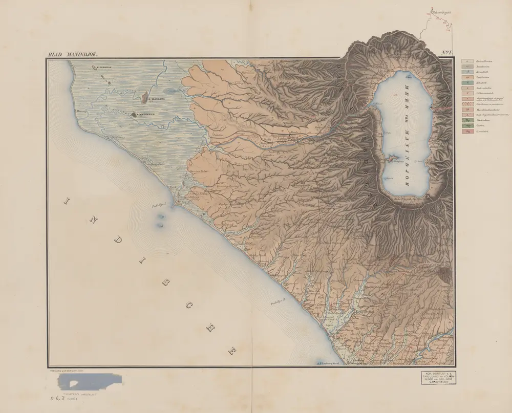
Blad Manindjoe / [opgenomen door de Mijningenieurs R.D.M. Verbeek, C.J. van Schelle, R. Fennema en D. de Jongh Hz. met medewerking van de Topografen Schliep, Axel, De Groot en Stremaijer en de Opzieners bij het Mijnwezen Nagel, Le Roij, Rolland, Neumann, De Corte, Faber en Bornemann ; onder leiding van den eerstaanwezend Mijningenieur R.D.M. Verbeek, in de jaren 1875-1879]
1883
[Amsterdam : C.F. Stemler]
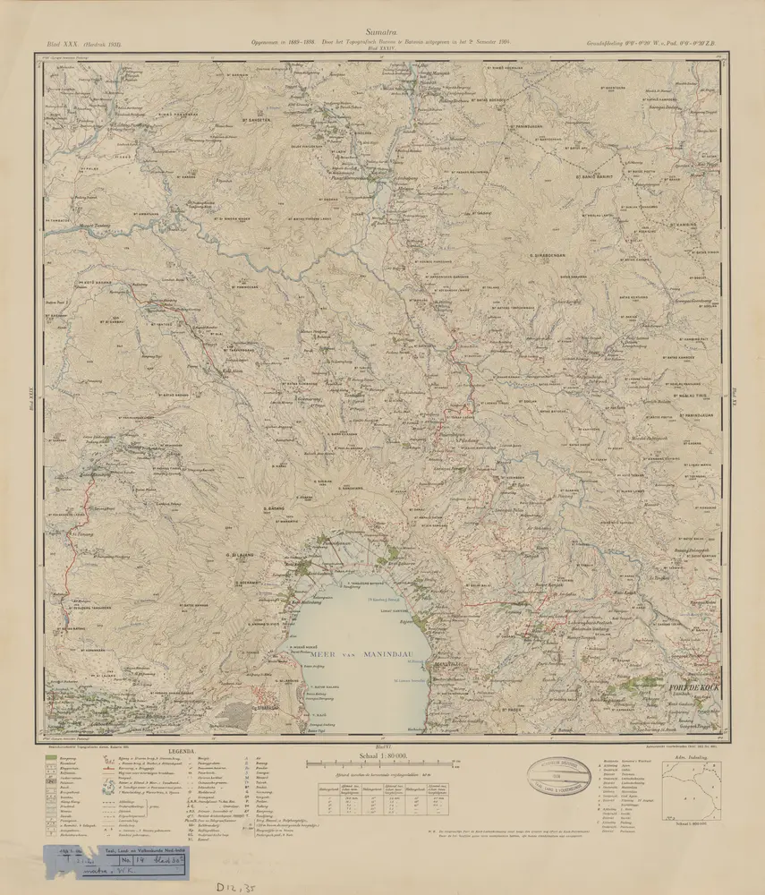
[Manindjau] : opgenomen in 1889-1898 / door het Topographisch Bureau te Batavia uitgegeven in het 2e semester 1904
1930
Topografische Dienst Batavia
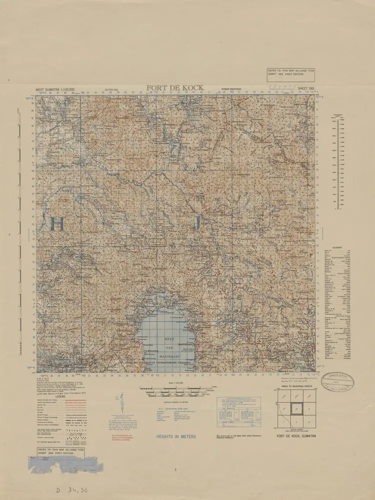
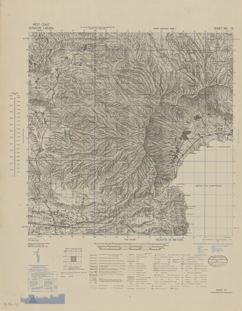
Fort de Kock / prepared under the direction of the Chief of Engineers U.S. Army by the Army Map Service, U.S. Army, 1943
1944
Army Map Service U.S. Army Washington
[Manindjau] : opgenomen in 1889-1898 / door het Topographisch Bureau te Batavia uitgegeven in het 2e semester 1904
1904
Topographisch Bureau Batavia
[Profielen Sumatra's Westkust]
1883
Amsterdam : C.F. Stemler
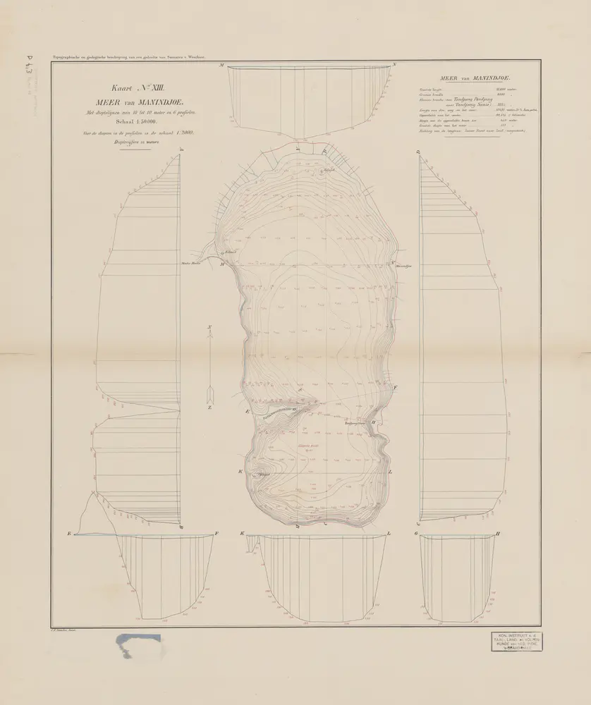
Meer van Manindjoe : met dieptelijnen van 10 tot 10 meter en 6 profielen
1883
Amsterdam : C.F. Stemler
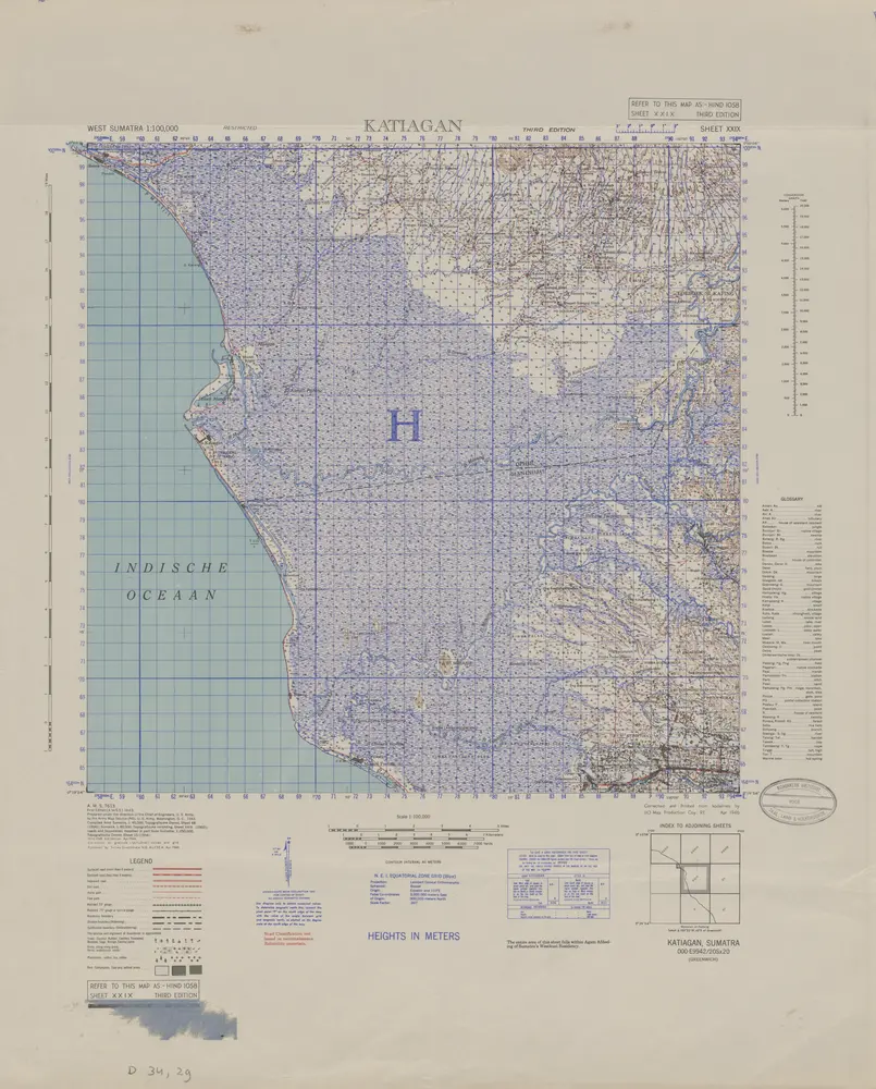
Katiagan / prepared under the direction of the Chief of Engineers U.S. Army by the Army Map Service, U.S. Army, 1943
1944
Army Map Service U.S. Army Washington
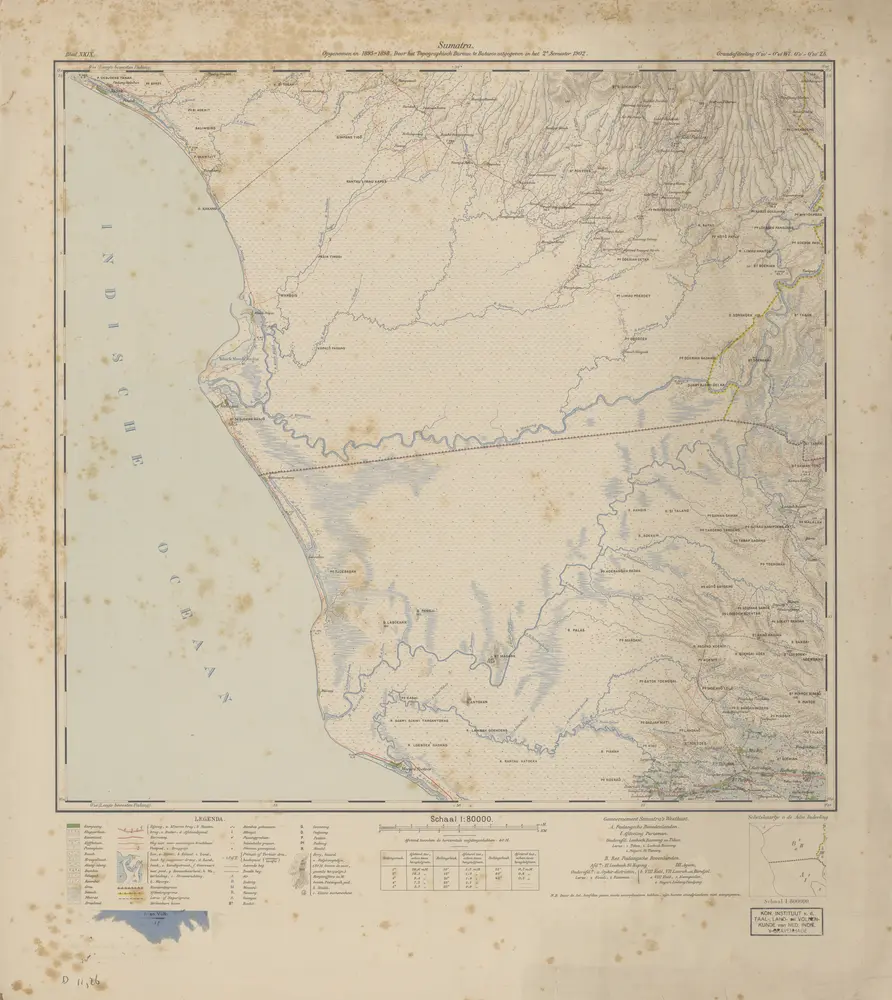
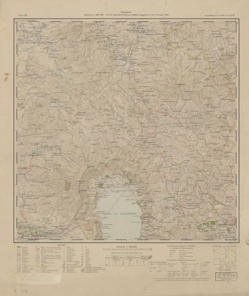
[Moearo Poetoes] : opgenomen in 1895-1898 / door het Topographisch Bureau te Batavia uitgegeven in het 2e semester 1902
1902
Topographisch Bureau Batavia
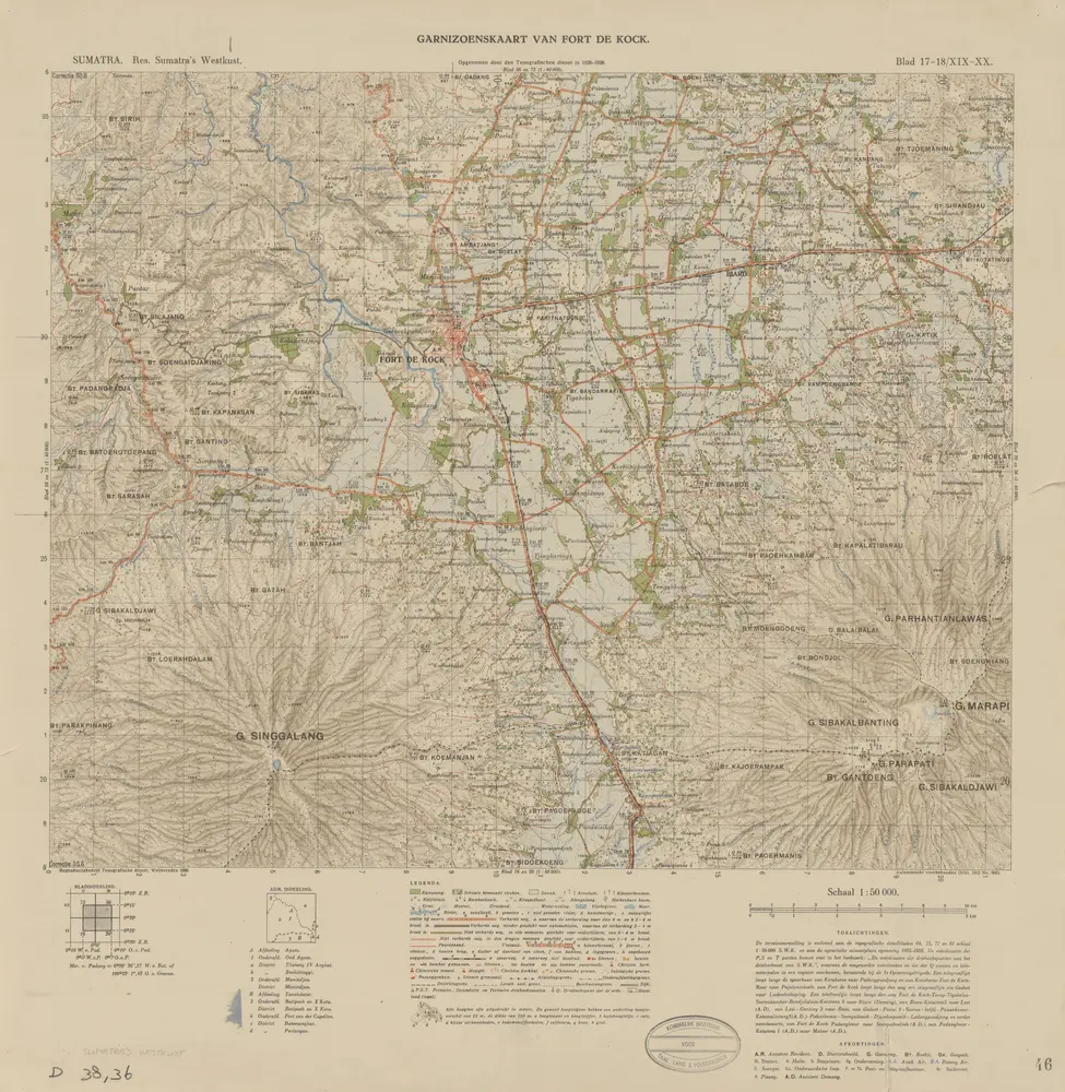
Garnizoenskaart van Fort De Kock / opgenomen door den Topografischen Dienst in 1926-1928
1930
Topografische Dienst Weltevreden (Batavia)
[Kota Ketjil] / prepared under the direction of the Chief of Engineers, U.S. Army, 1943
1943
Army Map Service U.S. Army Washington D.C.