Cataloged map
[Bandjarnegeri] / opgenomen in 1908-1911 [door den Topographischen Dienst]


Full title:[Bandjarnegeri] / opgenomen in 1908-1911 [door den Topographischen Dienst]
Depicted:1914
Publisher:Batavia : Topographische Inrichting
Physical Size:20 x 30 cm
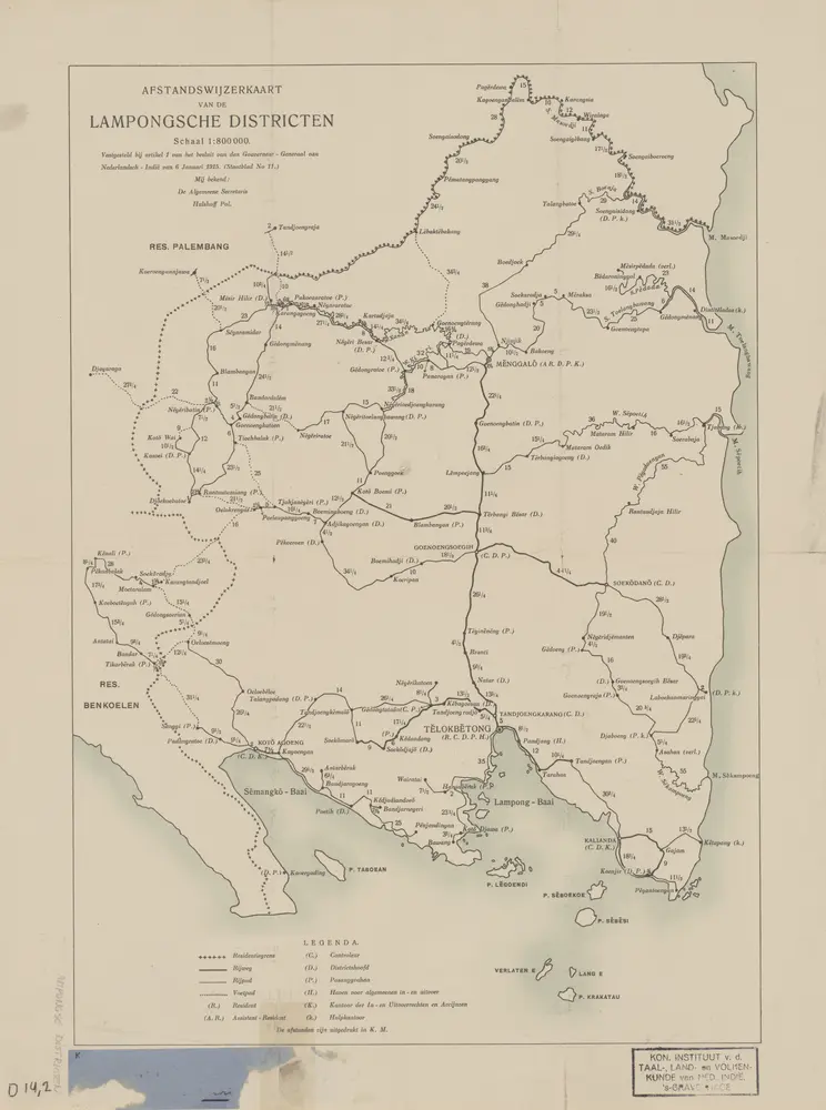
Afstandswijzerkaart van de Lampongsche Districten : vastgesteld bij artikel 1 van het besluit van den Gouverneur-Generaal van Nederlandsch-Indie van 6 januari 1915 (Staatsblad no.11)
1915
[S.l. : s.n.]
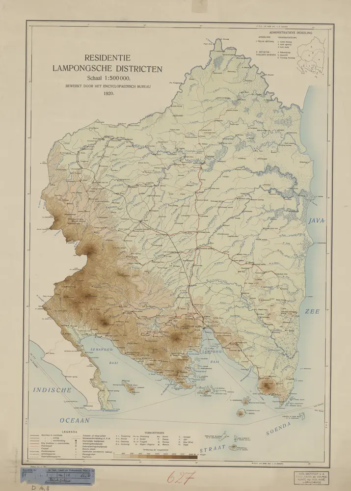
Residentie Lampongse Districten / bewerkt door het Encyclopaedisch Bureau
1920
Encyclopaedisch Bureau Batavia
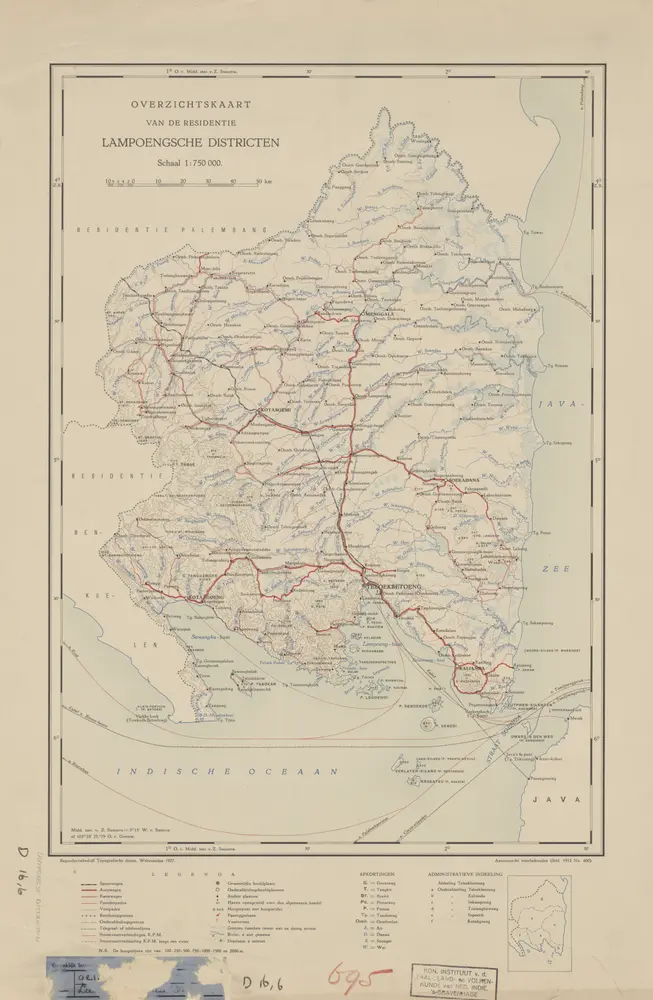
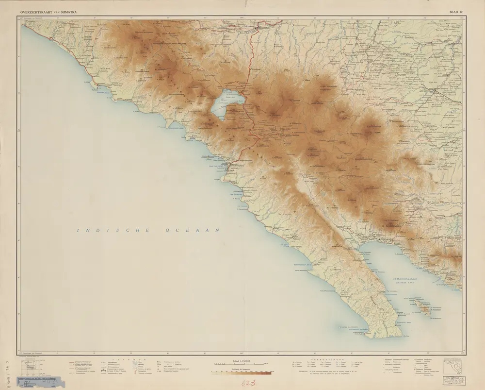
Overzichtskaart van de Residentie Lampoengsche Districten / Topografische Dienst
1927
Topografische Dienst Weltevreden
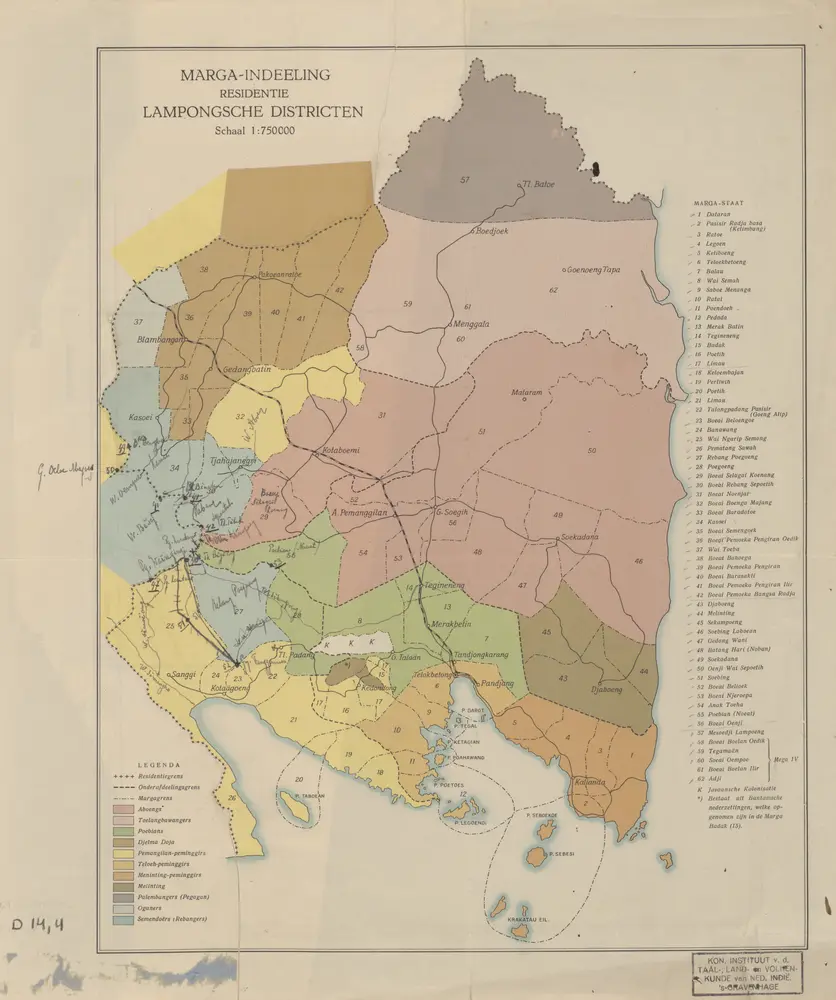
Marga-indeeling Residentie Lampongsche Districten
1910
[S.l. : s.n.]
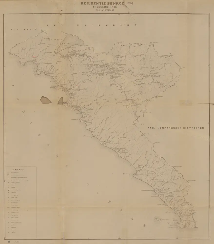
Atlas behoorende bij het eindverslag over het Geologisch-Mijnbouwkundig Onderzoek in de Residentie Benkoelen
1925
[S.l. : s.n.]
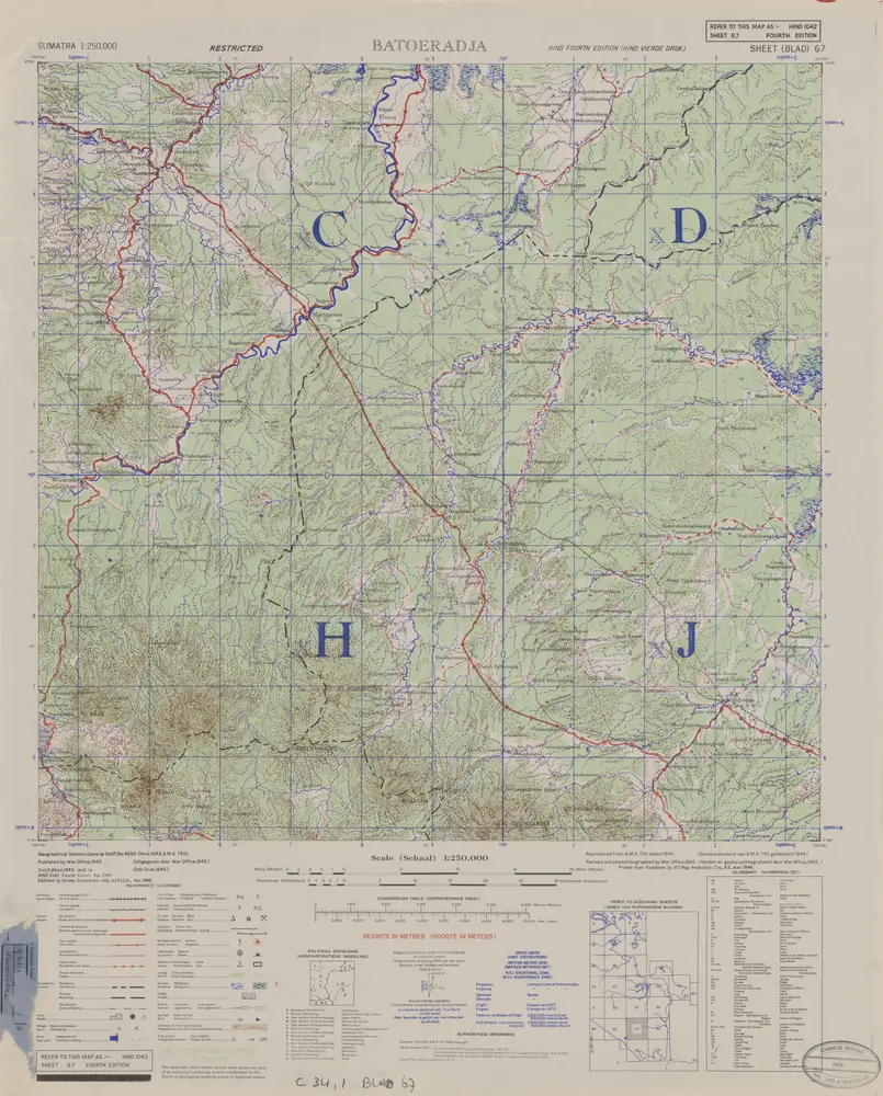
Batoeradja / published by War Office = uitgegeven door War Office ; revised and photolithographed by War Office
1946
War Office Washington D.C.
[Ranau-Meer]
1924
Topografische Dienst Batavia
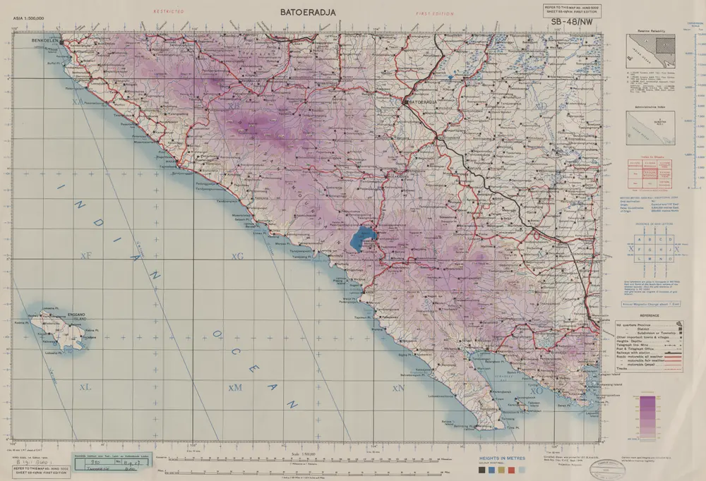
Batoeradja / Survey of India
1944
Survey of India
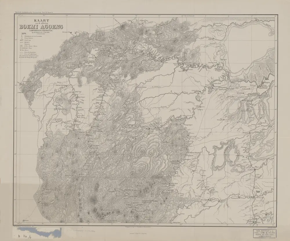
Kaart van de afdeeling Boemi Agoeng (Lampongsche Districten) / [overgenomen van een algemeene kaart der Lampongs van] B. Vitzthum von Eckstaedt del. ; J. Postma lith
1877
Aardrijkskundig Genootschap Amsterdam
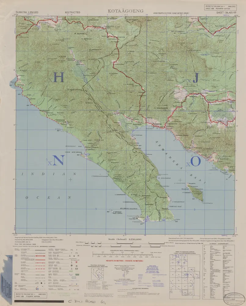
Kota-Agoeng / published by War Office = uitgegeven door War Office ; revised and photolithographed by War Office
1946
War Office Washington D.C.