Maps of Sumatera Barat

[Taikako] / vluchtig opgenomen door den Topografischen Dienst in 1934
Topografische Dienst Batavia Batavia : Reproductiebedrijf Topografische Dienst
Matobe / prepared under the direction of the Chief of Engineers U.S. Army by the Army Map Service
Army Map Service U.S. Army Washington D.C. Washington D.C. : Army Map Service
[Zuid-Pagai]
Topografische Dienst Batavia Batavia : Reproductiebedrijf Topografische Dienst
Schetskaart der Mentawei-Eilanden : West Sumatra / door J.B. Neumann ; C. Craandijk del
Koninklijk Nederlandsch Aardrijkskundig Genootschap Amsterdam Leiden : Boekhandel en drukkerij voorheen E.J. Brill
Moekomoeko / Survey of India
Survey of India [S.l.] : Survey of India
Res[identie] Sumatra's Westkust / Topografische Dienst, Batavia
[S.l. : s.n.]
Residentie Sumatra's Westkust / bewerkt door het Encyclopaedisch Bureau
Encyclopaedisch Bureau Batavia [Batavia] : Encyclopaedisch Bureau
Padang / samengesteld en gedrukt bij den Topografischen Dienst
Topografische Dienst Batavia Batavia : Topografische Dienst
Padang / Survey of India
Survey of India [S.l.] : Survey of India
Bladwijzer van Midden Sumatra : 1:40.000
[S.l. : s.n.]
Bladwijzer van West Sumatra
[S.l. : s.n.]
Geologische overzichtskaart van den Nederlandsch Oost-Indischen Archipel : Tapanoeli, Sumatra's Oostkust, Sumatra's Westkust / bewerkt door J. Zwierzycki
Batavia : Landsdrukkerij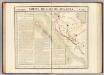
Partie, Sumatra. Oceanique no. 18.
1 : 1641836 Vandermaelen, Philippe, 1795-1869
Wegenkaart Zuid-Sumatra

Automobielkaart van Sumatra / Koninklijke Nederlandsch-Indische Motor Club, Semarang
Koninklijke Nederlandsch-Indische Motor Club Semarang Semarang : Koninklijke Nederlandsch-Indische Motor Club
Automobielkaart van Zuid-Sumatra / samengesteld en uitgegeven door de Koninklijke Vereeniging Java Motor Club
Koninklijke Vereeniging Java Motor Club Semarang Semarang : Koninklijke Vereeniging Java Motorclub
Overzichtskaartje Midden-Sumatra / Top[ografische] D[ienst]
Topografische Dienst Weltevreden (Batavia) Welt[evreden] (Batavia) : Repr[oductie] Bedr[ijf] Top[ografische] D[ienst]
Zuid-Sumatra

Figuratieve schets van het Gouvernement Sumatra's Westkust tot 1830 / door H. de S.

To Captain Samuel Ashmore, in acknowledgement of much valuable information given, elucidative of oriental navigation, and of the western coast of Sumatra in particular
1 : 1800000 this chart is inscribed by James Horsburgh engraved by J. & C. Walker [London] : J. Horsburgh
Overzichtskaart van het eiland Sumatra : met aanduiding van de politieke indeeling, de organisatie van het bestuur, de bestaande en nog aan te leggen verkeerswegen, de groote cultuur- en industrieele centra en van de vindplaatsen van mineralen / samengest. op last van de N.I. Regeering [door de Topographische Inrichting]
Topographische Inrichting Batavia Batavia : Topographische Inrichting
Economische overzichtskaart van het eiland Sumatra / samengesteld bij den Topografischen Dienst
Topografische Dienst, Nederlandsch-Indië Batavia : Top. Inr. Bat.
Overzichtskaart aangevende de ligging der erfpachtsperceelen en landbouwconcessies op Sumatra / vervaardigd aan het Hoofdbureau van het Kadaster te Batavia
Hoofdbureau van het Kadaster Batavia Batavia : Hoofdbureau van het Kadaster
Verkeers- en overzichtskaart van het eiland Sumatra / samengesteld door E. Franssen Herderschee, Referendaris 1ste Kl[asse] opname S.S. ten behoeve der Commissie voor de Welvaartspolitiek
Topografische Dienst Weltevreden (Batavia) Weltevreden (Batavia) : Reproductiebedrijf Topografische Dienst
Overzichtskaart van het eiland Sumatra / Topografische Dienst
Topografische Dienst Weltevreden Weltevreden : Reproductiebedrijf Topografische Dienst
Kaart van het eiland Sumatra
In steen gegrav. d. D. Heyse, te 's Hage ; gedrukt bij P.W.M. Trap, te Leyden te 's Hage : uitgave van K. Fuhri
Overzichtskaart van het Eiland Sumatra : uitgave 1941 / Topografische Dienst
Topografische Dienst Batavia Batavia : Reproductiebedrijf Topografische Dienst
![[Taikako] / vluchtig opgenomen door den Topografischen Dienst in 1934](https://images-2.georeferencer.com/images/iiif/986891193124/full/,300/0/native.jpg)

