Cataloged map
Soengai Lansat / prepared under the direction of the Chief of Engineers U.S. Army by the Army Map Service, U.S. Army, 1943
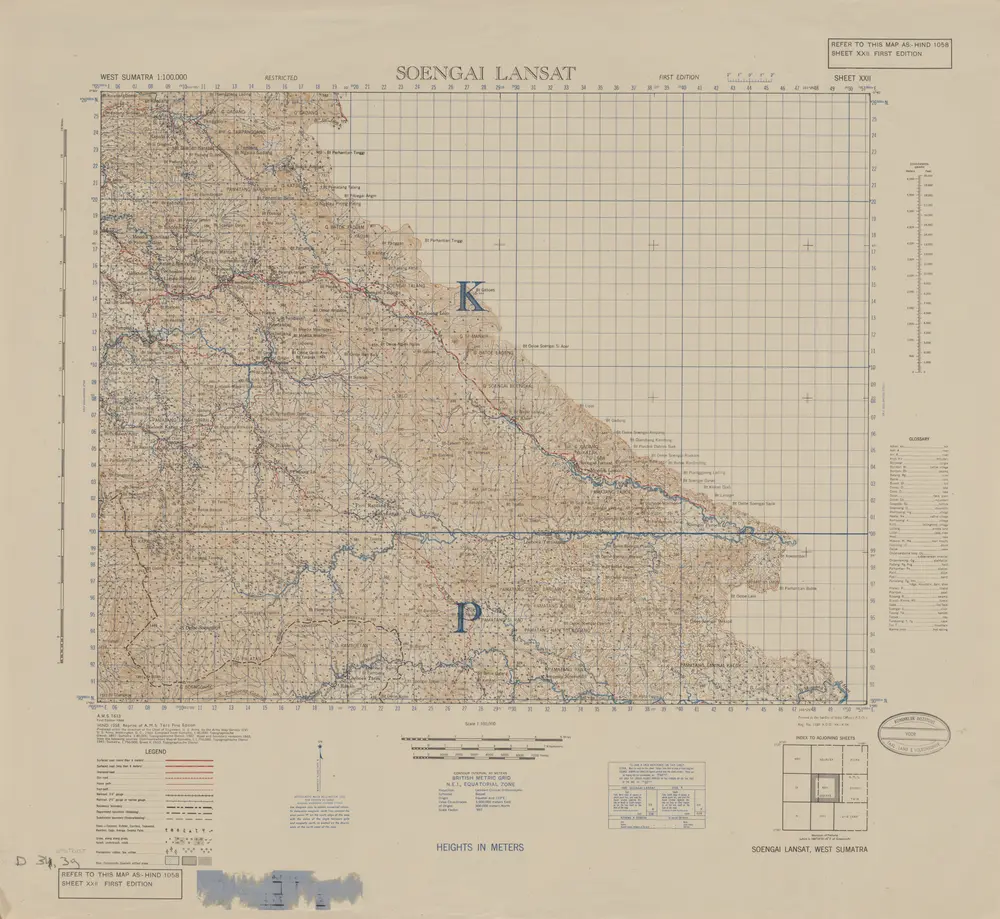

Full title:Soengai Lansat / prepared under the direction of the Chief of Engineers U.S. Army by the Army Map Service, U.S. Army, 1943
Depicted:1944
Publisher:[S.l.] : Survey of India Offices (P.Z.O.)
Physical Size:20 x 30 cm
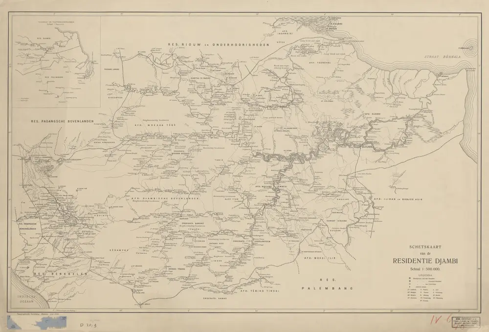
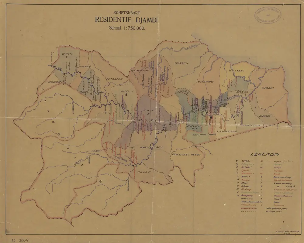
Schetskaart van de Residentie Djambi / Topographische Inrichting
1906
Topographische Inrichting Batavia
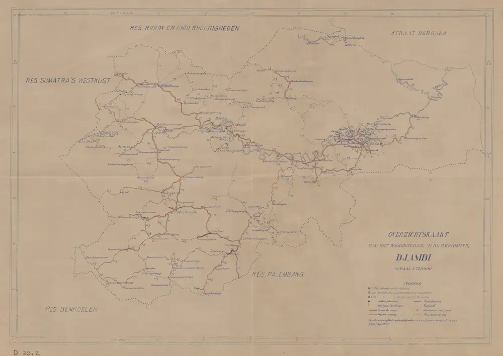
Overzichtskaart van het wegenstelsel in de Residentie Djambi
1930
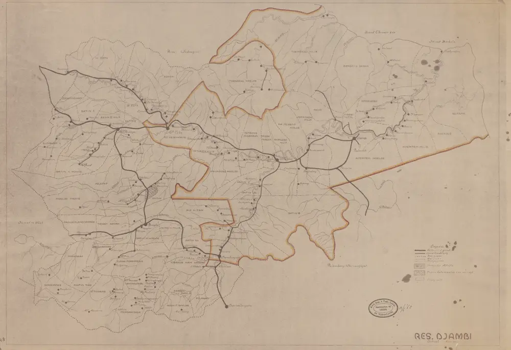
Res[identie] Djambi
1930
[S.l. : s.n.]
Schetskaart Residentie Djambi / gewerkt door den Opn[emer] B[innenlandsch] B[estuur] Daris
1930
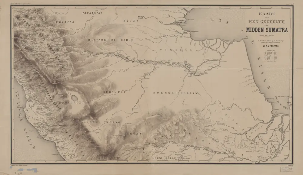
Kaart van een gedeelte van Midden-Sumatra / J. Postma, lith[ograaf]
1879
Aardrijkskundig Genootschap Amsterdam
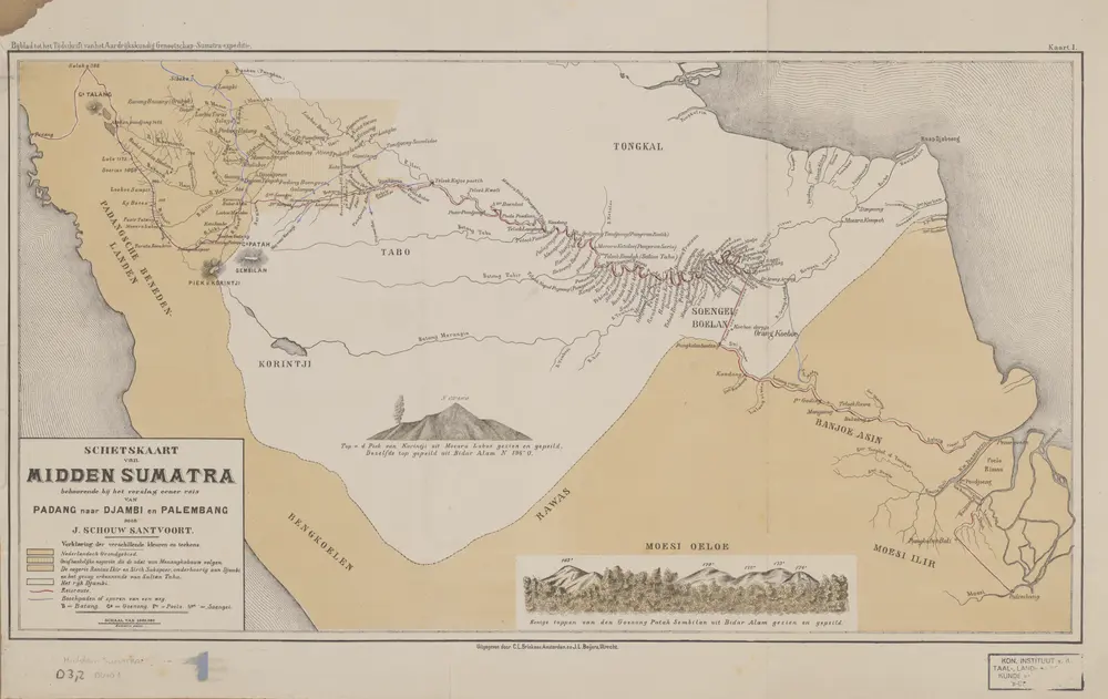
Schetskaart van Midden Sumatra : behoorende bij een verslag eener reis van Padang naar Djambi en Palembang / door J. Schouw Santvoort
1879
Aardrijkskundig Genootschap Amsterdam
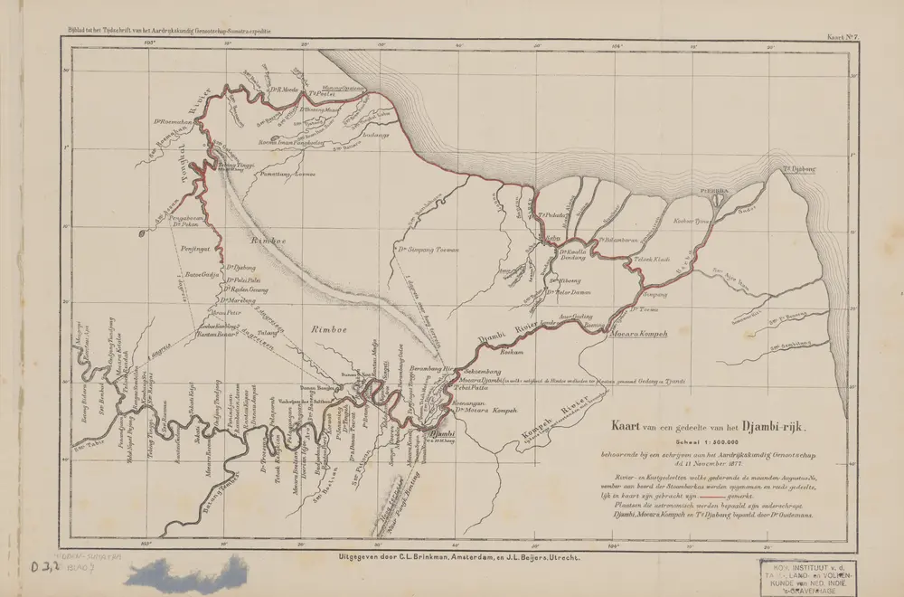
Kaart van een gedeelte van het Djambi-Rijk
1879
Aardrijkskundig Genootschap Amsterdam
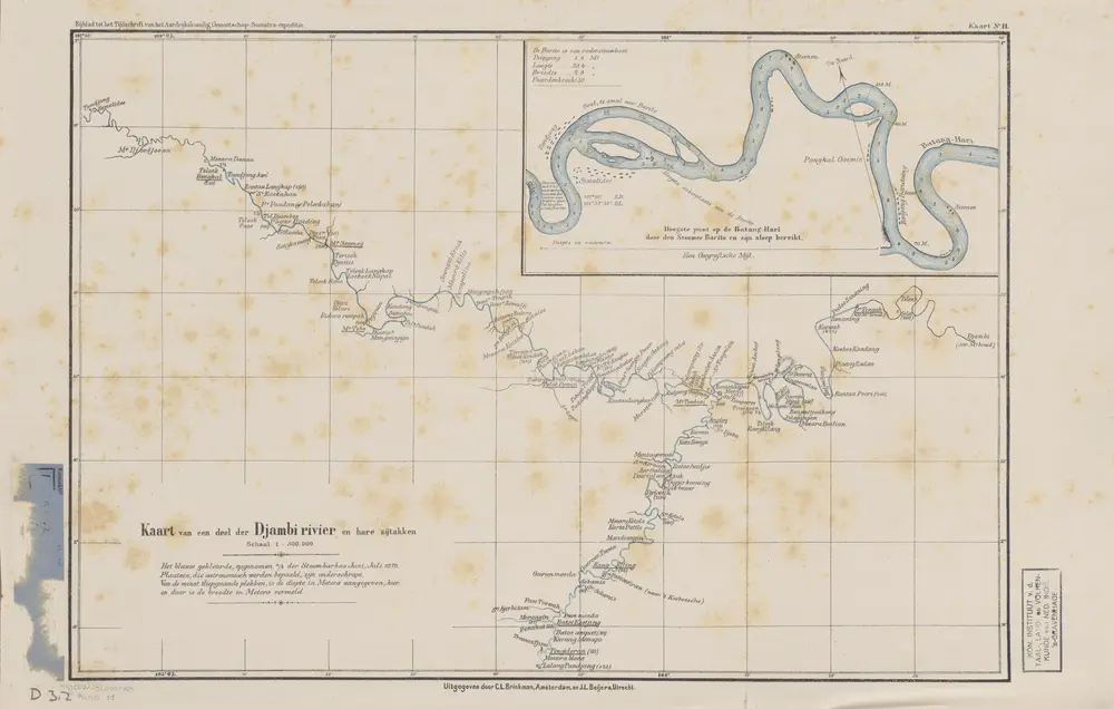
Kaart van een deel der Djambi Rivier en hare zijtakken
1879
Aardrijkskundig Genootschap Amsterdam
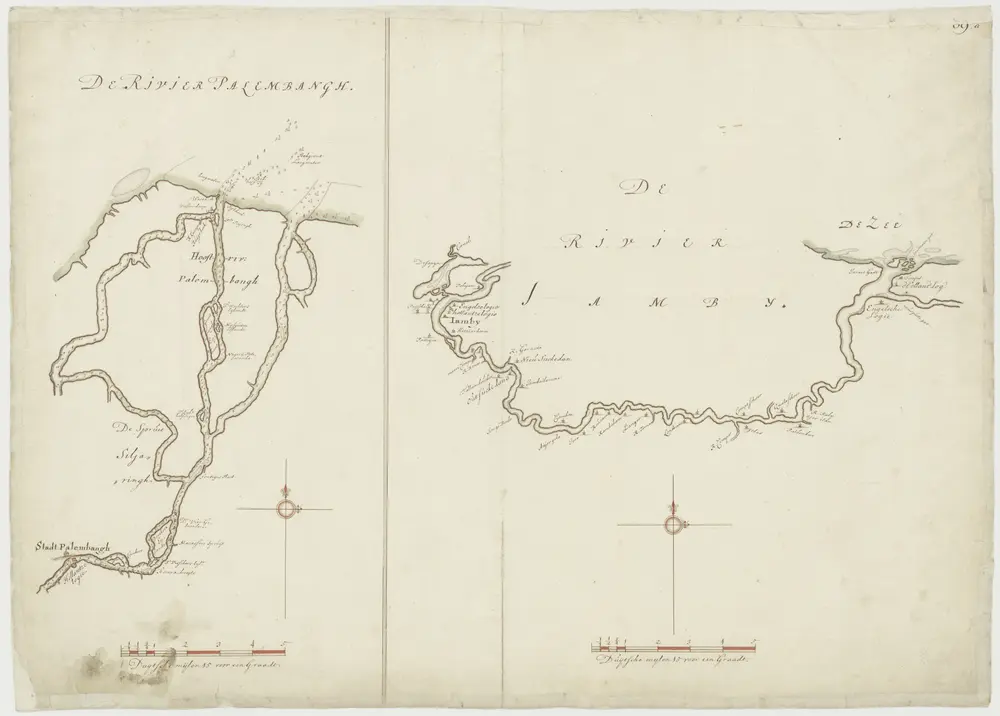
Kaart van de rivieren van Jamby en Palembang
1700
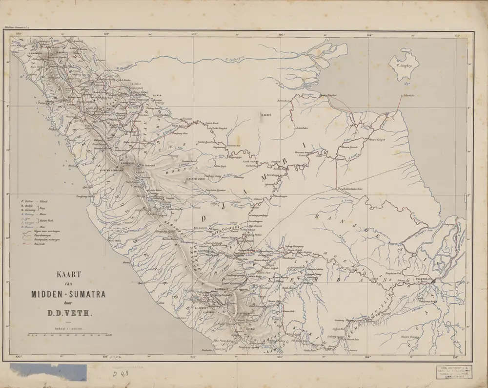
Kaart van Midden Sumatra / door D.D. Veth
1882
Aardrijkskundig Genootschap Amsterdam