Maps of Limapuluh Koto Regency

Koto Baharoe / prepared under the direction of the Chief of Engineers U.S. Army [by the Army Map Service, U.S. Army], 1943
Army Map Service U.S. Army Washington [S.l.] : Survey of India Offices (P.Z.O.)
[Kota Baharoe] : opgenomen in 1894-1897 / door het Topographisch Bureau te Batavia uitgegeven in het 1e semester 1900
Topographisch Bureau Batavia Batavia : Topographisch Bureau
[Koeak] / opgenomen door den Topografischen Dienst in 1926-1929
Topografische Dienst Batavia Batavia : Reproductiebedrijf Topografische Dienst
Loeboeksikaping / published by War Office = uitgegeven door War Office ; revised and photolithographed by War Office
War Office Washington D.C. [Washington D.C.] : War Office
Blad Paja Koemboeh / opgenomen door den Mijn Ingenieur R.D.M. Verbeek met medewerking van den Topograaf De Groot en de Opzieners bij het Mijnwezen Naumann en De Corte, 1880
Amsterdam : C.F. Stemler
[Tandoen] / opgenomen door den Topografischen Dienst in 1926-1931
Topografische Dienst Batavia Batavia : Reproductiebedrijf Topografische Dienst
[Bangkinang] / opgenomen door den Topografischen Dienst in 1926-1928
Topografische Dienst Batavia Batavia : Reproductiebedrijf Topografische Dienst
Kaart van een gedeelte der Siak-Rivier
Nederlandsch Aardrijkskundig Genootschap Amsterdam Amsterdam : C.L. Brinkman
Bladwijzer der Topographische Kaart van Sumatra
[Batavia : Topographisch Bureau]
Pakanbaroe / Survey of India
Survey of India [S.l.] : Survey of India
Schetskaart van het stroomgebied der Indragiri-rivier en aangrenzende landstreken / Topographische Inrichting
Topographische Inrichting Batavia Batavia : Topographische Inrichting
Kaart tot afstandswijzer van het Gouvernement Sumatra's Westkust / Topographische Inrichting
Topographische Inrichting Batavia Batavia : Topographische Inrichting
[Recto], uit: De keur der Buitenbezittingen
titelvariant: Het Gouvernement van Sumatra's Westkust; Annotatie: Uit: Nederland en Insulinde : een school- en handelsatlas in 16 bladen ... / door F. Bruins. - 2e dr. - Groningen : Noordhoff, [1889] Groningen : Noordhoff
Bladwijzer der Topographische Kaart van de Padangsche Beneden- en Bovenlanden
Topographisch Bureau Batavia Batavia : Topographisch Bureau
[Pakanbaroe]
Topografische Dienst Batavia Batavia : Reproductiebedrijf Topografische Dienst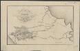
Figurative kaart van een gedeelte van Sumatra voornamelijk aantoonende de wegen en rivieren, welke uit de Padangsche binnenlanden naar de oostkust afloopen
1 : 1360000 opgenomen door S. Muller en H. Hellbach steendr. van H.J. Backer Amsterdam : Beyerinck
Het Minangkabausche land (Alam Minangkabau)
[S.l. : s.n.]
Gouvernement Sumatra's Westkust / Topographische Inrichting
Topographische Inrichting [Batavia] : Topographische Inrichting
Etappekaart Sumatra's W[es]t Kust

9. Gouvernement Sumatra's Westkust, uit: Atlas van Nederlandsch Oost-Indië / samengest. door Topographisch Bureau te Batavia van 1897-1904
Annotatie: Omgewerkte versie van: Atlas der Nederlandsche bezittingen in Oost-Indië / naar de nieuste bronnen samengest. door J.W. Stemfoort en J.J. ten Siethoff. - 's-Gravenhage : Topographische Inrichting, [ca. 1885] Topographisch Bureau, Batavia 's-Gravenhage : Topographische Inrichting
De autoweg Medan-Padang / bewerkt door het Encyclopaedisch Bureau
Encyclopaedisch Bureau Batavia [Batavia] : Encyclopaedisch Bureau
Overzichtskaart bij het reisverslag van Medan naar Padang en terug

Residentie Sumatra's Westkust / bewerkt door het Encyclopaedisch Bureau
Encyclopaedisch Bureau Batavia [Batavia] : Encyclopaedisch Bureau
Routekaart Medan - Pakanbaroe
[S.l. : s.n.
Routekaart Pakanbaroe - Batavia
[S.l. : s.n.
North Sumatra : Tactical Pilotage Chart
[London] : Ministry of Defence United Kingdom
Bladwijzer van Midden Sumatra : 1:40.000
[S.l. : s.n.]
Bladwijzer van West Sumatra
[S.l. : s.n.]
Bladwijzer van Oost-Sumatra : 1:100.000
[S.l. : s.n.]
![Koto Baharoe / prepared under the direction of the Chief of Engineers U.S. Army [by the Army Map Service, U.S. Army], 1943](https://images-2.georeferencer.com/images/iiif/788940891581/full/,300/0/native.jpg)

