Maps of Sumatra

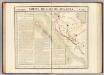
Bintoehan / [bew. door C.H. van Raalten]
Dienst van den Mijnbouw in Nederlandsch-Indië Batavia [Batavia] : Dienst van den Mijnbouw in Nederlandsch-Indië
Bintoehan / verkend in 1893-1894 door het Topographisch Bureau en uitgegeven in het 1e semester 1895
Topographisch Bureau Batavia Batavia : Topographisch Bureau
[Tjoekoe Pandan] / opgenomen door den Topografischen Dienst in 1912-1924
Topografische Inrichting Batavia Batavia : Topografische Inrichting
[P[oelau] Pisang] / opgenomen in 1912-1913 [door den Topographischen Dienst]
Topographische Inrichting Batavia Batavia : Topographische Inrichting
Bintoehan / published by War Office = uitgegeven door War Office ; revised and photolithographed by War Office
War Office Washington D.C. [Washington D.C.] : War Office
[Ranau-Meer]
Topografische Dienst Batavia Batavia : Reproductiebedrijf Topografische Dienst
Kaart van de voornaamste wegen in het zuidelijk deel der Residentie Palembang
Aardrijkskundig Genootschap Amsterdam Amsterdam : C.L. Brinkman
Atlas behoorende bij het eindverslag over het Geologisch-Mijnbouwkundig Onderzoek in de Residentie Benkoelen
[S.l. : s.n.]
Atlas behoorende bij het eindverslag over het Geologisch-Mijnbouwkundig Onderzoek in de Residentie Benkoelen
[S.l. : s.n.]
Batoeradja / Survey of India
Survey of India [S.l.] : Survey of India
Woongebied van den Besemahschen stam

Woongebied van den Besemahschen stam

[Schetskaart van de Residentie Palembang]

Residentie Benkoelen / bewerkt door het Encyclopaedisch Bureau naar gegevens van den Top[ografischen] Dienst en de Marine
Encyclopaedisch Bureau Batavia [Batavia : Javasche Boekhandel & Drukkerij]
[Kaart van Zuid-Sumatra]

[Kaart van Zuid-Sumatra]

Zuid-Sumatra / Voorlichtingsdienst van het Algemeen Landbouw Syndicaat
Voorlichtingsdienst van het Algemeen Landbouw Syndicaat [S.l.] : Voorlichtingsdienst van het Algemeen Landbouw Syndicaat
Kaart aangevende de administratieve indeeling van de residentie Benkoelen
[S.l. : s.n.]
Plan tot den aanleg van spoorwegen in Zuid-Sumatra : overzichtskaart
Ministerie van Koloniën [Den Haag] : [Departement van Koloniën]
Batavia / Survey of India
Survey of India [S.l.] : Survey of India
Batavia / Topografische Inrichting
Topografische Dienst Batavia Batavia : Topografische Inrichting
Sumatra : 1:100.000
[S.l. : s.n.]
Stroomgebieden der Moesi en regenval
[S.l. : s.n.]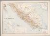
8. Zuid-Sumatra, uit: Atlas van Nederlandsch Oost-Indië / samengest. door Topographisch Bureau te Batavia van 1897-1904
Annotatie: Omgewerkte versie van: Atlas der Nederlandsche bezittingen in Oost-Indië / naar de nieuste bronnen samengest. door J.W. Stemfoort en J.J. ten Siethoff. - 's-Gravenhage : Topographische Inrichting, [ca. 1885] Topographisch Bureau, Batavia 's-Gravenhage : Topographische Inrichting
Kaart van Zuid Sumatra : Residentiën Benkoelen, Lampongsche Distrikten en Palembang / [J.W. Stemfoort en J.J. ten Siethoff ; gereproduceerd op last van het Departement van Koloniën, aan de Topographische Inrichting te 's-Gravenhage, onder leiding van den Directeur C.A. Eckstein]
Ministerie van Koloniën Den Haag s-Gravenhage : Departement van Koloniën
Zuid-Sumatra
Partie, Sumatra. Oceanique no. 18.
1 : 1641836 Vandermaelen, Philippe, 1795-1869
Wegenkaart Zuid-Sumatra

Automobielkaart van Sumatra / Koninklijke Nederlandsch-Indische Motor Club, Semarang
Koninklijke Nederlandsch-Indische Motor Club Semarang Semarang : Koninklijke Nederlandsch-Indische Motor Club
![Bintoehan / [bew. door C.H. van Raalten]](https://images-2.georeferencer.com/images/iiif/611405456798/full/,300/0/native.jpg)

