编目地图
Sketch of a journey from Moco-Moco to Pengkatan Jambee : including a visit to the large lake in Korinchi / by J. Barnes, 1818
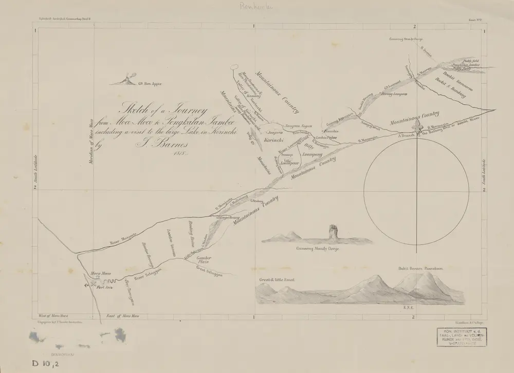

完整标题:Sketch of a journey from Moco-Moco to Pengkatan Jambee : including a visit to the large lake in Korinchi / by J. Barnes, 1818
描述:1879
出版商:Amsterdam : C.F. Stemler
物理尺寸:20 x 30 cm
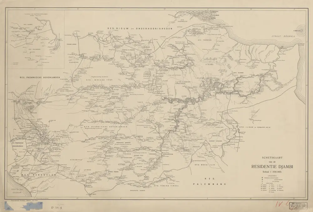
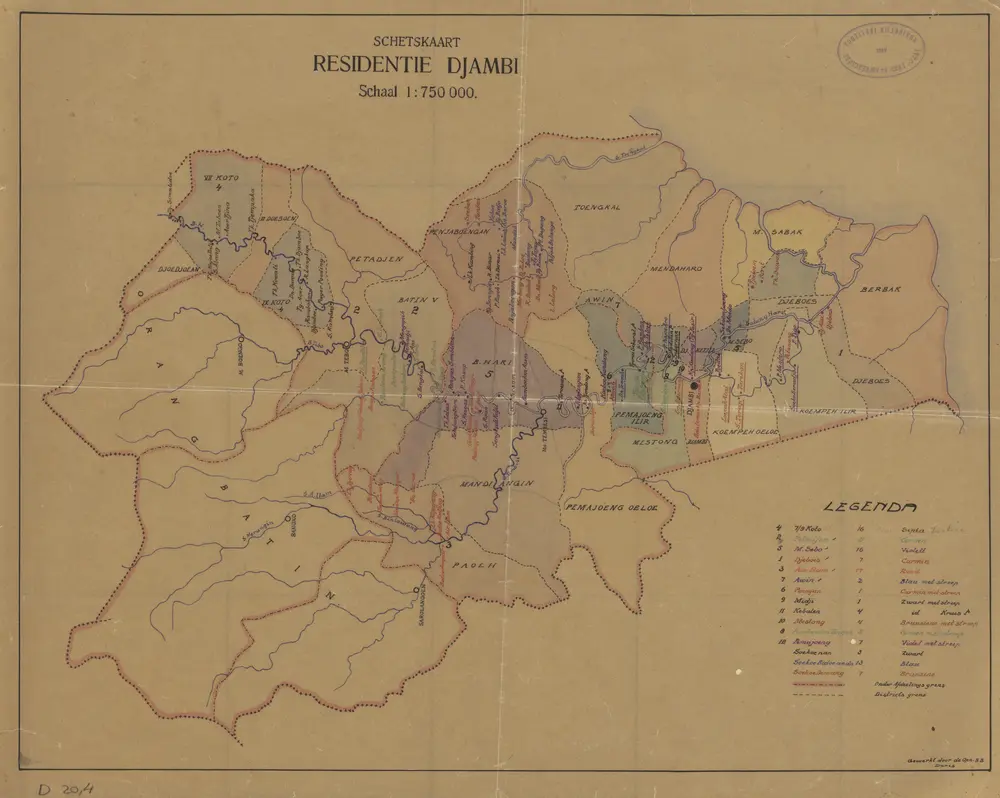
Schetskaart van de Residentie Djambi / Topographische Inrichting
1906
Topographische Inrichting Batavia
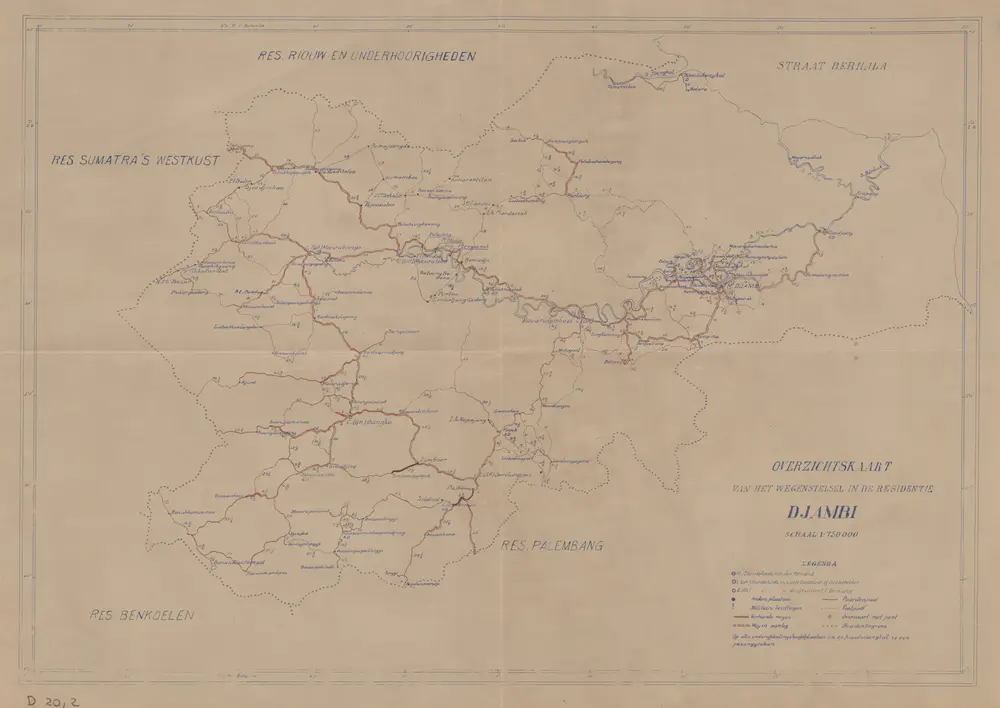
Overzichtskaart van het wegenstelsel in de Residentie Djambi
1930
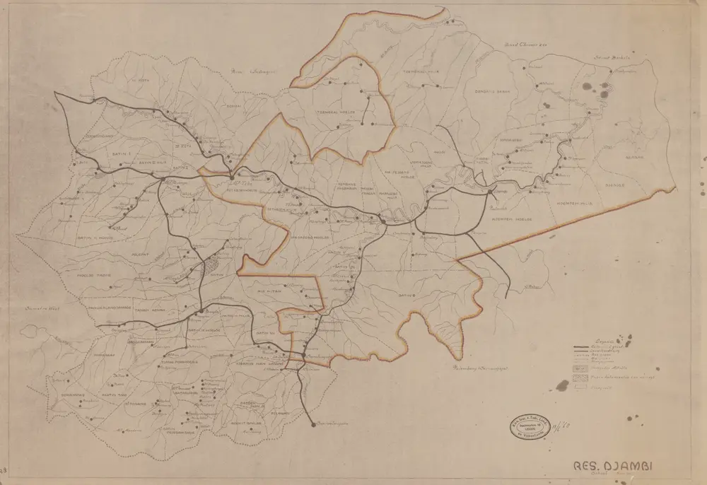
Res[identie] Djambi
1930
[S.l. : s.n.]
Schetskaart Residentie Djambi / gewerkt door den Opn[emer] B[innenlandsch] B[estuur] Daris
1930
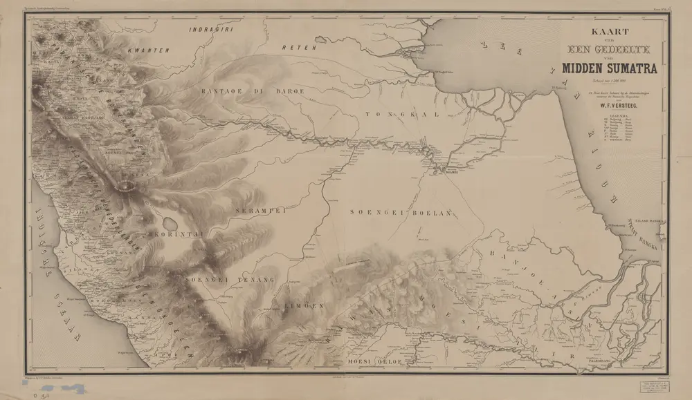
Kaart van een gedeelte van Midden-Sumatra / J. Postma, lith[ograaf]
1879
Aardrijkskundig Genootschap Amsterdam
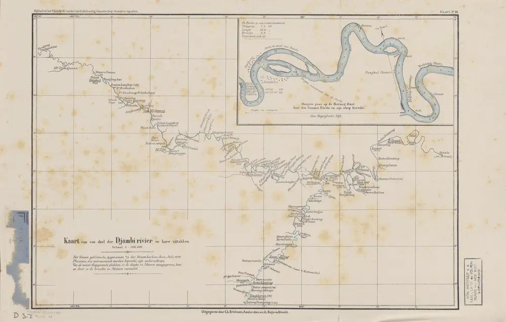
Kaart van een deel der Djambi Rivier en hare zijtakken
1879
Aardrijkskundig Genootschap Amsterdam
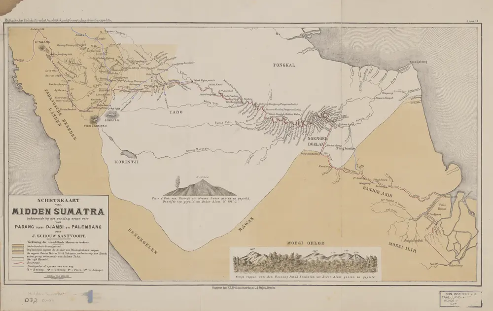
Schetskaart van Midden Sumatra : behoorende bij een verslag eener reis van Padang naar Djambi en Palembang / door J. Schouw Santvoort
1879
Aardrijkskundig Genootschap Amsterdam
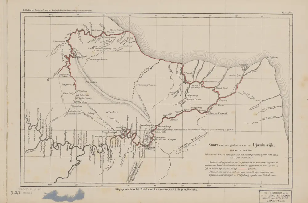
Kaart van een gedeelte van het Djambi-Rijk
1879
Aardrijkskundig Genootschap Amsterdam
[Bangko]
1940
Topografische Dienst Batavia
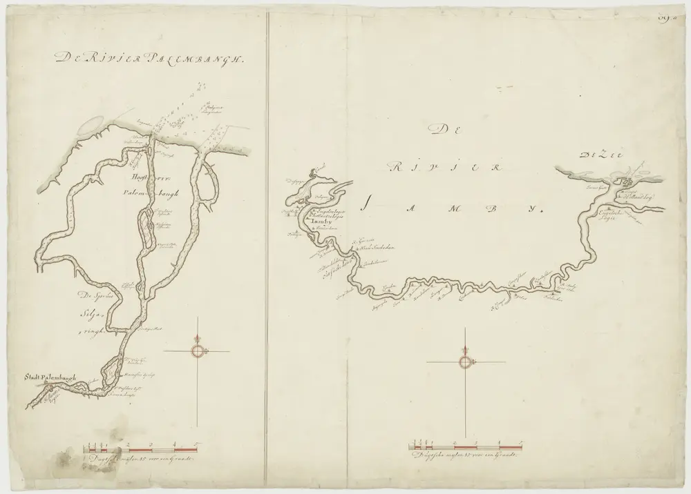
Kaart van de rivieren van Jamby en Palembang
1700