Maps of Sulawesi Utara

Kawio Islands / Corps of Engineers, War Department
War Department Washington D.C. . Corps of Engineers U.S. Army [Washington D.C.] : War Department
Schetskaart van de Sangi- en Talaud Eilanden / E[ncyclopaedisch] B[ureau]
Encyclopaedisch Bureau Batavia ['s-Gravenhage : N.V. Electrische Drukkerij 'Luctor et Emergo']
Schetskaart van de Sangi- en Talaud Eilanden / samengesteld bij het E[ncyclopaedisch] B[ureau] der Afdeeling Bestuurszaken der Buitenbezittingen van het Departement van Binnenlandsch-Bestuur
Encyclopaedisch Bureau Batavia ['s-Gravenhage : N.V. Electrische Drukkerij 'Luctor et Emergo']
Tahoena / Survey of India
Survey of India [S.l.] : Survey of India
Sangir- en Talaud
[S.l. : s.n.]
South Mindanao / Topografische Dienst
Topografische Dienst Batavia Batavia : Reproductiebedrijf Topografische Dienst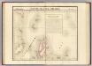
Partie, l'Ile Gilolo. Oceanique no. 15.
1 : 1641836 Vandermaelen, Philippe, 1795-1869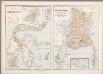
14. Kaart van Celebes, Kaart van Zuid-West-Celebes, uit: Atlas van Nederlandsch Oost-Indië / samengest. door Topographisch Bureau te Batavia van 1897-1904
Annotatie: Omgewerkte versie van: Atlas der Nederlandsche bezittingen in Oost-Indië / naar de nieuste bronnen samengest. door J.W. Stemfoort en J.J. ten Siethoff. - 's-Gravenhage : Topographische Inrichting, [ca. 1885] Topographisch Bureau, Batavia 's-Gravenhage : Topographische Inrichting
Kaart van het eiland Celebes
D. Heyse lith. te 's Hage ; steendr. v. P. Blommers te 's Hage te 's Hage : uitgave van K. Fuhri
Algemeene schetskaart van Nederlandsch-Indië : Gouv[ernement] Groote Oost, Res[identie] Manado / Topografische Dienst, Batavia
[S.l. : s.n.]
REDUZIRTE-KARTE VON DEN PHILIPPINEN und den SULU INSELN
1 : 2400000 Filipíny Berghaus, Heinrich Karl Wilhelm Aragon, Ildefonso de Justus Perthes
Reduzirte Karte von den Philippinen und den Sulu-Inseln
1 : 2356000 den Manen Don Alexandro ́s Malaspina, Espinosa y Tello's, [...] Don Ildefonso de Aragon gewidmet vom Verfasser [H. Berghaus] gest. v. Selmar Siebert Gotha : Perthes
127. Philippines. The World Atlas.
1 : 5000000 USSR (Union of Soviet Socialist Republics).
Carte des iles Moluques
1 : 3425000 par P. Melvill de Carnbee gravé par D. Heyse La Haye : lith de Ch. van Lier
No. 2. Mapa General.
1 : 6000000 U.S. Coast and Geodetic Survey
[Islas filipinas - distribution de temblores]
Atlas de Filipinas Algué, P. José Government Printing Office
[Islas filipinas - estaciones meteorologico-seismicas]
Atlas de Filipinas Algué, P. José Government Printing Office
[Islas filipinas - mapa general]
Atlas de Filipinas Algué, P. José Government Printing Office
No. 3. Mapa Etnografico.
1 : 6000000 U.S. Coast and Geodetic Survey
No. 4. Mapa Orografico.
1 : 6000000 U.S. Coast and Geodetic Survey
Mapa de las Islas Filipinas : formado expresamente para "El Correo Espaÿûnol" / por el topografo D. José Mendez
Madrid : Mendez
[Islas filipinas - mapa orografico]
Atlas de Filipinas Algué, P. José Government Printing Office
[Islas filipinas - mapa etnografico]
Atlas de Filipinas Algué, P. José Government Printing Office
[Borneo, Celebes, Halmaheira, Ceram] / Top. Bureau v/d Gen. Staf
Topographisch Bureau Generale Staf Batavia Batavia : Top. Bureau v/d Gen. Staf
Archipiélago de Filipinas: regalo a los Sres. suscriptores de la Crónica de la guerra de Cuba y de la rebelión de las Filipinas, Año 1896 / Passo
1 mapa. Casa Editorial Maucci, Asalto 8, Barcelona. Passo Casa Editorial Maucci
No. 5. Estaciones Meteorologico-Seismicas.
1 : 6000000 U.S. Coast and Geodetic Survey
No. 6. Distibucion de Temlores Signos.
1 : 6000000 U.S. Coast and Geodetic Survey
Islas Filipinas, 3a hoja / por el teniente coronel de ingenieros D. Francisco Coello ; las notas estadisticas e historicas han sido escritas por D. Pascual Madoz
1 : 1000000 1 full d'un mapa en tres fulls, b/n. Dins: Atlas de España y sus posesiones de ultramar Coello, Francisco ; Madoz, Pascual [Imprenta del Atlas de España]
Insula Borneo in Indonesia : Præfectura Apostolica Bornæi Hollandici : anno 1905 erecta eiusque regiones vicinæ et dismembrationes ecclesiasticæ
1 : 16500000 titelvariant: Præfectura Apostolica Bornæi Hollandici [S.l. : Vicario Apostolico de Pontianak]


