Maps of North Sumatra

[Kotapinang-Baroe] : opgenomen door den Topografischen Dienst in 1924-1926
Topografische Dienst Weltevreden (Batavia) Weltevreden (Batavia) : Reproductiebedrijf Topografische Dienst
Schetskaart van het Zelfbesturend Landschap Kota Pinang : behoorende tot de Afd[eeling] Asahan der Res[identie] O[ost] K[ust] van Sumatra
Encyclopaedisch Bureau Batavia [Batavia] : Encyclopaedisch Bureau
Schetskaart van Kota-Pinang

Kotatengah / published by War Office = uitgegeven door War Office ; revised and photolithographed by War Office
War Office Washington D.C. [Washington D.C.] : War Office
Schetskaart [van] Laboehan Batoe

Rantau Prapat en omgeving
Batavia : [s.n.]
Kaart van Laboean Batoe / samengesteld door de Deli Automobiel Club
Deli Automobiel Club Medan [Medan] : Deli Automobiel Club
[T[or] Si Kara-Kara] : opgenomen in 1904-1905 / Topographische Inrichting, Batavia 1908
Topographische Inrichting Batavia Batavia : Topographische Inrichting
Figuratieve schets van het stroomgebied der Bila en Pane : naar de kaart, door het Topographisch Bureau uitgegeven
Nederlandsch Aardrijkskundig Genootschap Amsterdam [Amsterdam : C.L. Brinkman]
Pakanbaroe / Survey of India
Survey of India [S.l.] : Survey of India
Kaart van de cultuurondernemingen in het Gouvernement Oostkust van Sumatra / bewerkt door het Encyclopaedisch Bureau
Encyclopaedisch Bureau Batavia [Batavia] : Encyclopaedisch Bureau
Bladwijzer van Noord Sumatra : schaal 1:100.000
[S.l. : s.n.]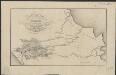
Figurative kaart van een gedeelte van Sumatra voornamelijk aantoonende de wegen en rivieren, welke uit de Padangsche binnenlanden naar de oostkust afloopen
1 : 1360000 opgenomen door S. Muller en H. Hellbach steendr. van H.J. Backer Amsterdam : Beyerinck
Gouvernement Sumatra's Westkust / Topographische Inrichting
Topographische Inrichting [Batavia] : Topographische Inrichting
Etappekaart Sumatra's W[es]t Kust

9. Gouvernement Sumatra's Westkust, uit: Atlas van Nederlandsch Oost-Indië / samengest. door Topographisch Bureau te Batavia van 1897-1904
Annotatie: Omgewerkte versie van: Atlas der Nederlandsche bezittingen in Oost-Indië / naar de nieuste bronnen samengest. door J.W. Stemfoort en J.J. ten Siethoff. - 's-Gravenhage : Topographische Inrichting, [ca. 1885] Topographisch Bureau, Batavia 's-Gravenhage : Topographische Inrichting
10. Residentiën Sumatra's Oostkust en Tapanoeli, uit: Atlas van Nederlandsch Oost-Indië / samengest. door Topographisch Bureau te Batavia van 1897-1904
Annotatie: Omgewerkte versie van: Atlas der Nederlandsche bezittingen in Oost-Indië / naar de nieuste bronnen samengest. door J.W. Stemfoort en J.J. ten Siethoff. - 's-Gravenhage : Topographische Inrichting, [ca. 1885] Topographisch Bureau, Batavia 's-Gravenhage : Topographische Inrichting
De autoweg Medan-Padang / bewerkt door het Encyclopaedisch Bureau
Encyclopaedisch Bureau Batavia [Batavia] : Encyclopaedisch Bureau
Overzichtskaart bij het reisverslag van Medan naar Padang en terug

Rubber-estates on the east-coast of Sumatra
1 : 600000 [Verlag nicht ermittelbar]
Cultuurgebied Oostkust van Sumatra / uitgegeven door de A.V.R.O.S. ; herziening 1928-1929 door J.F.J. van Bijlevelt
Algemeene Vereeniging van Rubberplanters ter Oostkust van Sumatra (AVROS) [Medan] : A[lgemeene] V[ereeniging van] R[ubberplanters ter] O[ostkust van] S[umatra]
Medan / Survey of India
Survey of India [S.l.] : Survey of India
Routekaart Medan - Pakanbaroe
[S.l. : s.n.
British Possessions In The Indian Seas.
Fullarton, A. & Co.
North Sumatra : Tactical Pilotage Chart
[London] : Ministry of Defence United Kingdom
Bladwijzer van Midden Sumatra : 1:40.000
[S.l. : s.n.]
Bladwijzer van West Sumatra
[S.l. : s.n.]
Kaart van het Gouvernement Oostkust van Sumatra : aangeboden door de Deli Spoorweg Maatschappij
Deli Spoorweg Maatschappij Medan [Medan] : Deli Spoorweg Maatschappij
Kaart van Midden-Sumatra : Gouver.nt v. Sumatra's Westkust, Zuid ged. d. R. Sumatra's-Oostkust, Afd. Lingga v.d. Res. Riouw en Onderh. en het Rijk Djambi/ [J.W. Stemfoort en J.J. ten Siethoff ; gereproduceerd op last van het Departement van Koloniën, aan de Topographische Inrichting te 's-Gravenhage, onder leiding van den Directeur C.A. Eckstein]
Ministerie van Koloniën Den Haag s-Gravenhage : Departement van Koloniën
![[Kotapinang-Baroe] : opgenomen door den Topografischen Dienst in 1924-1926](https://images-2.georeferencer.com/images/iiif/633886445577/full/,300/0/native.jpg)

