Mapa catalogado
[Padangsidimpoean]
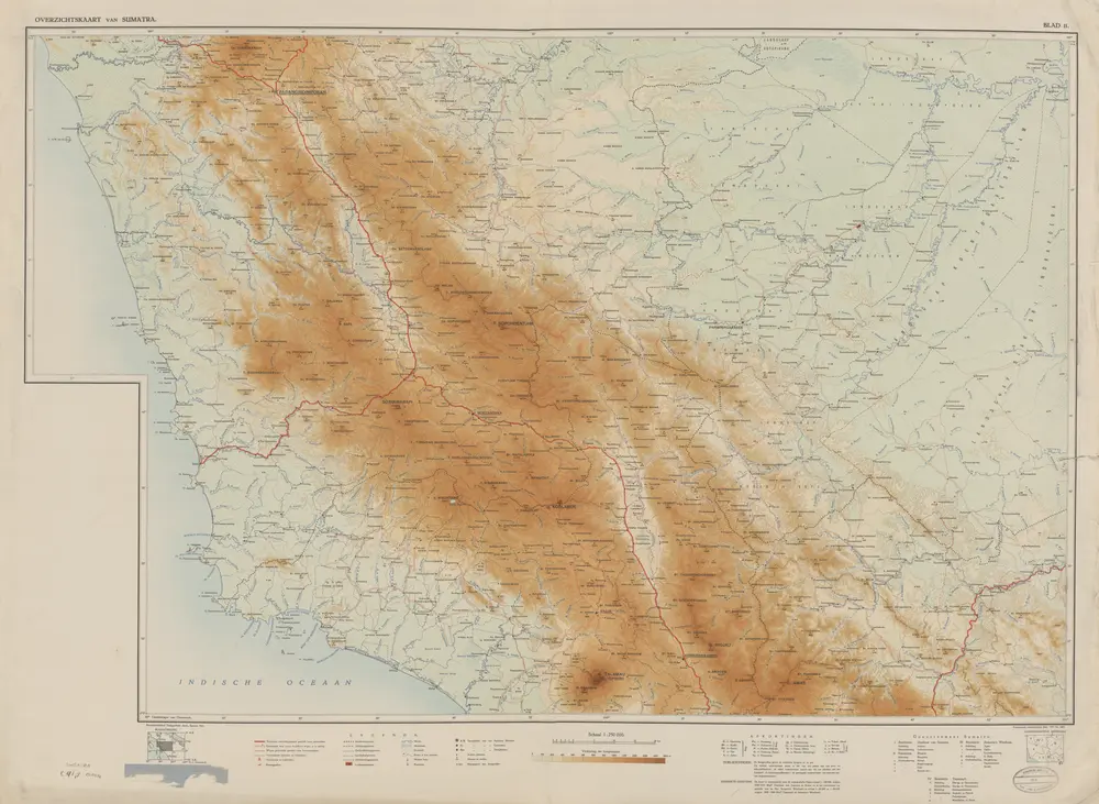

Título completo:[Padangsidimpoean]
Año de ilustración:1941
Editorial:Batavia : Reproductiebedrijf Topografische Dienst
Tamaño físico:20 x 30 cm
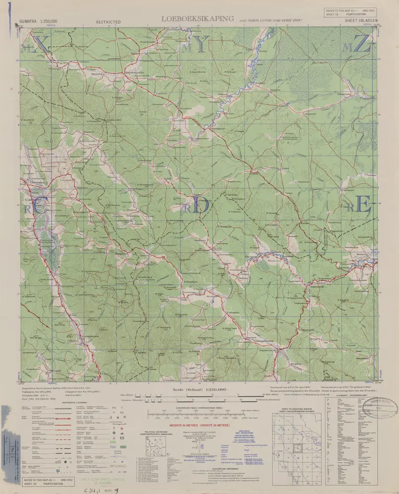
Loeboeksikaping / published by War Office = uitgegeven door War Office ; revised and photolithographed by War Office
1946
War Office Washington D.C.
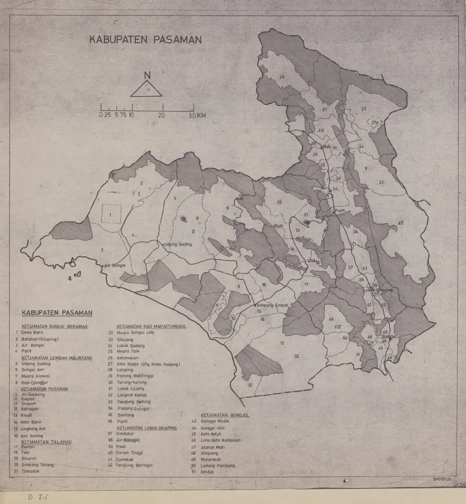
Kabupaten Pasaman / [Direktorat Tata Kota dan Tata Daerah, Direktorat Djenderal Tjipta Karja, Departemen Pekerdjaan Umum dan Tenaga Listrik]
1971
Departemen Pekerdjaan Umum dan Tenaga Listrik Indonesia . Direktorat Djenderal Tjipta Karja . Direktorat Tata Kota dan Tata Daerah
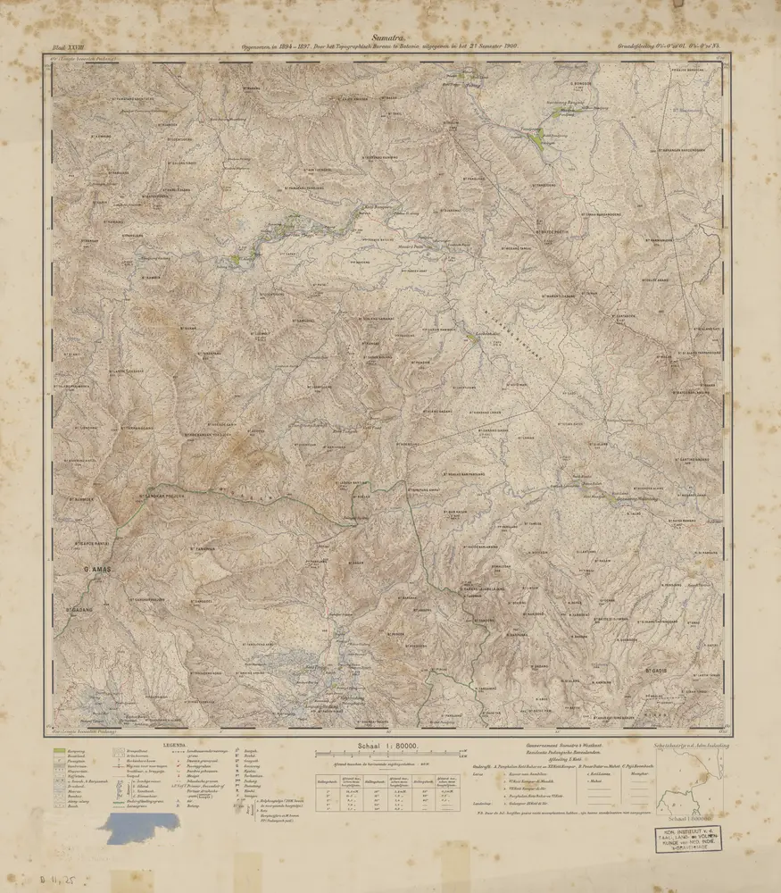
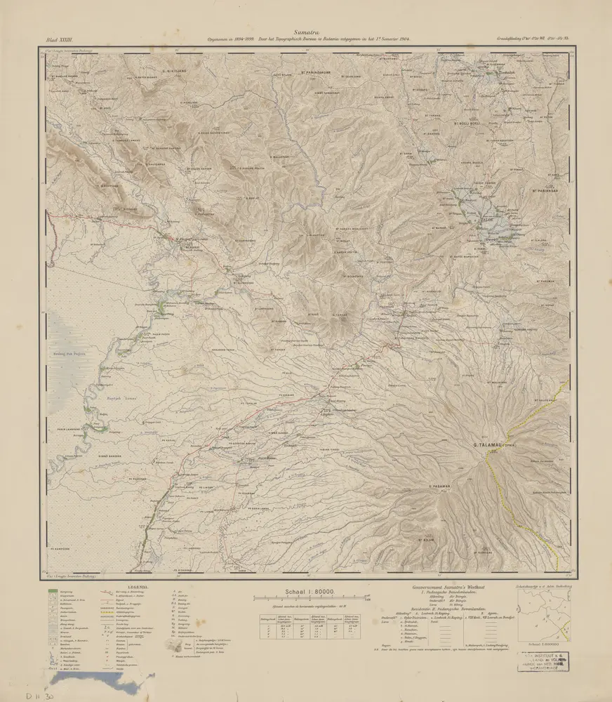
[G[oenoeng] Amas] : opgenomen in 1894-1897 / door het Topographisch Bureau te Batavia uitgegeven in het 2e semester 1900
1900
Topographisch Bureau Batavia
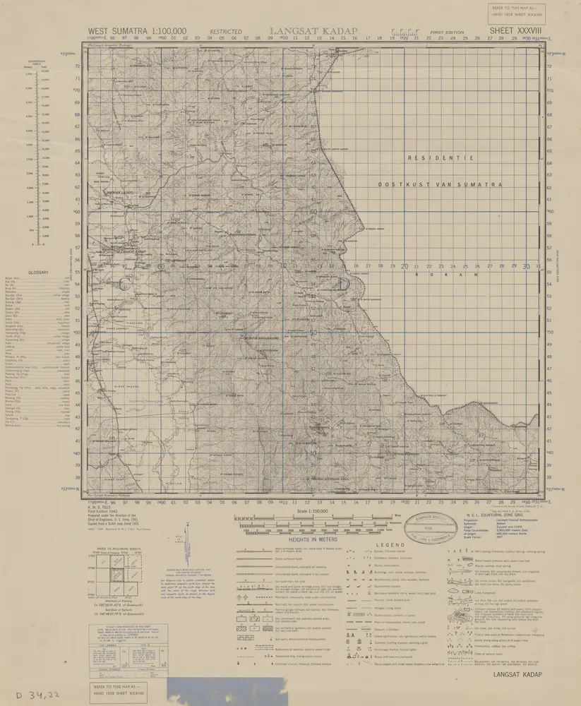
Langsat Kadap / prepared under the direction of the Chief of Engineers U.S. Army by the Army Map Service, U.S. Army, 1943
1944
Army Map Service U.S. Army Washington
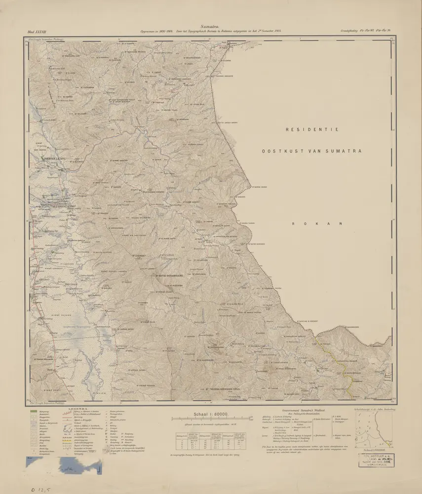
[Taloe] : opgenomen in 1894-1899 / door het Topographisch Bureau te Batavia uitgegeven in het 1e semester 1904
1904
Topographisch Bureau Batavia
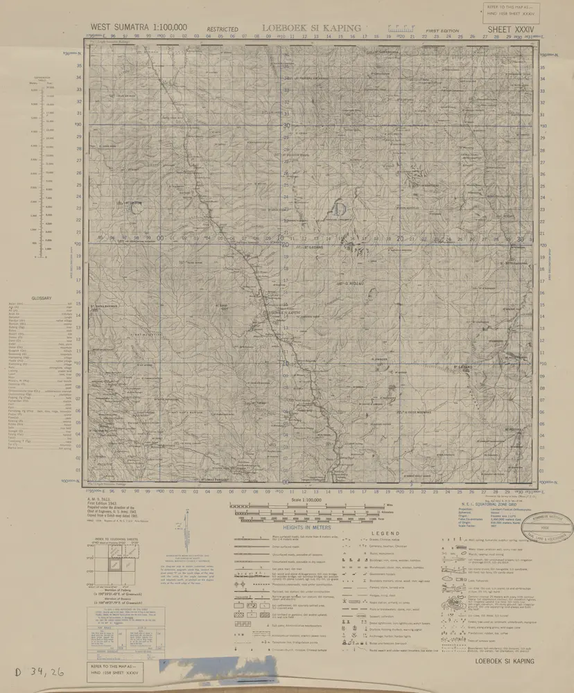
Loeboek Si Kaping / prepared under the direction of the Chief of Engineers U.S. Army by the Army Map Service, U.S. Army, 1943
1944
Army Map Service U.S. Army Washington
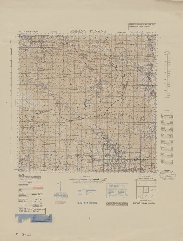
Simpang Tonang / prepared under the direction of the Chief of Engineers U.S. Army by the Army Map Service, U.S. Army, 1943
1944
Army Map Service U.S. Army Washington
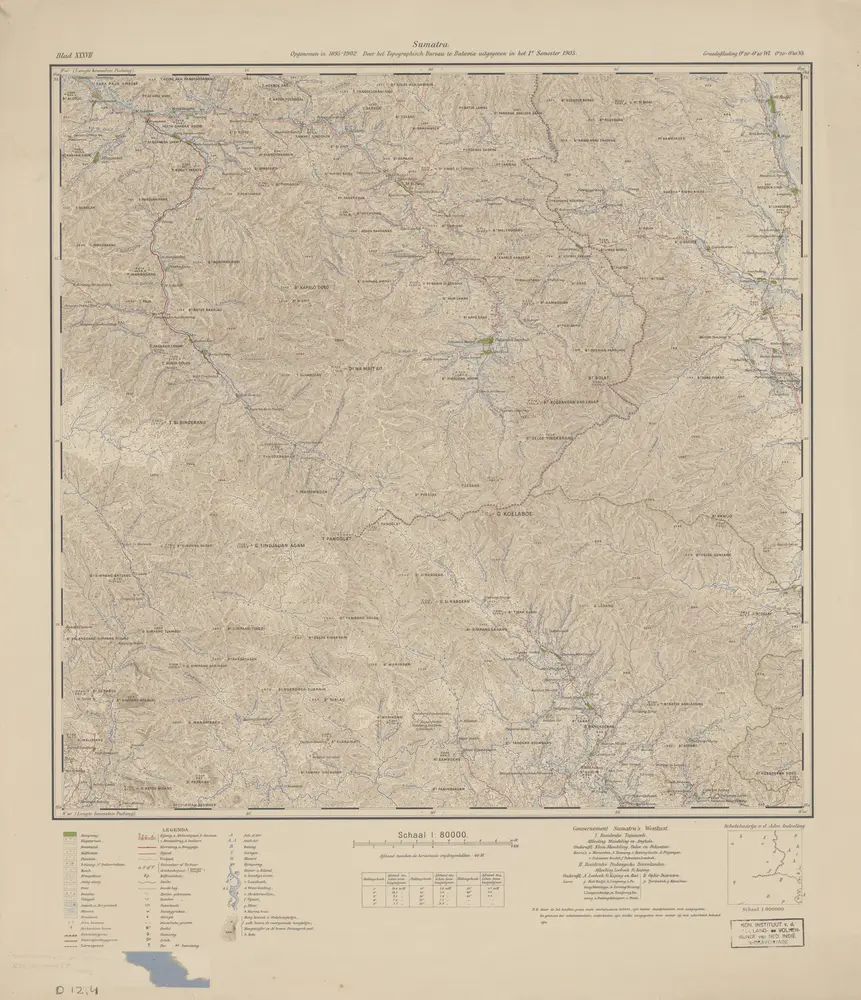
[G[oenoeng] Koelaboe] : opgenomen in 1895-1902 / door het Topographisch Bureau te Batavia uitgegeven in het 1e semester 1905
1905
Topographisch Bureau Batavia
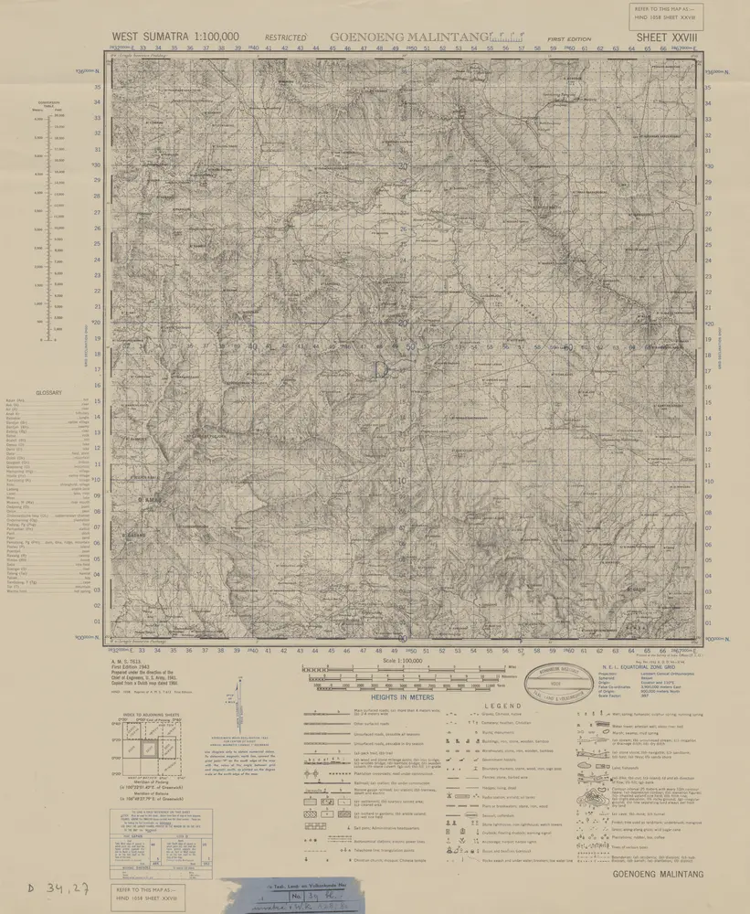
Goenoeng Malintang / prepared under the direction of the Chief of Engineers U.S. Army [by the Army Map Service, U.S. Army], 1943
1944
Army Map Service U.S. Army Washington
[Langsat Kadap] : opgenomen in 1895-1904 / door het Topographisch Bureau te Batavia uitgegeven in het 2e semester 1905
1905
Topographisch Bureau Batavia