Maps of Kotabumi

Batoeradja / published by War Office = uitgegeven door War Office ; revised and photolithographed by War Office
War Office Washington D.C. [Washington D.C.] : War Office
Kaart van de afdeeling Boemi Agoeng (Lampongsche Districten) / [overgenomen van een algemeene kaart der Lampongs van] B. Vitzthum von Eckstaedt del. ; J. Postma lith
Aardrijkskundig Genootschap Amsterdam Amsterdam : C.F. Stemler
Batoeradja / [bew. door R.W. van Bemmelen]
Dienst van den Mijnbouw in Nederlandsch-Indië Batavia [Batavia] : Dienst van den Mijnbouw in Nederlandsch-Indië
Gedongratoe / [bew. door J. van Tuijn]
Dienst van den Mijnbouw in Nederlandsch-Indië Batavia [Batavia] : Dienst van den Mijnbouw in Nederlandsch-Indië
[Soengsang] / opgenomen in 1912-1913 [door den Topographischen Dienst]
Topographische Inrichting Batavia Batavia : Topographische Inrichting
[Tandjoengrajo] / opgenomen [door den Topographischen Dienst] in 1912-1913
Topographische Dienst Batavia Batavia : Topographische Inrichting
[Martapoero] / opgenomen [door den Topographischen Dienst] in 1910-1913
Topographische Dienst Batavia Batavia : Topographische Inrichting
[Oeloemajoes] / opgenomen in 1911-1914 [door den Topographischen Dienst]
Topographische Inrichting Batavia Batavia : Topographische Inrichting
[Moearadoea] / opgenomen door den Topografischen Dienst in 1907-1915
Topografische Dienst Batavia Batavia : Topografische Inrichting
[Batoeradja] / opgenomen [door den Topographischen Dienst] in 1906-1911
Topographische Dienst Batavia Batavia : Topographische Inrichting
[Kota Batoe] / opgenomen in 1909-1916 [door den Topographischen Dienst]
Topographische Inrichting Batavia Batavia : Topographische Inrichting
[Karanginda] / opgenomen in 1908-1910 [door den Topographischen Dienst]
Topographische Inrichting Batavia Batavia : Topographische Inrichting
[Batoeradja] / opgenomen in 1908-1911 [door den Topographischen Dienst]
Topographische Inrichting Batavia Batavia : Topographische Inrichting
[Toeboehan] / opgenomen in 1907-1910 [door den Topographischen Dienst]
Topographische Inrichting Batavia Batavia : Topographische Inrichting
Kroei / [bew. door R.W. van Bemmelen]
Dienst van den Mijnbouw in Nederlandsch-Indië Batavia [Batavia] : Dienst van den Mijnbouw in Nederlandsch-Indië
Kotaboemi / [bew. door J. Westerveld]
Dienst van den Mijnbouw in Nederlandsch-Indië Batavia [Batavia] : Dienst van den Mijnbouw in Nederlandsch-Indië
Gedongratoe
[S.l.] : Survey of India Offices (P.L.O.)
[Goenoengsoegih] / opgenomen in 1909-1912 [door den Topographischen Dienst]
Topographische Inrichting Batavia Batavia : Topographische Inrichting
Lebaktebang / published by War Office
War Office Washington D.C. [Washington D.C.] : War Office
Batoeradja / Survey of India
Survey of India [S.l.] : Survey of India
Woongebied van den Besemahschen stam
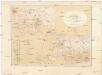
Kaart van Het Gedeelte Java en Sumatra
1 : 500000 Jáva (Indonésie) Eckstein, G. A. Gebroeders Van Cleef
Woongebied van den Besemahschen stam

Overzichtskaart der Residentie Palembang
[S.l. : s.n.]
[Schetskaart van de Residentie Palembang]

Residentie Palembang / bewerkt door het Encyclopaedisch Bureau ; naar gegevens van den Topografischen Dienst en anderen, 1919/20
Encyclopaedisch Bureau Batavia Weltevreden : Top. Inr.
Overzichtskaart van het wegenstelsel in de residentie Palembang / Topografische Dienst
Topografische Dienst Batavia Weltevreden : Reproductiebedrijf Topografische Dienst
[Kaart van Zuid-Sumatra]

Afstandswijzerkaart van de Residentie Palembang / Topografische Inrichting
Topografische Inrichting Batavia [Batavia] : Topografische Inrichting


