Maps of Riau

Kotatengah / published by War Office = uitgegeven door War Office ; revised and photolithographed by War Office
War Office Washington D.C. [Washington D.C.] : War Office
[Kotapinang-Baroe] : opgenomen door den Topografischen Dienst in 1924-1926
Topografische Dienst Weltevreden (Batavia) Weltevreden (Batavia) : Reproductiebedrijf Topografische Dienst
[Kebonbaroe] / opgenomen door den Topografischen Dienst in 1926-1927
Topografische Dienst Batavia Batavia : Reproductiebedrijf Topografische Dienst
[Daloedaloe] / opgenomen door den Topografischen Dienst in 1927-1929
Topografische Dienst Batavia Batavia : Reproductiebedrijf Topografische Dienst
[Bagansemoet] / opgenomen door den Topografischen Dienst in 1926-1927
Topografische Dienst Batavia Batavia : Reproductiebedrijf Topografische Dienst
[Kotatengah] / opgenomen door den Topografischen Dienst in 1928-1929
Topografische Dienst Batavia Batavia : Reproductiebedrijf Topografische Dienst
[Kasangbangsawan] / opgenomen door den Topografischen Dienst in 1926-1927
Topografische Dienst Batavia Batavia : Reproductiebedrijf Topografische Dienst
[Sintong] / opgenomen door den Topografischen Dienst in 1926-1928
Topografische Dienst Batavia Batavia : Reproductiebedrijf Topografische Dienst
[Bakal Malintang] : opgenomen in 1905 / door het Topographisch Bureau te Batavia uitgegeven in het 2e semester 1906
Topographische Inrichting Batavia Batavia : Topographisch Bureau
Hoeta Radja Tinggi / prepared under the direction of the Chief of Engineers U.S. Army [by the Army Map Service, U.S. Army], 1943 ; published by Survey Production Centre R.E.
Army Map Service U.S. Army Washington Washington D.C. : Survey Production Centre R.E.
Schetskaart van Kota-Pinang

Schetskaart van het Zelfbesturend Landschap Kota Pinang : behoorende tot de Afd[eeling] Asahan der Res[identie] O[ost] K[ust] van Sumatra
Encyclopaedisch Bureau Batavia [Batavia] : Encyclopaedisch Bureau
[Langadai] / opgenomen door den Topografischen Dienst in 1926-1928
Topografische Dienst Batavia Batavia : Reproductiebedrijf Topografische Dienst
[Telaga] / opgenomen door den Topografischen Dienst in 1929-1930
Topografische Dienst Batavia Batavia : Reproductiebedrijf Topografische Dienst
[Oedjoeng Padang] : opgenomen in 1903-1905 / Topographische Inrichting, Batavia 1907
Topographische Inrichting Batavia Batavia : Topographische Inrichting
Binanga / prepared under the direction of the Chief of Engineers U.S. Army, 1943
Army Map Service U.S. Army Washington Washington D.C. : Survey Production Centre R.E.
Pakanbaroe / Survey of India
Survey of India [S.l.] : Survey of India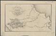
Figurative kaart van een gedeelte van Sumatra voornamelijk aantoonende de wegen en rivieren, welke uit de Padangsche binnenlanden naar de oostkust afloopen
1 : 1360000 opgenomen door S. Muller en H. Hellbach steendr. van H.J. Backer Amsterdam : Beyerinck
Gouvernement Sumatra's Westkust / Topographische Inrichting
Topographische Inrichting [Batavia] : Topographische Inrichting
Etappekaart Sumatra's W[es]t Kust

9. Gouvernement Sumatra's Westkust, uit: Atlas van Nederlandsch Oost-Indië / samengest. door Topographisch Bureau te Batavia van 1897-1904
Annotatie: Omgewerkte versie van: Atlas der Nederlandsche bezittingen in Oost-Indië / naar de nieuste bronnen samengest. door J.W. Stemfoort en J.J. ten Siethoff. - 's-Gravenhage : Topographische Inrichting, [ca. 1885] Topographisch Bureau, Batavia 's-Gravenhage : Topographische Inrichting
[Pakanbaroe]
Topografische Dienst Batavia Batavia : Reproductiebedrijf Topografische Dienst
[Recto], uit: De keur der Buitenbezittingen
titelvariant: Het Gouvernement van Sumatra's Westkust; Annotatie: Uit: Nederland en Insulinde : een school- en handelsatlas in 16 bladen ... / door F. Bruins. - 2e dr. - Groningen : Noordhoff, [1889] Groningen : Noordhoff
Bladwijzer van Noord Sumatra : schaal 1:100.000
[S.l. : s.n.]
[Padangsidimpoean]
Topografische Dienst Batavia Batavia : Reproductiebedrijf Topografische Dienst
Figuratieve schets van het stroomgebied der Bila en Pane : naar de kaart, door het Topographisch Bureau uitgegeven
Nederlandsch Aardrijkskundig Genootschap Amsterdam [Amsterdam : C.L. Brinkman]
Schetskaart [van] Laboehan Batoe

Ondernemings-kaart res. Asahan
[S.l. : s.n.
Kaart van Laboean Batoe / samengesteld door de Deli Automobiel Club
Deli Automobiel Club Medan [Medan] : Deli Automobiel Club


