Maps of Aceh

Tjalang / published by War Office = uitgegeven door War Office ; revised and photolithographed by War Office
War Office Washington D.C. [Washington D.C.] : War Office
Tjalang / samengesteld door den Topografischen Dienst (Kartogr[afische] Afd[eling] naar diverse gegevens in 1941
Topografische Dienst Batavia Batavia : Reproductiebedrijf Topografische Dienst
Figuratieve schetskaart van een gedeelte van Atjeh's Westkust van Hoeala Lam Besoi t/m Tennom / vervaardigd naar enkele vluchtige opnamen en overigens naar gegevens van Inlanders door den 1e Luitenant, Gewestelijk Adjudant P.J. Spruijt
[S.l. : s.n.]
[Tjalang] : opgenomen door den Topografischen Dienst in 1917-1920
Topografische Dienst Batavia Batavia : Topographische Inrichting
Tjalang / prepared under the direction of the Chief of Engineers U.S. Army by the Army Map Service
Army Map Service U.S. Army Washington D.C. Washington D.C. : Army Map Service
[P[oelau] Raja] : opgenomen in 1916-1917 / Topographische Inrichting
Topographische Inrichting Batavia Batavia : Topographische Inrichting
[P[oelau] Keueh] : opgenomen in 1916-1917 / Topographische Inrichting
Topographische Inrichting Batavia Batavia : Topographische Inrichting
Poelau Keueh / prepared under the direction of the Chief of Engineers U.S. Army by the Army Map Service
Army Map Service U.S. Army Washington D.C. Washington D.C. : Army Map Service
Kaart van de kuststrook van Lageun tot Seunagan ter Westkust van Atjeh : naar opmetingen tijdens de excursiën in 1898 en de eerste helft van 1899 / vervaardigd naar gegevens van inlanders door den Controleur 1e Kl[asse] B[innenlandsch] B[estuur] H.J.A. Raedt van Oldenbarnevelt
[S.l. : s.n.]
Geumpang / samengesteld door den Topografischen Dienst (Kartogr[afische] Afd[eling] naar diverse gegevens in 1940
Topografische Dienst Batavia Batavia : Reproductiebedrijf Topografische Dienst
Koetaradja / Survey of India
Survey of India [S.l.] : Survey of India
Bladwijzer van Noord Sumatra : 1:100.000
[S.l. : s.n.]
Kaart van Atjeh en Onderhoorigheden / Topographisch Bureau
Topographisch Bureau Batavia Batavia : Topographisch Bureau
Overzichtskaart van Atjèh en Onderhoorigheden / Topographisch Bureau
Topographisch Bureau Batavia Batavia : Topographisch Bureau
Bladwijzer van het Gouvernement Atjeh en Onderhoorigheden / Topografische Inrichting
Topografische Inrichting Batavia Batavia : Topografische Inrichting
Kaart van het Gouvernement van Atjeh en Onderhoorigheden / uitgave van de Gebroeders Van Cleef ; lithographie van J. Smulders & Co
Gebroeders Van Cleef 's-Gravenhage s-Gravenhage : Gebroeders Van Cleef
Overzichtskaart van Atjeh en Onderhoorigheden / Topographisch Bureau
Topographisch Bureau Batavia Batavia : Topographisch Bureau
Gouvernement Atjeh en Onderhoorigheden / bewerkt door het Encyclopaedisch Bureau, 1916
Encyclopedisch Bureau Batavia [Batavia] : Encyclopedisch Bureau
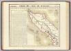
Atjeh
[S.l. : s.n.]
[Takingeun]
Topografische Dienst Batavia Batavia : Reproductiebedrijf Topografische Dienst
Overzichtskaart van Groot-Atjèh en Pidië / [Topographisch Bureau]
Topographisch Bureau Batavia Batavia : Topographisch Bureau
Schets van de patrouille ter overvalling van Teungkoe Tjhi Majet Tiro 3/5 september 1910

Meulaboh / samengesteld door den Topografischen Dienst (Kartogr[afische] Afd[eling] naar diverse gegevens in 1941
Topografische Dienst Batavia Batavia : Reproductiebedrijf Topografische Dienst
Schets Landschap Geumpang en Lamjeuë
Encyclopaedisch Bureau Batavia ['s-Gravenhage : N.V. Electrische Drukkerij 'Luctor et Emergo']
[P[oelau] Kloeang] / [Topographisch Bureau]
Topographisch Bureau Batavia [Batavia : Topographisch Bureau]
Glé Seumadeuen / prepared under the direction of the Chief of Engineers U.S. Army by the Army Map Service
Army Map Service U.S. Army Washington D.C. Washington D.C. : Army Map Service
Schetskaart van het Rijk Atjeh en van de aangrenzende landstreken van Sumatra / Top[ographisch] Bureau ; lith. H.A.T. den Doop
Topographisch Bureau, Batavia [Batavia] : Top[ographisch] Bureau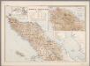
6. Noord Sumatra, uit: Atlas van Nederlandsch Oost-Indië / samengest. door Topographisch Bureau te Batavia van 1897-1904
Annotatie: Omgewerkte versie van: Atlas der Nederlandsche bezittingen in Oost-Indië / naar de nieuste bronnen samengest. door J.W. Stemfoort en J.J. ten Siethoff. - 's-Gravenhage : Topographische Inrichting, [ca. 1885] Topographisch Bureau, Batavia 's-Gravenhage : Topographische Inrichting
Kaart van Noord Sumatra : Gouvernement Atjeh en Onderhoorigheeden, Noordelijke gedeelten van de Res.n Tapanoeli en Sumatra's Oostkust, en de onafhankelijkeBatak Landen / [door J.W. Stemfoort en J.J. ten Siethoff ; gereproduceerd op last van het Departement van Koloniën, aan de Topographische Inrichting te 's-Gravenhage, onder leiding van den Directeur C.A. Eckstein]
Ministerie van Koloniën Den Haag s-Gravenhage : Departement van Koloniën